Channel Islands Beach, California
| Channel Islands Beach | |
|---|---|
| Census-designated place | |
 Location in Ventura County and the state of California | |
| Coordinates: 34°9′28″N 119°13′22″W / 34.15778°N 119.22278°WCoordinates: 34°9′28″N 119°13′22″W / 34.15778°N 119.22278°W | |
| Country |
|
| State |
|
| County | Ventura |
| Government | |
| • State senator | Hannah-Beth Jackson (D)[1] |
| • Assemblymembers |
Monique Limón (D) and Jacqui Irwin (D)[1] |
| • U. S. Rep. | Julia Brownley (D)[2] |
| Area[3] | |
| • Total | 0.411 sq mi (1.063 km2) |
| • Land | 0.404 sq mi (1.046 km2) |
| • Water | 0.007 sq mi (0.018 km2) 1.65% |
| Elevation[4] | 7 ft (2 m) |
| Population (2010) | |
| • Total | 3,103 |
| • Density | 7,500/sq mi (2,900/km2) |
| Time zone | PST (UTC-8) |
| • Summer (DST) | PDT (UTC-7) |
| ZIP code | 93035 |
| Area code(s) | 805 |
| FIPS code | 06-12669 |
| GNIS feature IDs | 1867004, 2408010 |
Channel Islands Beach is an unincorporated community in Ventura County, California, United States consisting of two neighborhoods: Hollywood Beach and Silver Strand Beach. This densely populated narrow 1.3-mile-long strip (2.1 km) along the coastal edge of the Oxnard Plain was subdivided using the glamor of Hollywood to sell lots in the mid 1920s since the sand dunes had been used for movies.[5] Adjacent development has left this neighborhood hemmed in by Channel Islands Harbor and Naval Base Ventura County. The harbor mouth separates the two neighborhoods resulting in a round-about travel route around the harbor between them although the Channel Islands Beach Community Services District provides local utilities services to both neighborhoods.[6] The Special-purpose district has an elected Board of Directors which provides a forum for the unique concerns of the community.[6] Lying immediately adjacent but outside the corporate boundaries of the City of Oxnard and the City of Port Hueneme, they are governed by the county Board of Supervisors.
The population of this residential community was 3,103 at the 2010 census, down from 3,142 at the 2000 census. For statistical purposes, the United States Census Bureau has defined Channel Islands Beach as a census-designated place (CDP). The census definition of the area may not correspond to local understanding of the area.
Geography
This unincorporated coastal community overlooks the Santa Barbara Channel. Oxnard Beach Park is immediately upcoast of Hollywood Beach and separates the community from the Oxnard neighborhood of Oxnard Shores.[7] Three subdivision maps created the town lots (from north to south and the year recorded): Hollywood Beach (1924),[8] Hollywood by the Sea (1926),[9] and Silver Strand (1925).[10] The construction of the mouth of the harbor carved out a portion of the Hollywood-by-the-Sea subdivision so the name has fallen into disuse with the remaining lots on the north side adjacent to the harbor recognized as Hollywood Beach and the neighborhood on the south side isolated by the military base as Silver Strand Beach.[5]
The area is within the Hueneme School District.[11]
Climate
This region experiences warm (but not hot) and dry summers, with no average monthly temperatures above 71.6 °F (22.0 °C). According to the Köppen Climate Classification system, Channel Islands Beach has a warm-summer Mediterranean climate, abbreviated "Csb" on climate maps.[12]
Demographics
2010
The 2010 United States Census[13] reported that Channel Islands Beach had a population of 3,103. The population density was 7,556.9 people per square mile (2,917.8/km²). The racial makeup of Channel Islands Beach was 2,712 (87.4%) White, 27 (0.9%) African American, 16 (0.5%) Native American, 108 (3.5%) Asian, 6 (0.2%) Pacific Islander, 103 (3.3%) from other races, and 131 (4.2%) from two or more races. Hispanic or Latino of any race were 402 persons (13.0%).
The Census reported that 3,103 people (100% of the population) lived in households, 0 (0%) lived in non-institutionalized group quarters, and 0 (0%) were institutionalized.
There were 1,352 households, out of which 318 (23.5%) had children under the age of 18 living in them, 609 (45.0%) were opposite-sex married couples living together, 112 (8.3%) had a female householder with no husband present, 84 (6.2%) had a male householder with no wife present. There were 112 (8.3%) unmarried opposite-sex partnerships, and 15 (1.1%) same-sex married couples or partnerships. 363 households (26.8%) were made up of individuals and 105 (7.8%) had someone living alone who was 65 years of age or older. The average household size was 2.30. There were 805 families (59.5% of all households); the average family size was 2.75.
The population was spread out with 523 people (16.9%) under the age of 18, 261 people (8.4%) aged 18 to 24, 775 people (25.0%) aged 25 to 44, 1,105 people (35.6%) aged 45 to 64, and 439 people (14.1%) who were 65 years of age or older. The median age was 44.8 years. For every 100 females there were 111.7 males. For every 100 females age 18 and over, there were 112.9 males.
There were 1,869 housing units at an average density of 4,551.7 per square mile (1,757.4/km²), of which 728 (53.8%) were owner-occupied, and 624 (46.2%) were occupied by renters. The homeowner vacancy rate was 3.4%; the rental vacancy rate was 9.5%. 1,631 people (52.6% of the population) lived in owner-occupied housing units and 1,472 people (47.4%) lived in rental housing units.
2000
As of the census[14] of 2000, there were 3,142 people, 1,362 households, and 784 families residing in the CDP. The population density was 7,944.3 people per square mile (3,032.8/km²). There were 1,758 housing units at an average density of 4,445.0 per square mile (1,696.9/km²). The racial makeup of the CDP was 90.39% White, 1.11% African American, 0.45% Native American, 1.91% Asian, 0.22% Pacific Islander, 2.93% from other races, and 2.99% from two or more races. Hispanic or Latino of any race were 9.29% of the population.
There were 1,362 households out of which 24.5% had children under the age of 18 living with them, 41.9% were married couples living together, 10.1% had a female householder with no husband present, and 42.4% were non-families. 26.7% of all households were made up of individuals and 4.0% had someone living alone who was 65 years of age or older. The average household size was 2.31 and the average family size was 2.72.
In the CDP the population was spread out with 18.1% under the age of 18, 7.1% from 18 to 24, 39.1% from 25 to 44, 26.3% from 45 to 64, and 9.4% who were 65 years of age or older. The median age was 38 years. For every 100 females there were 107.4 males. For every 100 females age 18 and over, there were 108.9 males.
The median income for a household in the CDP was $58,306, and the median income for a family was $60,577. Males had a median income of $53,083 versus $39,946 for females. The per capita income for the CDP was $34,088. About 6.2% of families and 7.3% of the population were below the poverty line, including 9.0% of those under age 18 and 1.3% of those age 65 or over.
References
- 1 2 "Statewide Database". UC Regents. Retrieved December 8, 2014.
- ↑ "California's 26th Congressional District - Representatives & District Map". Civic Impulse, LLC. Retrieved October 5, 2014.
- ↑ "2010 Census U.S. Gazetteer Files – Places – California". United States Census Bureau.
- ↑ "Channel Islands Beach". Geographic Names Information System. United States Geological Survey. Retrieved December 8, 2014.
- 1 2 Masters, Nathan (August 4, 2014) "When Oxnard Beach Became 'Hollywood-by-the-Sea'" SoCal Focus. KCET
- 1 2 Channel Islands Beach Community Services District
- ↑ "Boundary Map and Geodata for the CDP of Channel Islands Beach in California, U.S.A.". MapTechnica.com. Retrieved October 26, 2013
- ↑ "HOLLYWOOD BEACH" 13 MR 2. Ventura County Recorder Retrieved October 26, 2013 from CountyView GIS: layer "Record Maps"
- ↑ "HOLLYWOOD-BY-THE-SEA" 18 MR 22. Ventura County Recorder Retrieved October 26, 2013 from CountyView GIS: layer "Record Maps"
- ↑ "SILVER STRAND" 15 MR 14. Ventura County Recorder Retrieved October 26, 2013 from CountyView GIS: layer "Record Maps"
- ↑ Boyd-Barrett, Claudia (March 24, 2015). "Hueneme school workers get pay hike". Ventura County Star. Retrieved 7 March 2016.
- ↑ Climate Summary for Channel Islands Beach, California
- ↑ "2010 Census Interactive Population Search: CA - Channel Islands Beach CDP". U.S. Census Bureau. Retrieved July 12, 2014.
- ↑ "American FactFinder". United States Census Bureau. Archived from the original on 2013-09-11. Retrieved 2008-01-31.
Municipalities and communities of Ventura County, California, United States | ||
|---|---|---|
| Cities | 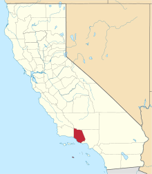 | |
| CDPs | ||
| Unincorporated communities | ||
| Footnotes | ‡This populated place also has portions in an adjacent county or counties | |