Oak View, California
| Oak View | |
|---|---|
| census-designated place | |
 Location in Ventura County and the state of California | |
| Coordinates: 34°23′51″N 119°18′0″W / 34.39750°N 119.30000°WCoordinates: 34°23′51″N 119°18′0″W / 34.39750°N 119.30000°W | |
| Country |
|
| State |
|
| County | Ventura |
| Government | |
| • State Senator | Hannah-Beth Jackson (D)[1] |
| • Assemblymember | Monique Limón (D)[1] |
| • U. S. Rep. | Julia Brownley (D)[2] |
| Area[3] | |
| • Total | 1.962 sq mi (5.082 km2) |
| • Land | 1.962 sq mi (5.082 km2) |
| • Water | 0 sq mi (0 km2) 0% |
| Elevation | 538 ft (164 m) |
| Population (2010) | |
| • Total | 4,066 |
| • Density | 2,100/sq mi (800/km2) |
| Time zone | PST (UTC-8) |
| • Summer (DST) | PDT (UTC-7) |
| ZIP code | 93022 |
| Area code(s) | 805 |
| FIPS code | 06-53182 |
| GNIS feature ID | 1661131 |
Oak View is an unincorporated community in Ventura County, California, United States located along the Ventura River between the towns of Casitas Springs (south) and Mira Monte (north) in a narrow river valley. Lake Casitas and the community of Ojai are nearby. For statistical purposes, the United States Census Bureau has defined Oak View as a census-designated place (CDP). The census definition of the area may not precisely correspond to local understanding of the area with the same name. At the 2010 census, the population of Oak View was 4,066, down from 4,199 at the 2000 census, making it the third largest community between Ojai and the city of Ventura.
History
The town of Oak View "sprang up" in the late 1940s and early 1950s as a bedroom community primarily, although not exclusively, for those who worked in the oil industry in nearby Ventura. Besides nearby downtown Ojai, Oak View is the only other town in the Ojai Valley with a discernible "downtown", which has developed along the Ventura Avenue/Highway 33 corridor, and includes a post office, a grocery store and a grocery mart, one bank, a Thai restaurant, a coffee house/restaurant, a Mexican restaurant, a pizza parlor, two automobile repair shops, two tire shops, two self-serve gasoline stations, two coffee shops, an equipment rental yard, several hair stylists, a pet supplies store, a bar, a liquor store, a walk-in medical office, a real estate office, a car wash, a laundromat, a used car dealership, a tanning salon, a Sheriff's post, a video store, and other service and retail-oriented businesses.
At various times the citizens of Oak View have contemplated incorporation as an alternative to being governed by the County of Ventura. But because the town lacks the ability to provide the same services of an incorporated city, and due to the lack of interest to self govern, those attempts have been short lived. At one time the citizens contemplated incorporation and a name change to "River City", which also failed to garner much local interest.
Oak View has a Civic Council, whose Web site is: http://www.oakviewca.org. The Oak View Civic Council (OVCC) focuses on community improvements and events. The Website contains information on the yearly events the Council either sponsors or supports. It also contains some links to local issues, local representatives, a few local non-profit organizations, and partial history articles about the town.
Geography
Oak View is located at 34°23′51″N 119°18′0″W / 34.39750°N 119.30000°W (34.397416, -119.300127).[4]
According to the United States Census Bureau, the CDP has a total area of 2.0 square miles (5.2 km2), all of it land.
Education
Although Oak View is located within the Ojai Valley, the town itself is located within the boundaries of the Ventura Unified School District. There is one school in Oak View, Arnaz Elementary (aka, Sunset Elementary), which is located on the south western portion of the town, at 400 Sunset. Previously two schools served the town, however, Oak View Elementary School, located off of Santa Ana Boulevard, was closed by the district. A ballot initiative to obtain a parcel tax used to finance the long-term purchase of the school succeeded in keeping the school property from seeing a development that would have included 33 low-income houses packed tightly into the relatively small property. Instead, The Oak View Park and Resource Center is slowly but steadily growing there. (See: http://www.ovparc.org)
Libraries
Public Libraries: Ventura County Library - 14 locations with three branches in the Ojai Valley: Oak View Library, Ojai Library, and Meiners Oaks Library.
Demographics
2010
The 2010 United States Census[5] reported that Oak View had a population of 4,066. The population density was 2,072.4 people per square mile (800.2/km²). The racial makeup of Oak View was 3,227 (79.4%) White, 11 (0.3%) African American, 63 (1.5%) Native American, 34 (0.8%) Asian, 3 (0.1%) Pacific Islander, 575 (14.1%) from other races, and 153 (3.8%) from two or more races. Hispanic or Latino of any race were 1,217 persons (29.9%).
The Census reported that 4,066 people (100% of the population) lived in households, 0 (0%) lived in non-institutionalized group quarters, and 0 (0%) were institutionalized.
There were 1,419 households, out of which 495 (34.9%) had children under the age of 18 living in them, 790 (55.7%) were opposite-sex married couples living together, 139 (9.8%) had a female householder with no husband present, 106 (7.5%) had a male householder with no wife present. There were 104 (7.3%) unmarried opposite-sex partnerships, and 12 (0.8%) same-sex married couples or partnerships. 262 households (18.5%) were made up of individuals and 82 (5.8%) had someone living alone who was 65 years of age or older. The average household size was 2.87. There were 1,035 families (72.9% of all households); the average family size was 3.24.
The population was spread out with 971 people (23.9%) under the age of 18, 356 people (8.8%) aged 18 to 24, 1,013 people (24.9%) aged 25 to 44, 1,310 people (32.2%) aged 45 to 64, and 416 people (10.2%) who were 65 years of age or older. The median age was 39.6 years. For every 100 females there were 100.0 males. For every 100 females age 18 and over, there were 98.8 males.
There were 1,523 housing units at an average density of 776.3 per square mile (299.7/km²), of which 1,015 (71.5%) were owner-occupied, and 404 (28.5%) were occupied by renters. The homeowner vacancy rate was 1.3%; the rental vacancy rate was 5.8%. 2,834 people (69.7% of the population) lived in owner-occupied housing units and 1,232 people (30.3%) lived in rental housing units.
2000
According to the census[6] of 2000, there were 4,199 people, 1,430 households, and 1,069 families residing in the CDP. The population density was 2,153.6 people per square mile (831.4/km²). There were 1,466 housing units at an average density of 751.9 per square mile (290.3/km²). The racial makeup of the CDP was 85.57% White, 0.57% African American, 1.67% Native American, 0.90% Asian, 0.05% Pacific Islander, 8.31% from other races, and 2.93% from two or more races. Hispanic or Latino of any race were 19.50% of the population.
There were 1,430 households out of which 37.8% had children under the age of 18 living with them, 60.3% were married couples living together, 9.2% had a female householder with no husband present, and 25.2% were non-families. 16.6% of all households were made up of individuals and 5.1% had someone living alone who was 65 years of age or older. The average household size was 2.94 and the average family size was 3.31.
In the CDP the population was spread out with 28.0% under the age of 18, 8.4% from 18 to 24, 30.7% from 25 to 44, 24.6% from 45 to 64, and 8.3% who were 65 years of age or older. The median age was 36 years. For every 100 females there were 98.3 males. For every 100 females age 18 and over, there were 99.5 males.
The median income for a household in the CDP was $56,786, and the median income for a family was $61,613. Males had a median income of $48,750 versus $39,554 for females. The per capita income for the CDP was $25,534. About 5.3% of families and 6.0% of the population were below the poverty line, including 6.1% of those under age 18 and 9.5% of those age 65 or over.
Notes
- 1 2 "Statewide Database". UC Regents. Retrieved December 10, 2014.
- ↑ "California's 26th Congressional District - Representatives & District Map". Civic Impulse, LLC. Retrieved October 5, 2014.
- ↑ "2010 Census U.S. Gazetteer Files – Places – California". United States Census Bureau.
- ↑ "US Gazetteer files: 2010, 2000, and 1990". United States Census Bureau. 2011-02-12. Retrieved 2011-04-23.
- ↑ "2010 Census Interactive Population Search: CA - Oak View CDP". U.S. Census Bureau. Retrieved July 12, 2014.
- ↑ "American FactFinder". United States Census Bureau. Archived from the original on September 11, 2013. Retrieved 2008-01-31.
External links
Municipalities and communities of Ventura County, California, United States | ||
|---|---|---|
| Cities | 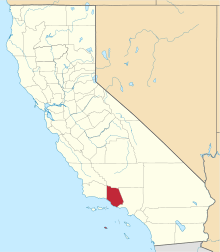 | |
| CDPs | ||
| Unincorporated communities | ||
| Footnotes | ‡This populated place also has portions in an adjacent county or counties | |