Chaseburg, Wisconsin
| Chaseburg, Wisconsin | |
|---|---|
| Village | |
 Location in Vernon County and the state of Wisconsin. | |
| Coordinates: 43°39′21″N 91°5′50″W / 43.65583°N 91.09722°WCoordinates: 43°39′21″N 91°5′50″W / 43.65583°N 91.09722°W | |
| Country | United States |
| State | Wisconsin |
| County | Vernon |
| Government | |
| • Mayor | Ken Bluske |
| Area[1] | |
| • Total | 0.93 sq mi (2.41 km2) |
| • Land | 0.92 sq mi (2.38 km2) |
| • Water | 0.01 sq mi (0.03 km2) |
| Elevation[2] | 709 ft (216 m) |
| Population (2010)[3] | |
| • Total | 284 |
| • Estimate (2014)[4] | 299 |
| • Density | 308.7/sq mi (119.2/km2) |
| Time zone | Central (CST) (UTC-6) |
| • Summer (DST) | CDT (UTC-5) |
| Area code(s) | 608 |
| FIPS code | 55-14150[5] |
| GNIS feature ID | 1562965[2] |
Chaseburg is a village in Vernon County, Wisconsin, United States. The population was 284 at the 2010 census.
Geography
Chaseburg is located at 43°39′21″N 91°5′50″W / 43.65583°N 91.09722°W (43.655890, -91.097095).[6] According to the United States Census Bureau, the village has a total area of 0.93 square miles (2.41 km2), of which, 0.92 square miles (2.38 km2) of it is land and 0.01 square miles (0.03 km2) is water.[1]
Demographics
| Historical population | |||
|---|---|---|---|
| Census | Pop. | %± | |
| 1880 | 125 | — | |
| 1930 | 218 | — | |
| 1940 | 258 | 18.3% | |
| 1950 | 219 | −15.1% | |
| 1960 | 242 | 10.5% | |
| 1970 | 224 | −7.4% | |
| 1980 | 279 | 24.6% | |
| 1990 | 365 | 30.8% | |
| 2000 | 306 | −16.2% | |
| 2010 | 284 | −7.2% | |
| Est. 2015 | 302 | [7] | 6.3% |
| U.S. Decennial Census[8] 2014 Estimate[4] | |||
2010 census
As of the census[3] of 2010, there were 284 people, 121 households, and 75 families residing in the village. The population density was 308.7 inhabitants per square mile (119.2/km2). There were 126 housing units at an average density of 137.0 per square mile (52.9/km2). The racial makeup of the village was 96.5% White, 0.4% Asian, 1.8% from other races, and 1.4% from two or more races. Hispanic or Latino of any race were 1.8% of the population.
There were 121 households of which 31.4% had children under the age of 18 living with them, 49.6% were married couples living together, 9.1% had a female householder with no husband present, 3.3% had a male householder with no wife present, and 38.0% were non-families. 32.2% of all households were made up of individuals and 14.1% had someone living alone who was 65 years of age or older. The average household size was 2.35 and the average family size was 3.00.
The median age in the village was 40.5 years. 25.4% of residents were under the age of 18; 7.6% were between the ages of 18 and 24; 25% were from 25 to 44; 24% were from 45 to 64; and 18% were 65 years of age or older. The gender makeup of the village was 54.2% male and 45.8% female.
2000 census
As of the census[5] of 2000, there were 306 people, 133 households, and 80 families residing in the village. The population density was 492.4 people per square mile (190.6/km²). There were 146 housing units at an average density of 234.9 per square mile (90.9/km²). The racial makeup of the village was 100.00% White.
There were 133 households out of which 30.1% had children under the age of 18 living with them, 52.6% were married couples living together, 3.8% had a female householder with no husband present, and 39.8% were non-families. 33.8% of all households were made up of individuals and 17.3% had someone living alone who was 65 years of age or older. The average household size was 2.30 and the average family size was 2.99.
In the village the population was spread out with 25.2% under the age of 18, 6.2% from 18 to 24, 30.1% from 25 to 44, 22.2% from 45 to 64, and 16.3% who were 65 years of age or older. The median age was 37 years. For every 100 females there were 114.0 males. For every 100 females age 18 and over, there were 108.2 males.
The median income for a household in the village was $38,438, and the median income for a family was $45,417. Males had a median income of $28,125 versus $25,469 for females. The per capita income for the village was $18,851. About 3.8% of families and 7.9% of the population were below the poverty line, including 2.5% of those under the age of eighteen and 20.0% of those sixty five or over.
Notable people
- Henry Chase, Wisconsin legislator
- Joseph W. Hoyt, merchant and Wisconsin legislator[9]
References
- 1 2 "US Gazetteer files 2010". United States Census Bureau. Archived from the original on 2012-01-24. Retrieved 2012-11-18.
- 1 2 "US Board on Geographic Names". United States Geological Survey. 2007-10-25. Retrieved 2008-01-31.
- 1 2 "American FactFinder". United States Census Bureau. Retrieved 2012-11-18.
- 1 2 "Population Estimates". United States Census Bureau. Retrieved June 7, 2015.
- 1 2 "American FactFinder". United States Census Bureau. Archived from the original on 2013-09-11. Retrieved 2008-01-31.
- ↑ "US Gazetteer files: 2010, 2000, and 1990". United States Census Bureau. 2011-02-12. Retrieved 2011-04-23.
- ↑ "Annual Estimates of the Resident Population for Incorporated Places: April 1, 2010 to July 1, 2015". Retrieved July 2, 2016.
- ↑ United States Census Bureau. "Census of Population and Housing". Archived from the original on May 11, 2015. Retrieved August 22, 2014.
- ↑ 'Wisconsin Blue Book 1885,' Biographical Sketch of Joseph W. Hoyt, pg. 420
Municipalities and communities of Vernon County, Wisconsin, United States | ||
|---|---|---|
| Cities | 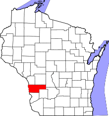 | |
| Villages | ||
| Towns | ||
| Unincorporated communities | ||
| Footnotes | ‡This populated place also has portions in an adjacent county or counties | |