Hillsboro, Wisconsin
| Hillsboro | |
|---|---|
| City | |
 Location in Vernon County and the state of Wisconsin. | |
| Coordinates: 43°39′10″N 90°20′29″W / 43.65278°N 90.34139°WCoordinates: 43°39′10″N 90°20′29″W / 43.65278°N 90.34139°W | |
| Country | United States |
| State | Wisconsin |
| County | Vernon |
| Area[1] | |
| • Total | 1.41 sq mi (3.65 km2) |
| • Land | 1.37 sq mi (3.55 km2) |
| • Water | 0.04 sq mi (0.10 km2) |
| Population (2010)[2] | |
| • Total | 1,417 |
| • Estimate (2012[3]) | 1,431 |
| • Density | 1,034.3/sq mi (399.3/km2) |
| Time zone | Central (CST) (UTC-6) |
| • Summer (DST) | CDT (UTC-5) |
| Area code(s) | 608 |
| Website |
www |


Hillsboro is a city in Vernon County, Wisconsin, United States. The population was 1,417 at the 2010 census. The city is located within the Town of Hillsboro. Hillsboro is known as the Czech Capital of Wisconsin.
Geography
Hillsboro is located at 43°39′10″N 90°20′28″W / 43.65278°N 90.34111°W (43.652843, -90.34133),[4] along the West Branch of the Baraboo River.
According to the United States Census Bureau, the city has a total area of 1.41 square miles (3.65 km2), of which, 1.37 square miles (3.55 km2) is land and 0.04 square miles (0.10 km2) is water.[1]
Demographics
| Historical population | |||
|---|---|---|---|
| Census | Pop. | %± | |
| 1880 | 195 | — | |
| 1890 | 461 | 136.4% | |
| 1900 | 785 | 70.3% | |
| 1910 | 804 | 2.4% | |
| 1920 | 950 | 18.2% | |
| 1930 | 972 | 2.3% | |
| 1940 | 1,146 | 17.9% | |
| 1950 | 1,341 | 17.0% | |
| 1960 | 1,366 | 1.9% | |
| 1970 | 1,231 | −9.9% | |
| 1980 | 1,263 | 2.6% | |
| 1990 | 1,288 | 2.0% | |
| 2000 | 1,302 | 1.1% | |
| 2010 | 1,417 | 8.8% | |
| Est. 2015 | 1,420 | [5] | 0.2% |
2010 census
As of the census[2] of 2010, there were 1,417 people, 587 households, and 366 families residing in the city. The population density was 1,034.3 inhabitants per square mile (399.3/km2). There were 662 housing units at an average density of 483.2 per square mile (186.6/km2). The racial makeup of the city was 98.0% White, 0.2% African American, 0.3% Asian, 0.4% from other races, and 1.1% from two or more races. Hispanic or Latino of any race were 2.3% of the population.
There were 587 households of which 32.9% had children under the age of 18 living with them, 46.8% were married couples living together, 11.1% had a female householder with no husband present, 4.4% had a male householder with no wife present, and 37.6% were non-families. 33.9% of all households were made up of individuals and 19.1% had someone living alone who was 65 years of age or older. The average household size was 2.41 and the average family size was 3.10.
The median age in the city was 38.4 years. 26.9% of residents were under the age of 18; 7.1% were between the ages of 18 and 24; 23.7% were from 25 to 44; 24% were from 45 to 64; and 18.4% were 65 years of age or older. The gender makeup of the city was 48.1% male and 51.9% female.
2000 census
As of the census[7] of 2000, there were 1,302 people, 565 households, and 333 families residing in the city. The population density was 1,086.6 people per square mile (418.9/km²). There were 603 housing units at an average density of 503.2 per square mile (194.0/km²). The racial makeup of the city was 99.23% White, 0.23% Native American, 0.15% from other races, and 0.38% from two or more races. 0.69% of the population were Hispanic or Latino of any race.
There were 565 households out of which 24.1% had children under the age of 18 living with them, 48.3% were married couples living together, 8.8% had a female householder with no husband present, and 40.9% were non-families. 37.3% of all households were made up of individuals and 21.6% had someone living alone who was 65 years of age or older. The average household size was 2.18 and the average family size was 2.86.
In the city the population was spread out with 21.2% under the age of 18, 7.1% from 18 to 24, 24.1% from 25 to 44, 20.1% from 45 to 64, and 27.5% who were 65 years of age or older. The median age was 43 years. For every 100 females there were 81.8 males. For every 100 females age 18 and over, there were 77.2 males.
The median income for a household in the city was $30,543, and the median income for a family was $42,750. Males had a median income of $30,700 versus $20,792 for females. The per capita income for the city was $16,005. About 6.3% of families and 9.2% of the population were below the poverty line, including 6.4% of those under age 18 and 14.7% of those age 65 or over.
Transportation
The city's airport, Joshua Sanford Field airport (KHBW) closed in August 2016; it served Hillsboro and the surrounding communities.
Notable people
- Dick Cepek, off-road hall of fame parts supplier and race
- Bernard J. Liska, food science
- Marc Mitscher, admiral
- Oscar A. Mitscher, politician
- Byron D. Shear, politician
- Denny Sullivan, MLB player[8]
References
- 1 2 "US Gazetteer files 2010". United States Census Bureau. Archived from the original on January 24, 2012. Retrieved 2012-11-18.
- 1 2 "American FactFinder". United States Census Bureau. Retrieved 2012-11-18.
- ↑ "Population Estimates". United States Census Bureau. Archived from the original on June 17, 2013. Retrieved 2013-06-24.
- ↑ "US Gazetteer files: 2010, 2000, and 1990". United States Census Bureau. 2011-02-12. Retrieved 2011-04-23.
- ↑ "Annual Estimates of the Resident Population for Incorporated Places: April 1, 2010 to July 1, 2015". Retrieved July 2, 2016.
- ↑ "Census of Population and Housing". Census.gov. Archived from the original on May 11, 2015. Retrieved June 4, 2015.
- ↑ "American FactFinder". United States Census Bureau. Retrieved 2008-01-31.
- ↑ http://www.baseball-reference.com/players/s/sullide02.shtml
External links
- City of Hillsboro
- Sanborn fire insurance maps: 1904 1914
Municipalities and communities of Vernon County, Wisconsin, United States | ||
|---|---|---|
| Cities | 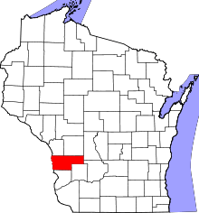 | |
| Villages | ||
| Towns | ||
| Unincorporated communities | ||
| Footnotes | ‡This populated place also has portions in an adjacent county or counties | |