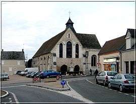
Cherisy
- Not to be confused with Chérisy, in the Pas-de-Calais department.
| Chérisy | ||
|---|---|---|
 | ||
| ||
 Chérisy | ||
|
Location within Centre-Val de Loire region  Chérisy | ||
| Coordinates: 48°44′50″N 1°25′22″E / 48.7472°N 1.4228°ECoordinates: 48°44′50″N 1°25′22″E / 48.7472°N 1.4228°E | ||
| Country | France | |
| Region | Centre-Val de Loire | |
| Department | Eure-et-Loir | |
| Arrondissement | Dreux | |
| Canton | Dreux-Est | |
| Intercommunality | Villages du Drouais | |
| Government | ||
| • Mayor (2008–2014) | Michel Lethuillier | |
| Area1 | 12.38 km2 (4.78 sq mi) | |
| Population (2008)2 | 1,820 | |
| • Density | 150/km2 (380/sq mi) | |
| Time zone | CET (UTC+1) | |
| • Summer (DST) | CEST (UTC+2) | |
| INSEE/Postal code | 28098 / 28500 | |
| Elevation |
74–139 m (243–456 ft) (avg. 133 m or 436 ft) | |
|
1 French Land Register data, which excludes lakes, ponds, glaciers > 1 km² (0.386 sq mi or 247 acres) and river estuaries. 2 Population without double counting: residents of multiple communes (e.g., students and military personnel) only counted once. | ||

Cherisy is a commune in the Eure-et-Loir department in northern France.
Population
| Historical population | ||
|---|---|---|
| Year | Pop. | ±% |
| 1962 | 838 | — |
| 1968 | 852 | +1.7% |
| 1975 | 1,103 | +29.5% |
| 1982 | 1,121 | +1.6% |
| 1990 | 1,741 | +55.3% |
| 1999 | 1,768 | +1.6% |
| 2008 | 1,820 | +2.9% |
See also
References
| Wikimedia Commons has media related to Cherisy. |
This article is issued from Wikipedia - version of the 11/15/2013. The text is available under the Creative Commons Attribution/Share Alike but additional terms may apply for the media files.