Gallardon
For other uses, see Gallardon (disambiguation).
| Gallardon | ||
|---|---|---|
|
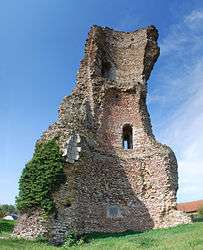
Ruined tower | ||
| ||
 Gallardon | ||
|
Location within Centre-Val de Loire region  Gallardon | ||
| Coordinates: 48°31′32″N 1°41′27″E / 48.5256°N 1.6908°ECoordinates: 48°31′32″N 1°41′27″E / 48.5256°N 1.6908°E | ||
| Country | France | |
| Region | Centre-Val de Loire | |
| Department | Eure-et-Loir | |
| Arrondissement | Chartres | |
| Canton | Maintenon | |
| Intercommunality | Val de Voise | |
| Government | ||
| • Mayor (2008–2014) | Yves Marie | |
| Area1 | 11.27 km2 (4.35 sq mi) | |
| Population (2008)2 | 3,430 | |
| • Density | 300/km2 (790/sq mi) | |
| Time zone | CET (UTC+1) | |
| • Summer (DST) | CEST (UTC+2) | |
| INSEE/Postal code | 28168 / 28320 | |
| Elevation |
107–158 m (351–518 ft) (avg. 140 m or 460 ft) | |
|
1 French Land Register data, which excludes lakes, ponds, glaciers > 1 km² (0.386 sq mi or 247 acres) and river estuaries. 2 Population without double counting: residents of multiple communes (e.g., students and military personnel) only counted once. | ||
.svg.png)
Gallardon is a commune in the Eure-et-Loir department in northern France.
Population
| Historical population | ||
|---|---|---|
| Year | Pop. | ±% |
| 1962 | 1,675 | — |
| 1968 | 1,850 | +10.4% |
| 1975 | 2,076 | +12.2% |
| 1982 | 2,303 | +10.9% |
| 1990 | 2,576 | +11.9% |
| 1999 | 3,510 | +36.3% |
| 2008 | 3,430 | −2.3% |
See also
References
| Wikimedia Commons has media related to Gallardon. |
This article is issued from Wikipedia - version of the 11/18/2013. The text is available under the Creative Commons Attribution/Share Alike but additional terms may apply for the media files.