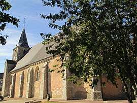
Prunay-le-Gillon
| Prunay-le-Gillon | ||
|---|---|---|
 | ||
| ||
 Prunay-le-Gillon | ||
|
Location within Centre-Val de Loire region  Prunay-le-Gillon | ||
| Coordinates: 48°21′58″N 1°38′10″E / 48.3661°N 1.6361°ECoordinates: 48°21′58″N 1°38′10″E / 48.3661°N 1.6361°E | ||
| Country | France | |
| Region | Centre-Val de Loire | |
| Department | Eure-et-Loir | |
| Arrondissement | Chartres | |
| Canton | Chartres-Sud-Est | |
| Intercommunality | L'Orée de Chartres | |
| Government | ||
| • Mayor (2001–2008) | Guy Gauthier | |
| Area1 | 25.36 km2 (9.79 sq mi) | |
| Population (2008)2 | 934 | |
| • Density | 37/km2 (95/sq mi) | |
| Time zone | CET (UTC+1) | |
| • Summer (DST) | CEST (UTC+2) | |
| INSEE/Postal code | 28309 / 28360 | |
| Elevation |
143–156 m (469–512 ft) (avg. 156 m or 512 ft) | |
|
1 French Land Register data, which excludes lakes, ponds, glaciers > 1 km² (0.386 sq mi or 247 acres) and river estuaries. 2 Population without double counting: residents of multiple communes (e.g., students and military personnel) only counted once. | ||

Prunay-le-Gillon (pronounced: [pʁy.nɛ.lə.ɡijɔ̃]) is a commune in the Eure-et-Loir department in northern France.
Population
| Historical population | ||
|---|---|---|
| Year | Pop. | ±% |
| 1962 | 620 | — |
| 1968 | 681 | +9.8% |
| 1975 | 727 | +6.8% |
| 1982 | 812 | +11.7% |
| 1990 | 941 | +15.9% |
| 1999 | 892 | −5.2% |
| 2008 | 934 | +4.7% |
See also
References
| Wikimedia Commons has media related to Prunay-le-Gillon. |
This article is issued from Wikipedia - version of the 3/15/2016. The text is available under the Creative Commons Attribution/Share Alike but additional terms may apply for the media files.