Clarksburg, Ohio
| Clarksburg, Ohio | |
|---|---|
| Village | |
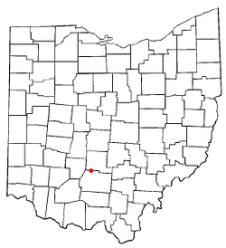 Location of Clarksburg, Ohio | |
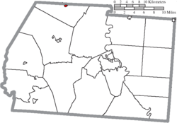 Location of Clarksburg in Ross County | |
| Coordinates: 39°30′23″N 83°9′16″W / 39.50639°N 83.15444°WCoordinates: 39°30′23″N 83°9′16″W / 39.50639°N 83.15444°W | |
| Country | United States |
| State | Ohio |
| County | Ross |
| Area[1] | |
| • Total | 0.17 sq mi (0.44 km2) |
| • Land | 0.17 sq mi (0.44 km2) |
| • Water | 0 sq mi (0 km2) |
| Elevation[2] | 771 ft (235 m) |
| Population (2010)[3] | |
| • Total | 455 |
| • Estimate (2012[4]) | 455 |
| • Density | 2,676.5/sq mi (1,033.4/km2) |
| Time zone | Eastern (EST) (UTC-5) |
| • Summer (DST) | EDT (UTC-4) |
| ZIP code | 43115 |
| Area code(s) | 740 |
| FIPS code | 39-15336[5] |
| GNIS feature ID | 1060975[2] |
Clarksburg is a village in Ross County, Ohio, United States. The population was 455 at the 2010 census.
Clarksburg was platted in 1817 by George Clark, and named for him.[6]
Gallery
-
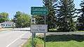
Clarksburg corporation limit sign.
-
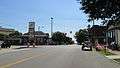
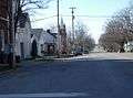
Intersection of Main and High Streets in Clarksburg.
-
Along High Street (Ohio Highway 138) in Clarksburg.
-
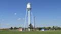
Water tower in Clarksburg.
-
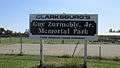
Zurmehly Park.
-
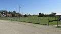
Zurmehly Park.
-
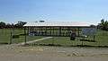
Zurmehly Park.
-
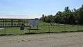
Zurmehly Park.
-
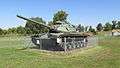
Zurmehly Park.
-
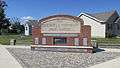
Site of former Clarksburg/Deerfield Township High School (1893 - 1965).
Geography
Clarksburg is located at 39°30′23″N 83°9′16″W / 39.50639°N 83.15444°W (39.506388, -83.154524).[7]
According to the United States Census Bureau, the village has a total area of 0.17 square miles (0.44 km2), all land.[1]
Demographics
| Historical population | |||
|---|---|---|---|
| Census | Pop. | %± | |
| 1880 | 308 | — | |
| 1890 | 378 | 22.7% | |
| 1900 | 551 | 45.8% | |
| 1910 | 558 | 1.3% | |
| 1920 | 420 | −24.7% | |
| 1930 | 400 | −4.8% | |
| 1940 | 390 | −2.5% | |
| 1950 | 391 | 0.3% | |
| 1960 | 438 | 12.0% | |
| 1970 | 457 | 4.3% | |
| 1980 | 483 | 5.7% | |
| 1990 | 523 | 8.3% | |
| 2000 | 516 | −1.3% | |
| 2010 | 455 | −11.8% | |
| Est. 2015 | 459 | [8] | 0.9% |
2010 census
As of the census[3] of 2010, there were 455 people, 166 households, and 117 families residing in the village. The population density was 2,676.5 inhabitants per square mile (1,033.4/km2). There were 184 housing units at an average density of 1,082.4 per square mile (417.9/km2). The racial makeup of the village was 98.5% White, 0.2% African American, 0.4% from other races, and 0.9% from two or more races. Hispanic or Latino of any race were 1.8% of the population.
There were 166 households of which 38.6% had children under the age of 18 living with them, 52.4% were married couples living together, 15.1% had a female householder with no husband present, 3.0% had a male householder with no wife present, and 29.5% were non-families. 22.9% of all households were made up of individuals and 12% had someone living alone who was 65 years of age or older. The average household size was 2.74 and the average family size was 3.23.
The median age in the village was 34.8 years. 29% of residents were under the age of 18; 8% were between the ages of 18 and 24; 25.8% were from 25 to 44; 23% were from 45 to 64; and 14.3% were 65 years of age or older. The gender makeup of the village was 47.3% male and 52.7% female.
2000 census
As of the census[5] of 2000, there were 516 people, 178 households, and 131 families residing in the village. The population density was 2,772.9 people per square mile (1,048.6/km²). There were 190 housing units at an average density of 1,021.0 per square mile (386.1/km²). The racial makeup of the village was 97.48% White, 1.55% African American, 0.19% Native American, 0.58% from other races, and 0.19% from two or more races.
There were 178 households out of which 37.1% had children under the age of 18 living with them, 53.4% were married couples living together, 15.7% had a female householder with no husband present, and 26.4% were non-families. 20.8% of all households were made up of individuals and 9.6% had someone living alone who was 65 years of age or older. The average household size was 2.80 and the average family size was 3.20.
In the village the population was spread out with 28.5% under the age of 18, 9.7% from 18 to 24, 28.1% from 25 to 44, 22.7% from 45 to 64, and 11.0% who were 65 years of age or older. The median age was 32 years. For every 100 females there were 100.8 males. For every 100 females age 18 and over, there were 95.2 males.
The median income for a household in the village was $32,159, and the median income for a family was $36,667. Males had a median income of $30,781 versus $17,500 for females. The per capita income for the village was $12,064. About 14.6% of families and 18.8% of the population were below the poverty line, including 26.4% of those under age 18 and 18.8% of those age 65 or over.
References
- 1 2 "US Gazetteer files 2010". United States Census Bureau. Archived from the original on 2012-01-24. Retrieved 2013-01-06.
- 1 2 "US Board on Geographic Names". United States Geological Survey. 2007-10-25. Retrieved 2008-01-31.
- 1 2 "American FactFinder". United States Census Bureau. Retrieved 2013-01-06.
- ↑ "Population Estimates". United States Census Bureau. Archived from the original on 2013-06-17. Retrieved 2013-06-17.
- 1 2 "American FactFinder". United States Census Bureau. Archived from the original on 2013-09-11. Retrieved 2008-01-31.
- ↑ Overman, William Daniel (1958). Ohio Town Names. Akron, OH: Atlantic Press. p. 29.
- ↑ "US Gazetteer files: 2010, 2000, and 1990". United States Census Bureau. 2011-02-12. Retrieved 2011-04-23.
- ↑ "Annual Estimates of the Resident Population for Incorporated Places: April 1, 2010 to July 1, 2015". Retrieved July 2, 2016.
- ↑ "Census of Population and Housing". Census.gov. Archived from the original on May 11, 2015. Retrieved June 4, 2015.
Municipalities and communities of Ross County, Ohio, United States | ||
|---|---|---|
| City | 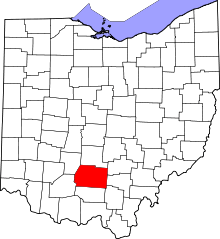 | |
| Villages | ||
| Townships | ||
| CDPs | ||
| Unincorporated communities | ||
| Ghost town | ||
| Footnotes | ‡This populated place also has portions in an adjacent county or counties | |