Paxton Township, Ross County, Ohio
| Paxton Township, Ross County, Ohio | |
|---|---|
| Township | |
|
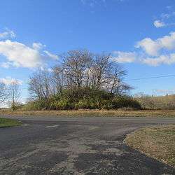
T.C. Campbell Mound | |
 Location of Paxton Township in Ross County | |
| Coordinates: 39°13′37″N 83°16′15″W / 39.22694°N 83.27083°WCoordinates: 39°13′37″N 83°16′15″W / 39.22694°N 83.27083°W | |
| Country | United States |
| State | Ohio |
| County | Ross |
| Area | |
| • Total | 31.8 sq mi (82.4 km2) |
| • Land | 31.7 sq mi (82.2 km2) |
| • Water | 0.1 sq mi (0.2 km2) |
| Elevation[1] | 810 ft (247 m) |
| Population (2000) | |
| • Total | 2,165 |
| • Density | 68.2/sq mi (26.3/km2) |
| Time zone | Eastern (EST) (UTC-5) |
| • Summer (DST) | EDT (UTC-4) |
| FIPS code | 39-61308[2] |
| GNIS feature ID | 1086902[1] |
Paxton Township is one of the sixteen townships of Ross County, Ohio, United States. The 2000 census found 2,165 people in the township, 1,153 of whom lived in the unincorporated portions of the township.[3]
Geography
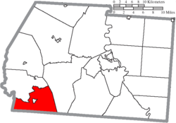
Located in the southwestern corner of the county, it borders the following townships:
- Paint Township - north
- Twin Township - east
- Benton Township, Pike County - southeast
- Perry Township, Pike County - southwest
- Paint Township, Highland County - west
The village of Bainbridge is located in central Paxton Township.
Name and history
It is the only Paxton Township statewide.[4]
Government
The township is governed by a three-member board of trustees, who are elected in November of odd-numbered years to a four-year term beginning on the following January 1. Two are elected in the year after the presidential election and one is elected in the year before it. There is also an elected township fiscal officer,[5] who serves a four-year term beginning on April 1 of the year after the election, which is held in November of the year before the presidential election. Vacancies in the fiscal officership or on the board of trustees are filled by the remaining trustees.
Education
Bainbridge Elementary School (now a preschool) is in Bainbridge, and the Paint Valley High School falls within the township.
References
- 1 2 "US Board on Geographic Names". United States Geological Survey. 2007-10-25. Retrieved 2008-01-31.
- ↑ "American FactFinder". United States Census Bureau. Archived from the original on 2013-09-11. Retrieved 2008-01-31.
- ↑ Ross County, Ohio — Population by Places Estimates Ohio State University, 2007. Accessed 15 May 2007.
- ↑ "Detailed map of Ohio" (PDF). United States Census Bureau. 2000. Retrieved 2007-02-16.
- ↑ §503.24, §505.01, and §507.01 of the Ohio Revised Code. Accessed 4/30/2009.
External links
Municipalities and communities of Ross County, Ohio, United States | ||
|---|---|---|
| City | 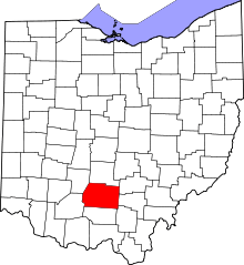 | |
| Villages | ||
| Townships | ||
| CDPs | ||
| Unincorporated communities | ||
| Ghost town | ||
| Footnotes | ‡This populated place also has portions in an adjacent county or counties | |