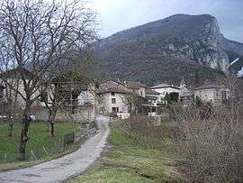
Cognin-les-Gorges
| Cognin-les-Gorges | |
|---|---|
 | |
 Cognin-les-Gorges | |
|
Location within Auvergne-Rhône-Alpes region  Cognin-les-Gorges | |
| Coordinates: 45°10′18″N 5°24′44″E / 45.1717°N 5.4122°ECoordinates: 45°10′18″N 5°24′44″E / 45.1717°N 5.4122°E | |
| Country | France |
| Region | Auvergne-Rhône-Alpes |
| Department | Isère |
| Arrondissement | Grenoble |
| Canton | Vinay |
| Intercommunality | Vinay |
| Government | |
| • Mayor (2014–2020) | Patrice Ferrouillat |
| Area1 | 12.52 km2 (4.83 sq mi) |
| Population (2011)2 | 661 |
| • Density | 53/km2 (140/sq mi) |
| Time zone | CET (UTC+1) |
| • Summer (DST) | CEST (UTC+2) |
| INSEE/Postal code | 38117 / 38470 |
| Elevation |
166–1,120 m (545–3,675 ft) (avg. 270 m or 890 ft) |
|
1 French Land Register data, which excludes lakes, ponds, glaciers > 1 km² (0.386 sq mi or 247 acres) and river estuaries. 2 Population without double counting: residents of multiple communes (e.g., students and military personnel) only counted once. | |
Cognin-les-Gorges is a commune in the Isère department in southeastern France.
Population
| Historical population | ||
|---|---|---|
| Year | Pop. | ±% |
| 1793 | 960 | — |
| 1800 | 975 | +1.6% |
| 1821 | 1,039 | +6.6% |
| 1831 | 1,146 | +10.3% |
| 1841 | 1,114 | −2.8% |
| 1851 | 1,202 | +7.9% |
| 1861 | 1,140 | −5.2% |
| 1872 | 695 | −39.0% |
| 1881 | 640 | −7.9% |
| 1891 | 626 | −2.2% |
| 1901 | 555 | −11.3% |
| 1911 | 548 | −1.3% |
| 1921 | 455 | −17.0% |
| 1931 | 436 | −4.2% |
| 1946 | 441 | +1.1% |
| 1954 | 444 | +0.7% |
| 1962 | 372 | −16.2% |
| 1968 | 397 | +6.7% |
| 1975 | 341 | −14.1% |
| 1982 | 425 | +24.6% |
| 1990 | 532 | +25.2% |
| 1999 | 539 | +1.3% |
| 2006 | 626 | +16.1% |
| 2011 | 661 | +5.6% |
See also
References
| Wikimedia Commons has media related to Cognin-les-Gorges. |
This article is issued from Wikipedia - version of the 10/28/2016. The text is available under the Creative Commons Attribution/Share Alike but additional terms may apply for the media files.