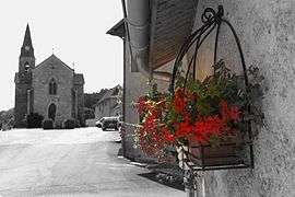
Salagnon
| Salagnon | ||
|---|---|---|
 | ||
| ||
 Salagnon | ||
|
Location within Auvergne-Rhône-Alpes region  Salagnon | ||
| Coordinates: 45°40′03″N 5°21′20″E / 45.6675°N 5.3556°ECoordinates: 45°40′03″N 5°21′20″E / 45.6675°N 5.3556°E | ||
| Country | France | |
| Region | Auvergne-Rhône-Alpes | |
| Department | Isère | |
| Arrondissement | La Tour-du-Pin | |
| Canton | Bourgoin-Jallieu-Nord | |
| Intercommunality | Les Balmes Dauphinoises | |
| Government | ||
| • Mayor (2014–2020) | Gilbert Durand | |
| Area1 | 8.21 km2 (3.17 sq mi) | |
| Population (2011)2 | 1,199 | |
| • Density | 150/km2 (380/sq mi) | |
| Time zone | CET (UTC+1) | |
| • Summer (DST) | CEST (UTC+2) | |
| INSEE/Postal code | 38467 / 38890 | |
| Elevation |
221–397 m (725–1,302 ft) (avg. 290 m or 950 ft) | |
|
1 French Land Register data, which excludes lakes, ponds, glaciers > 1 km² (0.386 sq mi or 247 acres) and river estuaries. 2 Population without double counting: residents of multiple communes (e.g., students and military personnel) only counted once. | ||

Salagnon is a commune in the Isère department in southeastern France.
Population
| Historical population | ||
|---|---|---|
| Year | Pop. | ±% |
| 1911 | 564 | — |
| 1921 | 458 | −18.8% |
| 1931 | 403 | −12.0% |
| 1946 | 358 | −11.2% |
| 1954 | 342 | −4.5% |
| 1962 | 343 | +0.3% |
| 1968 | 323 | −5.8% |
| 1975 | 357 | +10.5% |
| 1982 | 470 | +31.7% |
| 1990 | 693 | +47.4% |
| 1999 | 932 | +34.5% |
| 2006 | 1,125 | +20.7% |
| 2011 | 1,199 | +6.6% |
See also
References
| Wikimedia Commons has media related to Salagnon. |
This article is issued from Wikipedia - version of the 3/15/2016. The text is available under the Creative Commons Attribution/Share Alike but additional terms may apply for the media files.