Costa Marques
| Costa Marques | |
|---|---|
| Municipality | |
 Location in Rondônia state | |
 Costa Marques Location in Brazil | |
| Coordinates: 12°26′42″S 64°13′38″W / 12.44500°S 64.22722°WCoordinates: 12°26′42″S 64°13′38″W / 12.44500°S 64.22722°W | |
| Country |
|
| Region | North Region |
| State | Rondônia |
| Area | |
| • Total | 4,987 km2 (1,925 sq mi) |
| Population (2015) | |
| • Total | 16,651 |
| • Density | 3.3/km2 (8.6/sq mi) |
| Time zone | BRT-1 (UTC-4) |
Costa Marques is a municipality located in the Brazilian state of Rondônia. Its population was 16,651 (2015) and its area is 4,987 km².[1]
The city is located in the Guaporé River's right bank and the main attraction is Forte Príncipe da Beira (named after the Prince of Beira), which was built in 1786 by the Portuguese Kingdom to protect that region from the Spanish Crown.
The municipality contains 91% of the 36,442 hectares (90,050 acres) Serra dos Reis State Park.[2] It also contains 52.5% of the 146,400 hectares (362,000 acres) Rio Cautário State Extractive Reserve, created in 1995.[3]
References
- ↑ IBGE -
- ↑ PES Serra dos Reis (in Portuguese), ISA: Instituto Socioambiental, retrieved 2016-08-06
- ↑ RESEX Rio Cautário (Estadual) (in Portuguese), ISA: Instituto Socioambiental, retrieved 2016-09-15
Capital: Porto Velho | ||
| Alvorada d'Oeste | 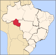 | |
| Ariquemes | ||
| Cacoal | ||
| Colorado do Oeste | ||
| Guajara-Mirim | ||
| Ji-Parana | ||
| Porto Velho | ||
| Vilhena | ||
This article is issued from Wikipedia - version of the 9/15/2016. The text is available under the Creative Commons Attribution/Share Alike but additional terms may apply for the media files.