Pimenteiras do Oeste
| Pimenteiras do Oeste | |
|---|---|
| Municipality | |
 | |
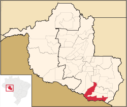 Location in Rondônia state | |
 Pimenteiras do Oeste Location in Brazil | |
| Coordinates: 13°28′57″S 61°2′48″W / 13.48250°S 61.04667°WCoordinates: 13°28′57″S 61°2′48″W / 13.48250°S 61.04667°W | |
| Country |
|
| Region | North Region |
| State | Rondônia |
| Area | |
| • Total | 6,015 km2 (2,322 sq mi) |
| Elevation | 185 m (607 ft) |
| Population (2015) | |
| • Total | 2,424 |
| • Density | 0.40/km2 (1.0/sq mi) |
| Time zone | BRT-1 (UTC-4) |
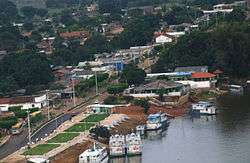
Pimenteiras do Oeste is a municipality located in the Brazilian state of Rondônia. Its population was 2,424 (2015) and its area is 6,015 km².[1]
The municipality contains 52% of the 384,055 hectares (949,020 acres) Corumbiara State Park, created in 1990.[2]
References
- ↑ IBGE -
- ↑ PES de Corumbiara (in Portuguese), ISA: Instituto Socioambiental, retrieved 2016-10-31
Capital: Porto Velho | ||
| Alvorada d'Oeste | 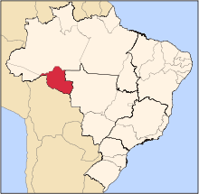 | |
| Ariquemes | ||
| Cacoal | ||
| Colorado do Oeste | ||
| Guajara-Mirim | ||
| Ji-Parana | ||
| Porto Velho | ||
| Vilhena | ||
This article is issued from Wikipedia - version of the 10/31/2016. The text is available under the Creative Commons Attribution/Share Alike but additional terms may apply for the media files.