Country Club Hills, Missouri
| Country Club Hills, Missouri | |
|---|---|
| City | |
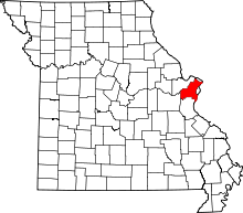
 Location of Country Club Hills, Missouri | |
| Coordinates: 38°43′17″N 90°16′24″W / 38.72139°N 90.27333°WCoordinates: 38°43′17″N 90°16′24″W / 38.72139°N 90.27333°W | |
| Country | United States |
| State | Missouri |
| County | St. Louis |
| Government | |
| • Mayor | Bender McKinney, Jr. |
| Area[1] | |
| • Total | 0.18 sq mi (0.47 km2) |
| • Land | 0.18 sq mi (0.47 km2) |
| • Water | 0 sq mi (0 km2) |
| Elevation | 541 ft (165 m) |
| Population (2010)[2] | |
| • Total | 1,274 |
| • Estimate (2012[3]) | 1,268 |
| • Density | 7,077.8/sq mi (2,732.8/km2) |
| Time zone | Central (CST) (UTC-6) |
| • Summer (DST) | CDT (UTC-5) |
| ZIP code | 63136 |
| Area code(s) | 314 |
| FIPS code | 29-16822[4] |
| GNIS feature ID | 0755935[5] |
Country Club Hills is a city in St. Louis County, Missouri, United States. The population was 1,274 at the 2010 census.[6]
Geography
Country Club Hills is located at 38°43′17″N 90°16′24″W / 38.72139°N 90.27333°W (38.721350, -90.273235).[7]
According to the United States Census Bureau, the city has a total area of 0.18 square miles (0.47 km2), all of it land.[1]
History
As of June 25, 2010, Country Club Hills was the third city to use speed cameras in Missouri.
Demographics
| Historical population | |||
|---|---|---|---|
| Census | Pop. | %± | |
| 1950 | 1,731 | — | |
| 1960 | 1,763 | 1.8% | |
| 1970 | 1,644 | −6.7% | |
| 1980 | 1,315 | −20.0% | |
| 1990 | 1,316 | 0.1% | |
| 2000 | 1,381 | 4.9% | |
| 2010 | 1,274 | −7.7% | |
| Est. 2015 | 1,272 | [8] | −0.2% |
2010 census
As of the census[2] of 2010, there were 1,274 people, 462 households, and 343 families residing in the city. The population density was 7,077.8 inhabitants per square mile (2,732.8/km2). There were 534 housing units at an average density of 2,966.7 per square mile (1,145.4/km2). The racial makeup of the city was 8.2% White, 90.9% African American, 0.2% Native American, 0.1% from other races, and 0.7% from two or more races. Hispanic or Latino of any race were 0.2% of the population.
There were 462 households of which 45.0% had children under the age of 18 living with them, 23.8% were married couples living together, 44.2% had a female householder with no husband present, 6.3% had a male householder with no wife present, and 25.8% were non-families. 22.5% of all households were made up of individuals and 6.1% had someone living alone who was 65 years of age or older. The average household size was 2.76 and the average family size was 3.18.
The median age in the city was 31.4 years. 30.5% of residents were under the age of 18; 10.9% were between the ages of 18 and 24; 26.4% were from 25 to 44; 24.5% were from 45 to 64; and 7.6% were 65 years of age or older. The gender makeup of the city was 44.3% male and 55.7% female.
2000 census
As of the census[4] of 2000, there were 1,381 people, 515 households, and 373 families residing in the city. The population density was 7,761.7 people per square mile (2,962.3/km²). There were 557 housing units at an average density of 3,130.5 per square mile (1,194.8/km²). The racial makeup of the city was 17.16% White, 80.96% African American, 0.22% Native American, 0.07% Asian, 0.07% from other races, and 1.52% from two or more races. Hispanic or Latino of any race were 0.80% of the population.
There were 515 households out of which 39.6% had children under the age of 18 living with them, 28.5% were married couples living together, 38.3% had a female householder with no husband present, and 27.4% were non-families. 22.7% of all households were made up of individuals and 7.8% had someone living alone who was 65 years of age or older. The average household size was 2.68 and the average family size was 3.09.
In the city the population was spread out with 32.3% under the age of 18, 8.4% from 18 to 24, 32.4% from 25 to 44, 18.5% from 45 to 64, and 8.5% who were 65 years of age or older. The median age was 31 years. For every 100 females there were 79.4 males. For every 100 females age 18 and over, there were 70.0 males.
The median income for a household in the city was $27,955, and the median income for a family was $31,845. Males had a median income of $26,938 versus $22,727 for females. The per capita income for the city was $15,374. About 14.1% of families and 14.7% of the population were below the poverty line, including 19.3% of those under age 18 and 12.4% of those age 65 or over.
Visitors
Visitors to The City of Country Club Hills should be aware that an automated traffic enforcement system is in place. The system utilizes cameras to help the city enforce speed control laws.
References
- 1 2 "US Gazetteer files 2010". United States Census Bureau. Archived from the original on 2012-07-14. Retrieved 2012-07-08.
- 1 2 "American FactFinder". United States Census Bureau. Retrieved 2012-07-08.
- ↑ "Population Estimates". United States Census Bureau. Archived from the original on 2013-06-17. Retrieved 2013-05-30.
- 1 2 "American FactFinder". United States Census Bureau. Archived from the original on 2013-09-11. Retrieved 2008-01-31.
- ↑ "US Board on Geographic Names". United States Geological Survey. 2007-10-25. Retrieved 2008-01-31.
- ↑ "Race, Hispanic or Latino, Age, and Housing Occupancy: 2010 Census Redistricting Data (Public Law 94-171) Summary File (QT-PL), Country Club Hills city, Missouri". U.S. Census Bureau, American FactFinder 2. Archived from the original on September 11, 2013. Retrieved October 19, 2011.
- ↑ "US Gazetteer files: 2010, 2000, and 1990". United States Census Bureau. 2011-02-12. Retrieved 2011-04-23.
- ↑ "Annual Estimates of the Resident Population for Incorporated Places: April 1, 2010 to July 1, 2015". Retrieved July 2, 2016.
- ↑ "Census of Population and Housing". Census.gov. Archived from the original on May 11, 2015. Retrieved June 4, 2015.