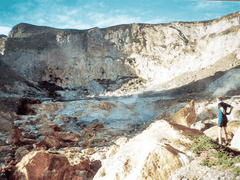
Curtis Island, New Zealand
 Curtis Island (left) and Cheeseman Island from north. | |
 Map | |
| Geography | |
|---|---|
| Coordinates | 30°33′S 178°34′W / 30.550°S 178.567°W |
| Archipelago | Kermadec Islands |
| Area | 40 ha (99 acres) |
| Highest elevation | 130 m (430 ft) |
| Administration | |
Curtis Island is an island in the southwest Pacific (located at 30°33′S 178°34′W / 30.550°S 178.567°W). It is a volcanic island with an elevation of 130 m (427 ft) and an area of 40 ha (99 acres). Together with neighboring Cheeseman Island it belongs to the Kermadec Islands. Politically it is part of New Zealand. The Kermadec Islands lie halfway between North Island, New Zealand and Tonga at approximately the latitude of the Gold Coast, Queensland.
History
Lieutenant John Watts, RN was the first European to visit the Macauley and Curtis Islands — which he named after patrons George Mackenzie Macaulay and William Curtis — on the Lady Penrhyn in late 1788.[1] Lady Penryn had delivered convicts to New South Wales as part of the First Fleet and was proceeding to Macao.
Count von Luckner, Commander of the German raider Seeadler during the First World War, stopped off at Curtis Island to replenish his stores from the castaway depot left there by the New Zealand Marine Department (for the use of shipwrecked crews) while attempting to make good his escape from New Zealand to South America.
Environment
The island is a breeding site for the masked booby.[2] It forms part of the Kermadec Islands Important Bird Area, identified as such by BirdLife International because it is an important site for nesting seabirds.[3]
See also
References
- ↑ Alderman Macaulay 1750-1803, The Worshipful Company of Bowyers, retrieved 2012-02-23
- ↑ Greene et al. (2004).
- ↑ BirdLife International. (2012). Important Bird Areas factsheet: Kermadec Islands. Downloaded from "Archived copy". Archived from the original on 2007-07-10. Retrieved 2014-04-01. on 2012-02-03.
- Greene, T.C.; Scofield, R.P.; Dilks, P.J. (July 2004). Status of Kermadec red-crowned parakeets and the likely effects of a proposed kiore eradication programme. Macauley Island expedition July 2002 (PDF). DOC Science Internal Series 179. Wellington: Department of Conservation, New Zealand. ISBN 0-478-22579-2.