Drakes Branch, Virginia
| Drakes Branch, Virginia | ||
|---|---|---|
| Town | ||
| ||
 Location of Drakes Branch, Virginia | ||
| Coordinates: 36°59′35″N 78°36′6″W / 36.99306°N 78.60167°WCoordinates: 36°59′35″N 78°36′6″W / 36.99306°N 78.60167°W | ||
| Country | United States | |
| State | Virginia | |
| County | Charlotte | |
| Area | ||
| • Total | 4.1 sq mi (10.7 km2) | |
| • Land | 4.1 sq mi (10.7 km2) | |
| • Water | 0.0 sq mi (0.0 km2) | |
| Elevation | 384 ft (117 m) | |
| Population (2010) | ||
| • Total | 530 | |
| • Density | 128/sq mi (49.5/km2) | |
| Time zone | Eastern (EST) (UTC−5) | |
| • Summer (DST) | EDT (UTC−4) | |
| ZIP code | 23937 | |
| Area code | 434 | |
| FIPS code | 51-23376[1] | |
| GNIS feature ID | 1465943[2] | |
| Website |
www | |

Drakes Branch is a town in Charlotte County, Virginia, United States. The population was 530 at the 2010 census.[3]
Geography
Drakes Branch is located southeast of the center of Charlotte County at 36°59′35″N 78°36′6″W / 36.99306°N 78.60167°W (36.992958, -78.601714).[4] Virginia State Route 47 passes through the town, leading north 5 miles (8 km) to Charlotte Court House, the county seat, and southeast 7 miles (11 km) to U.S. Route 15. Virginia State Route 59 intersects Route 47 in the north part of town and leads northeast 8 miles (13 km) to Keysville.
According to the United States Census Bureau, Drakes Branch has a total area of 4.1 square miles (10.7 km2), all of it land.[3]
Demographics
| Historical population | |||
|---|---|---|---|
| Census | Pop. | %± | |
| 1880 | 87 | — | |
| 1910 | 703 | — | |
| 1920 | 660 | −6.1% | |
| 1930 | 583 | −11.7% | |
| 1940 | 438 | −24.9% | |
| 1950 | 410 | −6.4% | |
| 1960 | 759 | 85.1% | |
| 1970 | 702 | −7.5% | |
| 1980 | 617 | −12.1% | |
| 1990 | 565 | −8.4% | |
| 2000 | 504 | −10.8% | |
| 2010 | 530 | 5.2% | |
| Est. 2015 | 515 | [5] | −2.8% |
As of the census[1] of 2000, there were 504 people, 231 households, and 134 families residing in the town. The population density was 121.8 people per square mile (47.0/km²). There were 262 housing units at an average density of 63.3 per square mile (24.4/km²). The racial makeup of the town was 59.33% White, 40.08% African American, 0.20% from other races, and 0.40% from two or more races. Hispanic or Latino of any race were 1.98% of the population.
There were 231 households out of which 21.6% had children under the age of 18 living with them, 39.0% were married couples living together, 14.3% had a female householder with no husband present, and 41.6% were non-families. 35.5% of all households were made up of individuals and 14.7% had someone living alone who was 65 years of age or older. The average household size was 2.18 and the average family size was 2.81.
In the town the age distribution of the population shows 20.4% under the age of 18, 6.5% from 18 to 24, 24.4% from 25 to 44, 28.4% from 45 to 64, and 20.2% who were 65 years of age or older. The median age was 44 years. For every 100 females there were 88.8 males. For every 100 females age 18 and over, there were 91.0 males.
The median income for a household in the town was $25,583, and the median income for a family was $35,000. Males had a median income of $25,469 versus $17,500 for females. The per capita income for the town was $15,701. About 8.2% of families and 16.8% of the population were below the poverty line, including 20.5% of those under age 18 and 14.3% of those age 65 or over.
References
- 1 2 "American FactFinder". United States Census Bureau. Retrieved 2008-01-31.
- ↑ "US Board on Geographic Names". United States Geological Survey. 2007-10-25. Retrieved 2008-01-31.
- 1 2 "Geographic Identifiers: 2010 Demographic Profile Data (G001): Drakes Branch town, Virginia". U.S. Census Bureau, American Factfinder. Retrieved August 25, 2015.
- ↑ "US Gazetteer files: 2010, 2000, and 1990". United States Census Bureau. 2011-02-12. Retrieved 2011-04-23.
- ↑ "Annual Estimates of the Resident Population for Incorporated Places: April 1, 2010 to July 1, 2015". Retrieved July 2, 2016.
- ↑ "Census of Population and Housing". Census.gov. Retrieved June 4, 2015.
External links
Municipalities and communities of Charlotte County, Virginia, United States | ||
|---|---|---|
| Towns | 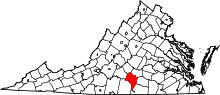 | |
| Unincorporated communities | ||