McKenney, Virginia
| McKenney, Virginia | |
|---|---|
| Town | |
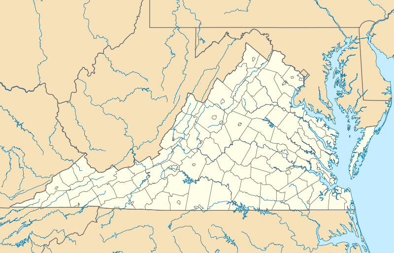 McKenney Location within the state of Virginia | |
| Coordinates: 36°59′00″N 77°43′08″W / 36.98333°N 77.71889°W | |
| Country | United States |
| State | Virginia |
| County | Dinwiddie |
| Area | |
| • Total | 0.9 sq mi (2.4 km2) |
| • Land | 0.9 sq mi (2.4 km2) |
| • Water | 0.0 sq mi (0.0 km2) |
| Elevation | 335 ft (102 m) |
| Population (2010) | |
| • Total | 483 |
| • Density | 521/sq mi (201.0/km2) |
| Time zone | Eastern (EST) (UTC-5) |
| • Summer (DST) | EDT (UTC-4) |
| ZIP code | 23872 |
| Area code(s) | 804 |
| FIPS code | 51-48344[1] |
| GNIS feature ID | 1495918[2] |
McKenney is an incorporated town in Dinwiddie County, Virginia, United States. The population was 483 at the 2010 census.[3]
History
Montrose, the Sappony Church, and Zehmer Farm are listed on the National Register of Historic Places.[4]
Geography
McKenney is located in southwestern Dinwiddie County at 36°59′00″N 77°43′08″W / 36.983307°N 77.718810°WCoordinates: 36°59′00″N 77°43′08″W / 36.983307°N 77.718810°W (36.983307, -77.718810).[5] U.S. Route 1 passes through the southeast side of town, and Interstate 85 passes just southeast of the city limits, with access from Exit 42. Via either highway it is 26 miles (42 km) northeast to Petersburg and 30 miles (48 km) southwest to South Hill. Virginia State Route 40 passes through the center of town, leading east 18 miles (29 km) to Stony Creek and northwest 20 miles (32 km) to Blackstone.
According to the United States Census Bureau, McKenney has a total area of 0.93 square miles (2.4 km2), all land.[3]
Demographics
| Historical population | |||
|---|---|---|---|
| Census | Pop. | %± | |
| 1930 | 341 | — | |
| 1940 | 453 | 32.8% | |
| 1950 | 476 | 5.1% | |
| 1960 | 519 | 9.0% | |
| 1970 | 489 | −5.8% | |
| 1980 | 473 | −3.3% | |
| 1990 | 386 | −18.4% | |
| 2000 | 441 | 14.2% | |
| 2010 | 483 | 9.5% | |
| Est. 2015 | 481 | [6] | −0.4% |
As of the census[1] of 2000, there were 441 people, 167 households, and 105 families residing in the town. The population density was 464.8 people per square mile (179.2/km²). There were 183 housing units at an average density of 192.9 per square mile (74.4/km²). The racial makeup of the town was 66.21% White, 33.33% African American, 0.23% Asian, and 0.23% from two or more races. Hispanic or Latino of any race were 2.04% of the population.
There were 167 households out of which 26.3% had children under the age of 18 living with them, 44.9% were married couples living together, 15.6% had a female householder with no husband present, and 37.1% were non-families. 32.3% of all households were made up of individuals and 15.6% had someone living alone who was 65 years of age or older. The average household size was 2.43 and the average family size was 3.11.
In the town the population was spread out with 20.6% under the age of 18, 7.5% from 18 to 24, 27.2% from 25 to 44, 25.9% from 45 to 64, and 18.8% who were 65 years of age or older. The median age was 42 years. For every 100 females there were 105.1 males. For every 100 females age 18 and over, there were 88.2 males.
The median income for a household in the town was $34,583, and the median income for a family was $45,625. Males had a median income of $32,500 versus $21,250 for females. The per capita income for the town was $19,005. About 4.0% of families and 10.3% of the population were below the poverty line, including 6.8% of those under age 18 and 15.6% of those age 65 or over.
References
- 1 2 "American FactFinder". United States Census Bureau. Archived from the original on September 11, 2013. Retrieved 2008-01-31.
- ↑ "US Board on Geographic Names". United States Geological Survey. 2007-10-25. Retrieved 2008-01-31.
- 1 2 "Geographic Identifiers: 2010 Demographic Profile Data (G001): McKenney town, Virginia". American Factfinder. U.S. Census Bureau. Retrieved January 13, 2016.
- ↑ National Park Service (2010-07-09). "National Register Information System". National Register of Historic Places. National Park Service.
- ↑ "US Gazetteer files: 2010, 2000, and 1990". United States Census Bureau. 2011-02-12. Retrieved 2011-04-23.
- ↑ "Annual Estimates of the Resident Population for Incorporated Places: April 1, 2010 to July 1, 2015". Retrieved July 2, 2016.
- ↑ "Census of Population and Housing". Census.gov. Archived from the original on May 11, 2015. Retrieved June 4, 2015.
Municipalities and communities of Dinwiddie County, Virginia, United States | ||
|---|---|---|
| Town | 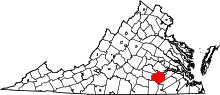 | |
| Unincorporated communities | ||