East Merrimack, New Hampshire
| East Merrimack, New Hampshire | |
|---|---|
| Census-designated place | |
|
Daniel Webster Highway | |
 East Merrimack  East Merrimack | |
| Coordinates: 42°51′35″N 71°29′27″W / 42.85972°N 71.49083°WCoordinates: 42°51′35″N 71°29′27″W / 42.85972°N 71.49083°W | |
| Country | United States |
| State | New Hampshire |
| County | Hillsborough |
| Town | Merrimack |
| Area | |
| • Total | 3.3 sq mi (8.6 km2) |
| • Land | 3.0 sq mi (7.8 km2) |
| • Water | 0.3 sq mi (0.8 km2) |
| Elevation | 98 ft (30 m) |
| Population (2010) | |
| • Total | 4,197 |
| • Density | 1,300/sq mi (490/km2) |
| Time zone | Eastern (EST) (UTC-5) |
| • Summer (DST) | EDT (UTC-4) |
| Area code(s) | 603 |
| FIPS code | 33-21780 |
| GNIS feature ID | 1867352 |

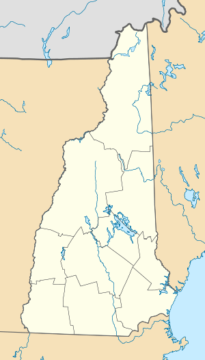
East Merrimack is a census-designated place (CDP) in the town of Merrimack in Hillsborough County, New Hampshire, United States. There is no village center named "East Merrimack"; rather, the CDP refers to the region of the town of Merrimack lying east of the F. E. Everett Turnpike, overlapping portions of the villages of Reeds Ferry, Thornton's Ferry, and the center of Merrimack. The population was 4,197 at the 2010 census.[1]
Geography
East Merrimack is located at 42°51′35″N 71°29′27″W / 42.85972°N 71.49083°W (42.859787, -71.490864).[2]
According to the United States Census Bureau, the CDP has a total area of 3.3 square miles (8.5 km2), of which, 3.0 square miles (7.8 km2) of it is land and 0.3 square miles (0.78 km2) of it (9.04%) is water.
Demographics
As of the census[3] of 2000, there were 3,784 people, 1,667 households, and 990 families residing in the CDP. The population density was 1,253.0 people per square mile (483.8/km²). There were 1,709 housing units at an average density of 565.9/sq mi (218.5/km²). The racial makeup of the CDP was 95.30% White, 1.00% African American, 0.13% Native American, 2.06% Asian, 0.03% Pacific Islander, 0.40% from other races, and 1.08% from two or more races. Hispanic or Latino of any race were 1.74% of the population.
There were 1,667 households out of which 28.4% had children under the age of 18 living with them, 42.4% were married couples living together, 12.0% had a female householder with no husband present, and 40.6% were non-families. 32.2% of all households were made up of individuals and 10.3% had someone living alone who was 65 years of age or older. The average household size was 2.26 and the average family size was 2.86.
In the CDP the population was spread out with 22.6% under the age of 18, 6.8% from 18 to 24, 35.5% from 25 to 44, 22.8% from 45 to 64, and 12.2% who were 65 years of age or older. The median age was 37 years. For every 100 females there were 92.0 males. For every 100 females age 18 and over, there were 89.4 males.
The median income for a household in the CDP was $47,130, and the median income for a family was $52,829. Males had a median income of $39,188 versus $29,259 for females. The per capita income for the CDP was $25,880. About 2.8% of families and 4.7% of the population were below the poverty line, including 10.7% of those under age 18 and 7.9% of those age 65 or over.
References
- ↑ United States Census Bureau, American FactFinder, 2010 Census figures. Retrieved March 23, 2011.
- ↑ "US Gazetteer files: 2010, 2000, and 1990". United States Census Bureau. 2011-02-12. Retrieved 2011-04-23.
- ↑ "American FactFinder". United States Census Bureau. Retrieved 2008-01-31.
Municipalities and communities of Hillsborough County, New Hampshire, United States | ||
|---|---|---|
| Cities | 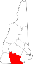 | |
| Towns | ||
| CDPs | ||
| Other villages | ||