Faina, Goiás
- For the Argentine pizzeria dish "Fainá", see Farinata
| Faina | |
|---|---|
| Municipality | |
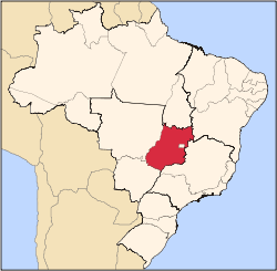
 Location in Goiás state | |
 Faina Location in Brazil | |
| Coordinates: 15°26′52″S 50°22′06″W / 15.44778°S 50.36833°WCoordinates: 15°26′52″S 50°22′06″W / 15.44778°S 50.36833°W | |
| Country |
|
| Region | Central-West Region |
| State | Goiás |
| Microregion | Rio Vermelho Microregion |
| Area | |
| • Total | 1,944.9 km2 (750.9 sq mi) |
| Elevation | 360 m (1,180 ft) |
| Population (2007) | |
| • Total | 6,918 |
| • Density | 3.6/km2 (9.2/sq mi) |
| Time zone | BRT/BRST (UTC-3/-2) |
| Postal code | 76740-000 |
Faina is a municipality in central-west Goiás state, Brazil. The population was 6,918 (2007) in a total area of 1,944.9 km².
Location and Connections
Faina is located 218 km. from Goiânia in the central-west area of the state. It is part of the Rio Vermelho Microregion. The main highways of access are: GO-070 / Goianira/ Itaberaí until the crossroads at Cidade de Goiás, and GO-164. Municipal boundaries:
- North: Araguapaz
- South: Goiás
- East: Itapuranga
- West: Matrinchã
Political Data
- Eligible voters: 5,981 (12/2007)
- Mayor: Caio Vellasco de Castro Curado (January 2009)
- Councilmembers: 09
Demographic Data
- Population density: 3.56 inhab/km² (2007)
- Population growth rate 2000/2007: -0.99.%
- Urban population in 2007: 3,862
- Rural population in 2007: 3,056
Economic Data
The main economic activities were cattle raising and agriculture. There were 146,000 head of cattle (2006). There was modest production of rice, corn, bananas, sugarcane, papaya, and passion fruit.
Education and Health
- Literacy rate: 79.4%
- Infant mortality rate: 28.53 in 1,000 live births
- Schools: 19 with 2,288 students in 2006
- Hospitals: 02 with 29 beds in 2007
- HDI-M: 0.703
- State ranking: 208 (out of 242 municipalities in 2000)
- National ranking: 2,945 (out of 5,507 municipalities in 2000)
Tourism
There are several waterfalls in the area, including Cachoeira das Três Quedas, which has a fall of fifty meters. There is also a cavern 120 meters deep with several large chambers containing both stalagmites and stalactites.
See also
References
Capital: Goiânia | |||||||||||||||||||||||||||||
|  | ||||||||||||||||||||||||||||
|
| |||||||||||||||||||||||||||||
| |||||||||||||||||||||||||||||
| |||||||||||||||||||||||||||||