Santa Fé de Goiás
| Santa Fé de Goiás | |
|---|---|
| Municipality | |
 Location in Goiás state | |
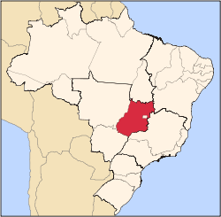
 Santa Fé de Goiás Location in Brazil | |
| Coordinates: 15°46′12″S 51°05′45″W / 15.77000°S 51.09583°WCoordinates: 15°46′12″S 51°05′45″W / 15.77000°S 51.09583°W | |
| Country |
|
| Region | Central-West Region |
| State | Goiás |
| Microregion | Rio Vermelho Microregion |
| Area | |
| • Total | 1,160.8 km2 (448.2 sq mi) |
| Elevation | 362 m (1,188 ft) |
| Population (2007) | |
| • Total | 4,594 |
| • Density | 4.0/km2 (10/sq mi) |
| Time zone | BRT/BRST (UTC-3/-2) |
| Postal code | 76265-000 |
Santa Fé de Goiás is a municipality in west-central Goiás state, Brazil.
Location
Santa Fé is located almost directly west of Brasília and northwest of Goiânia. The nearest town of any size is Jussara, which lies 34 km. to the southeast.
- Distance to regional center (Goiás Velho): 132 km.
- Highway connections: GO-060 / Trindade / GO-326 / Anicuns / Sanclerlândia / Novo Brasil / Jussara / BR-070 / Nova Trindade / GO-173.
Neighboring municipalities: Jussara, Britânia, Itapirapuã
Political Information
- Mayor: Ademar Marques de Carvalho (January 2005)
- City council: 09
- Eligible voters: 3,885 (December/2007)
In 1957 Santa Fé de Goiás became a district belonging to Goiás. In 1958 it was dismembered to become a district in the municipality of Jussara. In 1988 it got its municipal autonomy.
Demographic Information
- Population density: 3.96 inhab/km² (2007)
- Urban population: 3,514 (2007)
- Rural population: 1,080 (2007)
- Population growth: a gain of about 900 people since 1991
Economic Information
The economy is based on subsistence agriculture, cattle raising, services, public administration, and small transformation industries.
- Industrial units: 6 (2007)
- Commercial units: 57 (2007)
- Meat-packing plant: Frigorífico Arantes Ltda
- Cattle herd: 135,000 head
- Main crops: cotton, rice, sugarcane, bananas, sesame seeds, corn, and soybeans.
- Motor vehicles: 231 automobiles, 34 trucks, and 37 pickup trucks (2007)
Education (2006)
- Schools: 5
- Classrooms: 30
- Teachers: 60
- Students: 1,314
- Higher education: none
- Adult literacy rate: 83.7% (2000) (national average was 86.4%)
Health (2003)
- Hospitals: 0
- Hospital beds: 0
- Ambulatory clinics: 2
- Doctors, nurses, dentists: 3, 1, 1 (2002)
- Infant mortality rate: 26.34 (2000) (national average was 33.0)
- MHDI: 0.713
- State ranking: 190 (out of 242 municipalities)
- National ranking: 2,744 (out of 5,507 municipalities)
See also
References
Capital: Goiânia | |||||||||||||||||||||||||||||
|  | ||||||||||||||||||||||||||||
|
| |||||||||||||||||||||||||||||
| |||||||||||||||||||||||||||||
| |||||||||||||||||||||||||||||
This article is issued from Wikipedia - version of the 5/24/2016. The text is available under the Creative Commons Attribution/Share Alike but additional terms may apply for the media files.