Fir Mountain (New York)
| Fir Mountain | |
|---|---|
 Fir Mountain | |
| Highest point | |
| Elevation | 3620+ ft (1103+ m) NGVD 29[1] |
| Prominence | 420 ft (130 m) [1] |
| Listing | Catskill High Peaks |
| Coordinates | 42°01′39″N 74°28′09″W / 42.0275916°N 74.4690414°WCoordinates: 42°01′39″N 74°28′09″W / 42.0275916°N 74.4690414°W [2] |
| Geography | |
| Location | Ulster County, New York |
| Parent range | Catskill Mountains |
| Topo map | USGS Shandaken |
Fir Mountain is a mountain located in Ulster County, New York. The mountain is part of the Catskill Mountains. Fir Mountain is flanked to the northwest by Big Indian Mountain, and to the southeast by Spruce Mountain.
The east side of Fir Mountain drains into Esopus Creek, thence into the Hudson River, and into New York Bay. The northwest end of Fir Mtn. drains into Elk Bushkill, thence into Esopus Creek. The west and south sides of Fir Mtn. drain into Biscuit Brook, thence into the West Branch of the Neversink River, the Delaware River, and into Delaware Bay.
Fir Mountain is within the Big Indian Wilderness of New York's Catskill State Park.
See also
References
- 1 2 "Fir Mountain, New York". Peakbagger.com. Retrieved 2012-12-18.
- ↑ "Fir Mountain". Geographic Names Information System. United States Geological Survey. Retrieved 2012-12-18.
External links
| Northwest Catskills | 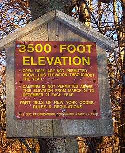  | |
|---|---|---|
| Blackhead Mountains | ||
| Other northeast Catskills | ||
| Devil's Path | ||
| Other central Catskills | ||
| Southwest Catskills | ||
| Burroughs Range | ||
| Other southern Catskills | ||
This article is issued from Wikipedia - version of the 9/1/2016. The text is available under the Creative Commons Attribution/Share Alike but additional terms may apply for the media files.