Fraccionamiento Camino Maldonado
| Fraccionamiento Camino Maldonado | |
|---|---|
| Suburb of Pando (2 fragments) | |
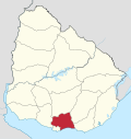
 Fraccionamiento Camino Maldonado Location in Uruguay | |
| Coordinates: 34°44′20″S 55°58′30″W / 34.73889°S 55.97500°WCoordinates: 34°44′20″S 55°58′30″W / 34.73889°S 55.97500°W | |
| Country |
|
| Department | Canelones Department |
| Population (2004) | |
| • Total | 15,057 |
| Time zone | UTC -3 |
| Postal code | 91001 |
| Dial plan | +598 2 (+7 digits) |
Fraccionamiento Camino Maldonado is a suburb of Pando. It is composed of two fragments, one at the northeast and one at the southwest of Barros Blancos. The three together form a southwestern extension of the urban area of Pando, and they all belong to the wider metropolitan area of Montevideo.
Population
In 2004, the two fragments had a population of 15,057.[1]
| Year | Population |
|---|---|
| 1963 | 3,449 |
| 1975 | 8,346 |
| 1985 | 10,082 |
| 1996 | 13,349 |
| 2004 | 15,057 |
Source: Instituto Nacional de Estadística de Uruguay[2]
At the 2011 census, no separate population was given for these fragments. Instead the new population number given for Barros Blancos seems to have incorporated their population.
Coordinates of fragments
- Northeast fragment: 34°44′20″S 55°58′30″W / 34.73889°S 55.97500°W
- Southwest fragment: 34°45′50″S 56°1′20″W / 34.76389°S 56.02222°W
References
- ↑ "2004 Census of Canelones department" (XLS). INE. 2004. Retrieved 29 June 2011.
- ↑ "1963–1996 Statistics / F" (DOC). Instituto Nacional de Estadística de Uruguay. 2004. Retrieved 29 June 2011.
External links
- INE map of Juan Antonio Artigas (Barros Blancos) and the two populated fragments of Camino Maldonado
Capital: Canelones | ||
| Towns and villages |
|  |
| Resorts of the Ciudad de la Costa | ||
| Sights |
| |
This article is issued from Wikipedia - version of the 10/16/2014. The text is available under the Creative Commons Attribution/Share Alike but additional terms may apply for the media files.