Fraccionamiento Camino del Andaluz y Ruta 84
| Fraccionamiento Camino del Andaluz y Ruta 84 | |
|---|---|
| Populated fragment | |
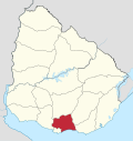
 Fraccionamiento Camino del Andaluz y Ruta 84 Location within Uruguay | |
| Coordinates: 34°45′30″S 56°4′24″W / 34.75833°S 56.07333°W | |
| Country |
|
| Department | Canelones Department |
| Founded | 1889 |
| Population (2011) | |
| • Total | 9,295 |
| Time zone | UTC -3 |
| Postal code | 91200 |
| Dial plan | +598 2 (+7 digits) |
Fraccionamiento Camino del Andaluz y Ruta 84 is a populated area composed of several fragments on both sides of Route 84, southwest of the town of Joaquín Suárez and east of Toledo in the Canelones Department, Uruguay. It is part of the wider Montevideo Metropolitan Area.
Population
In 2011 this area had a population of 9,295.[1][2]
| Year | Population |
|---|---|
| 1985 | 5,635 |
| 1996 | 7,192 |
| 2004 | 7,145 |
| 2011 | 9,295 |
Source: Instituto Nacional de Estadística de Uruguay[3]
References
- ↑ "Censos 2011 Cuadros Canelones". INE. 2012. Retrieved 25 August 2012.
- ↑ "Censos 2011 Canelones". INE. 2012. Retrieved 28 August 2012.
- ↑ "1963–1996 Statistics / F" (DOC). Instituto Nacional de Estadística de Uruguay. 2004. Retrieved 29 June 2011.
External links
Capital: Canelones | ||
| Towns and villages |
|  |
| Resorts of the Ciudad de la Costa | ||
| Sights |
| |
This article is issued from Wikipedia - version of the 10/16/2014. The text is available under the Creative Commons Attribution/Share Alike but additional terms may apply for the media files.