Fruitdale, Indiana
| Fruitdale | |
|---|---|
| Unincorporated community | |
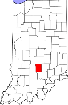 Brown County's location in Indiana | |
 Fruitdale Location in Brown County | |
| Coordinates: 39°19′19″N 86°15′28″W / 39.32194°N 86.25778°WCoordinates: 39°19′19″N 86°15′28″W / 39.32194°N 86.25778°W | |
| Country | United States |
| State | Indiana |
| County | Brown |
| Township | Jackson |
| Elevation | 846 ft (258 m) |
| ZIP code | 46160 |
| FIPS code | 18-26080[1] |
| GNIS feature ID | 434882[2] |
Fruitdale is an unincorporated community in Jackson Township, Brown County, Indiana.
History
Fruitdale had a post office between 1909 and 1937.[3] Fruitdale was likely named from fruit orchards nearby.[4]
Geography
Fruitdale is located at 39°19′19″N 86°15′28″W / 39.32194°N 86.25778°W.
References
- ↑ "American FactFinder". United States Census Bureau. Retrieved 2008-01-31.
- ↑ "Fruitdale, Indiana". Geographic Names Information System. United States Geological Survey. Retrieved 2009-10-17.
- ↑ "Brown County". Jim Forte Postal History. Retrieved 28 August 2014.
- ↑ Baker, Ronald L. (October 1995). From Needmore to Prosperity: Hoosier Place Names in Folklore and History. Indiana University Press. p. 140. ISBN 978-0-253-32866-3.
...it is generally believed that it comes from the location of the village, in the fruit belt.
Municipalities and communities of Brown County, Indiana, United States | ||
|---|---|---|
| Town | ||
| Townships | ||
| CDP | ||
| Other unincorporated communities |
| |
| Footnotes | ‡This populated place also has portions in an adjacent county or counties | |
This article is issued from Wikipedia - version of the 10/24/2016. The text is available under the Creative Commons Attribution/Share Alike but additional terms may apply for the media files.