Gandy, Utah
| Gandy | |
|---|---|
| Unincorporated community | |
 Gandy Location within the state of Utah | |
| Coordinates: 39°27′00″N 113°58′59″W / 39.45000°N 113.98306°WCoordinates: 39°27′00″N 113°58′59″W / 39.45000°N 113.98306°W | |
| Country | United States |
| State | Utah |
| County | Millard |
| Named for | Isaac Gandy |
| Elevation[1] | 4,951 ft (1,509 m) |
| Time zone | Mountain (MST) (UTC-7) |
| • Summer (DST) | MDT (UTC-6) |
| ZIP codes | 84728 |
| Area code(s) | 435 |
| GNIS feature ID | 1437769[1] |
| Historical population | |||
|---|---|---|---|
| Census | Pop. | %± | |
| 1900 | 89 | — | |
| 1910 | 69 | −22.5% | |
| 1920 | 79 | 14.5% | |
| 1930 | 65 | −17.7% | |
| 1940 | 39 | −40.0% | |
| 1950 | 48 | 23.1% | |
| Source: U.S. Census Bureau[2] | |||
Gandy is a small farming unincorporated community in Millard County, Utah, located just east of the Nevada border. It is located in the west-central part of Snake Valley. It is known for Gandy Warm Springs and Gandy Creek, a large spring (15-19 cfs)[3] that comes out of the base of Spring Mountain to the west. It stays around 81–82 degrees Fahrenheit (27–28 Celsius) year-round.[4][5] Originally known as Smithville, Gandy was renamed in 1925 after Isaac Gandy, the first ranch owner in the area back when this was a post office stop along the Pony Express/Overland Route.[6]
References
- 1 2 U.S. Geological Survey Geographic Names Information System: Gandy, Utah. Retrieved May 18, 2011.
- ↑ "Census of Population and Housing". U.S. Census Bureau. Retrieved November 4, 2011.
- ↑ http://water.nv.gov/hearings/spring%20valley%20hearings/SNWA/506/Volume_4/Spring_Discharge.pdf
- ↑ http://protectsnakevalley.com/takeatrip.html
- ↑ http://www.ngdc.noaa.gov/nndc/struts/results?t=100006&s=1&d=1
- ↑ Van Cott, John W. (1990). Utah Place Names. Salt Lake City, Utah: University of Utah Press. p. 151. ISBN 0-87480-345-4.
External links
Municipalities and communities of Millard County, Utah, United States | ||
|---|---|---|
| Cities | 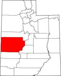 | |
| Towns | ||
| CDPs | ||
| Unincorporated communities | ||
| Ghost towns | ||
This article is issued from Wikipedia - version of the 1/24/2014. The text is available under the Creative Commons Attribution/Share Alike but additional terms may apply for the media files.