Gillette, Wyoming
| Gillette, Wyoming | |
|---|---|
| City | |
|
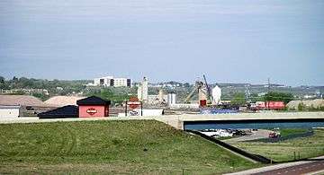
Gillette seen from I-90 | |
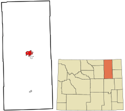 Location in Campbell County, Wyoming and the state of Wyoming. | |
| Coordinates: 44°16′58″N 105°30′19″W / 44.28278°N 105.50528°WCoordinates: 44°16′58″N 105°30′19″W / 44.28278°N 105.50528°W | |
| Country | United States |
| State | Wyoming |
| County | Campbell |
| Government | |
| • Mayor | Louise Carter-King[1] |
| Area[2] | |
| • Total | 19.00 sq mi (49.21 km2) |
| • Land | 18.97 sq mi (49.13 km2) |
| • Water | 0.03 sq mi (0.08 km2) |
| Elevation | 4,554 ft (1,388 m) |
| Population (2010)[3] | |
| • Total | 29,087 |
| • Estimate (2014[4]) | 31,971 |
| • Density | 1,533.3/sq mi (592.0/km2) |
| Time zone | Mountain (MST) (UTC-7) |
| • Summer (DST) | MDT (UTC-6) |
| ZIP code | 82716-82718 |
| Area code(s) | 307 |
| FIPS code | 56-31855[5] |
| GNIS feature ID | 1609094[6] |
| Website | gillettewy.gov |
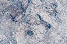
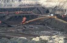
Gillette is a city in and the county seat of Campbell County, Wyoming, United States.[7] The population was estimated at 31,797 as of 1 July 2013.[8] Gillette is centrally located in an area involved with the development of vast quantities of American coal, oil, and coalbed methane gas. The city calls itself the "Energy Capital of the Nation," noting that the state of Wyoming provides nearly 35% of the nation's coal.[9] Over the last decade Gillette saw a population increase of 48% from the 2000 census of 19,646 residents.[10] [11]
History
Gillette was incorporated on January 6, 1892, less than two years after Wyoming became a state. The city was named after Edward Gillette, who worked as a surveyor for the Chicago, Burlington and Quincy Railroad. [12] Companies based in Gillette include Cloud Peak Energy.
In 1974, U.S. psychologist ElDean Kohrs used the town as the basic example of what he called the 'Gillette Syndrome': the social disruption that can occur in a community due to rapid population growth. During the 1960s, Gillette doubled its population from 3,580 to 7,194 residents.[13] Kohrs proposed that this fast increase of population caused the phenomenon known as Gillette Syndrome, resulting in increased crime, high costs of living and weakened social and community bonds.
Geography
Gillette is located at 44°16′58″N 105°30′19″W / 44.28278°N 105.50528°W (44.282660, −105.505256).[14] It is situated between the Big Horn Mountains to the west and the Black Hills to the east, in the Powder River Basin.
According to the United States Census Bureau, the city has a total area of 19.00 square miles (49.21 km2), of which, 18.97 square miles (49.13 km2) is land and 0.03 square miles (0.08 km2) is water.[2]
Climate
Gillette has a semi-arid climate (Köppen climate classification BSk).
| Climate data for Gillette, Wyoming | |||||||||||||
|---|---|---|---|---|---|---|---|---|---|---|---|---|---|
| Month | Jan | Feb | Mar | Apr | May | Jun | Jul | Aug | Sep | Oct | Nov | Dec | Year |
| Record high °F (°C) | 67 (19) |
70 (21) |
80 (27) |
88 (31) |
95 (35) |
104 (40) |
107 (42) |
106 (41) |
102 (39) |
89 (32) |
75 (24) |
69 (21) |
107 (42) |
| Average high °F (°C) | 30.9 (−0.6) |
36.6 (2.6) |
45.2 (7.3) |
54.7 (12.6) |
64.5 (18.1) |
76.0 (24.4) |
84.5 (29.2) |
83.5 (28.6) |
71.8 (22.1) |
58.7 (14.8) |
42.1 (5.6) |
32.9 (0.5) |
56.78 (13.77) |
| Daily mean °F (°C) | 20.5 (−6.4) |
25.7 (−3.5) |
33.4 (0.8) |
41.9 (5.5) |
51.5 (10.8) |
61.9 (16.6) |
69.3 (20.7) |
68.4 (20.2) |
57.5 (14.2) |
45.6 (7.6) |
31.2 (−0.4) |
22.5 (−5.3) |
44.12 (6.73) |
| Average low °F (°C) | 10.0 (−12.2) |
14.8 (−9.6) |
21.5 (−5.8) |
29.1 (−1.6) |
38.4 (3.6) |
47.7 (8.7) |
54.1 (12.3) |
53.3 (11.8) |
43.2 (6.2) |
32.4 (0.2) |
20.3 (−6.5) |
12.1 (−11.1) |
31.41 (−0.33) |
| Record low °F (°C) | −36 (−38) |
−40 (−40) |
−23 (−31) |
−12 (−24) |
11 (−12) |
28 (−2) |
35 (2) |
32 (0) |
10 (−12) |
−12 (−24) |
−26 (−32) |
−37 (−38) |
−40 (−40) |
| Average precipitation inches (mm) | 0.56 (14.2) |
0.54 (13.7) |
1.00 (25.4) |
1.97 (50) |
2.95 (74.9) |
2.64 (67.1) |
1.78 (45.2) |
1.33 (33.8) |
1.43 (36.3) |
1.57 (39.9) |
0.70 (17.8) |
0.67 (17) |
17.14 (435.3) |
| Source #1: NOAA (normals, 1971–2000)[15] | |||||||||||||
| Source #2: The Weather Channel (Records)[16] | |||||||||||||
Demographics
| Historical population | |||
|---|---|---|---|
| Census | Pop. | %± | |
| 1900 | 151 | — | |
| 1910 | 448 | 196.7% | |
| 1920 | 1,157 | 158.3% | |
| 1930 | 1,340 | 15.8% | |
| 1940 | 2,177 | 62.5% | |
| 1950 | 2,191 | 0.6% | |
| 1960 | 3,580 | 63.4% | |
| 1970 | 7,194 | 100.9% | |
| 1980 | 12,134 | 68.7% | |
| 1990 | 17,635 | 45.3% | |
| 2000 | 19,646 | 11.4% | |
| 2010 | 29,087 | 48.1% | |
| Est. 2015 | 32,649 | [17] | 12.2% |
| [13] | |||
As of 2000 the median income for a household in the city was $69,581, and the median income for a family was $78,377. Males had a median income of $41,131 versus $22,717 for females. The per capita income for the city was $19,749. About 5.7% of families and 7.9% of the population were below the poverty line, including 6.2% of those under age 18 and 14.1% of those age 65 or over.
2010 census
As of the census[3] of 2010, there were 29,087 people, 10,975 households, and 7,299 families residing in the city. The population density was 1,533.3 inhabitants per square mile (592.0/km2). There were 12,153 housing units at an average density of 640.6 per square mile (247.3/km2). The racial makeup of the city was 92.2% White, 0.4% African American, 1.2% Native American, 0.7% Asian, 3.2% from other races, and 2.2% from two or more races. Hispanic or Latino of any race were 9.5% of the population.
There were 10,975 households of which 38.9% had children under the age of 18 living with them, 49.2% were married couples living together, 10.3% had a female householder with no husband present, 7.0% had a male householder with no wife present, and 33.5% were non-families. 24.3% of all households were made up of individuals and 4.7% had someone living alone who was 65 years of age or older. The average household size was 2.61 and the average family size was 3.09.
The median age in the city was 30.6 years. 28% of residents were under the age of 18; 10.9% were between the ages of 18 and 24; 30.6% were from 25 to 44; 24.8% were from 45 to 64; and 5.8% were 65 years of age or older. The gender makeup of the city was 52.3% male and 47.7% female.
Education
Public education in the city of Gillette is provided by Campbell County School District #1. Gillette is home to Campbell County High School. Gillette College, a two-year college, is part of the Northern Wyoming Community College District.
Local media
- Radio
The Basin Radio Network owns KIML 1270 AM, KLED 93.3 FM, KAML-FM 97.3 FM, KGWY 100.7 FM, and KDDV-FM 101.5 FM.
Keyhole Broadcasting, LLC owns KGCC 99.9 FM, KQOL-FM 105.3 and KXXL 106.1 FM.
KUWG 90.9 FM, is a Wyoming Public Radio station.
- Television
Gillette Public Access Television is the only television station located in Gillette. It is a traditional PEG cable access station operated by the City of Gillette. It can be viewed on Charter Communications Cable Channels 189 (Education), 190 (Public Access) and 192 (Government). Programming on GPA-TV can be viewed live and archived online at gillettewy.gov/gpa.[18]
- Newspapers
Gillette has one newspaper, the Gillette News-Record, published by Ann Kennedy Turner, The News-Record was originally two newspapers, the Gillette News and the Campbell County Record. The News-Record became a daily July 14, 1975.
- Local magazines
Gillette has many local magazines, including The Gillette Wy Adventure Guide, published online by Tyson Waggener. Print magazines include: Anybody's Autos, The House Hunter, and W Magazine, which are valuable resources for anyone looking for information about the Gillette area.
Transportation
Highways
Airport
Gillette–Campbell County Airport (GCC) is served by Delta Air Lines, and by United Airlines operated by SkyWest Airlines. SkyWest currently operates 6 flights daily in and out of Gillette to hubs in Denver, and Salt Lake City.[19]
Special facilities
At Gillette, Wyoming there is a LORAN-C transmitter at 44°00'11" N and 105°37'24" W. Its antenna, a 700 ft (213.36 meter) high guyed radio mast, is the tallest structure in Wyoming.
The Wyoming Center, a 9,000 seat arena located at the Cam-Plex just east of the city, was completed in 2008. The Cam-Plex hosts events ranging from concerts and balls to the National High School Finals Rodeo.
The Campbell County Recreation Center is a 190,000 square foot facility that was established April 2010 and is a popular place for Gillette residents to visit. This new facility is a great place for physical activity and recreational sports. It includes a 42-foot climbing wall resembling the Devils Tower Monument. There is also an 81,000 square foot field house that contains a six-lane track and 5 indoor tennis courts.[20]
The Energy Capital Sports Complex is Wyoming's premier softball facility. The site features four fast-pitch softball fields that can be converted for Little League baseball. The fields use Slitfilm synthetic turf with sand-rubber infill. There is a 28,000 square foot protected spectator viewing area with a grass play area. There is also a 2.4 mile recreation trail around the complex. Since the grand opening in 2015, the Energy Capital Sports Complex has hosted many tournaments including the Razor City Softball Tournament and the 2016 Wyoming ASA State Softball Tournament.[21]
Notable features around Gillette
.jpg)
Devils Tower National Monument is a short hour drive from Gillette. This flat-top volcanic formation soars more than 1,200 feet above the ground and is a popular site to visit. Many people enjoy walking the 1.3 mile path around the entire monument while others love the thrill of climbing the formation.
Keyhole State Park is also a close 49 minute drive from Gillette that is a popular place to visit in both the summer and winter. Many residents enjoy the reservoir during the summer by camping, hiking, and engaging in water sports. During the winter many people ice fish at keyhole which is excellent fishing for walleye, catfish, small mouth bass, and northern pike. Another fun winter sport you can find people doing around keyhole is snowmobiling.[22]
Gillette is a midway point between the Bighorn Mountains and the Black Hills, and has a somewhat close proximity to both.
Notable people
- Jacob M. Appel - author[23]
- Jillian Balow - 2015 Wyoming superintendent of public instruction, a former teacher in Gillette[24]
- John Chick - Saskatchewan Roughriders, Indianapolis Colts defensive end
- Alicia Craig - distance runner
- George Raymond Eisele - decorated veteran
- Mike Enzi - United States Senator from Wyoming
- Joe Clifford Faust - author
- Bob Harris - Professional baseball player, 1938–42
- Burke Jackson - Wyoming rancher and legislator
- Tom Lubnau - Gillette attorney and former Speaker of the Wyoming House of Representatives
- Clint Oldenburg - Denver Broncos player
- John C. Ostlund - former Wyoming State Senator
- Sue Wallis - poet and former member of the Wyoming House of Representatives from Campbell County
- Kimberly Wilkerson - 2000 Miss Wyoming
References
- ↑ http://www.gillettewy.gov/index.aspx?page=194
- 1 2 "US Gazetteer files 2010". United States Census Bureau. Retrieved 2012-12-14.
- 1 2 "American FactFinder". United States Census Bureau. Retrieved 2012-12-14.
- ↑ "Population Estimates". United States Census Bureau. Retrieved 2015-02-02.
- ↑ "American FactFinder". United States Census Bureau. Retrieved 2008-01-31.
- ↑ "US Board on Geographic Names". United States Geological Survey. 2007-10-25. Retrieved 2008-01-31.
- ↑ "Find a County". National Association of Counties. Retrieved 2011-06-07.
- ↑ http://factfinder.census.gov/faces/tableservices/jsf/pages/productview.xhtml?src=bkmk
- ↑ "Coal Mine Tours - Campbell County Chamber of Commerce Gillette, WY". Retrieved 30 October 2014.
- ↑ "Gillette, WY Population - Census 2010 and 2000 Interactive Map, Demographics, Statistics, Quick Facts - CensusViewer". Retrieved 30 October 2014.
- ↑ About the County, Campbell County, Wyoming, retrieved August 20, 2012
- ↑ Edward Gillette (1925). Locating the iron trail. The Christopher Publishing House. p. 75. Retrieved 28 August 2012.
- 1 2 "Historical Decennial Census Population for Wyoming Counties, Cities, and Towns". Wyoming Department of State / U.S. Census Bureau. Retrieved 2008-06-30.
- ↑ "US Gazetteer files: 2010, 2000, and 1990". United States Census Bureau. 2011-02-12. Retrieved 2011-04-23.
- ↑ "Climatography of the United States NO.81" (PDF). National Oceanic and Atmospheric Administration. Retrieved January 13, 2011.
- ↑ "Monthly Averages for Gillette, WY". The Weather Channel. Retrieved January 13, 2011.
- ↑ "Annual Estimates of the Resident Population for Incorporated Places: April 1, 2010 to July 1, 2015". Retrieved July 2, 2016.
- ↑ http://www.gillettewy.gov/gpa
- ↑ "The Gillette-Campbell County Airport". Iflygillette.com. Retrieved 2012-06-05.
- ↑ http://www.ccgov.net/1039/Campbell-County-Recreation-Center
- ↑ http://www.gillettewy.gov/city-government/departments/public-works/parks/energy-capital-sports-complex
- 1 2 http://www.wyomingtourism.org/things-to-do/detail/Keyhole-State-Park/2571
- ↑ Appel, JM. Phoning Home. University of South Carolina Press, 2014
- ↑ "Biographical Profile for Jillian Balow". vote-wy.org. Retrieved December 11, 2014.
External links
- Campbell County Convention & Visitors Bureau
- City website
- Campbell County Chamber of Commerce
- Energy Capital Economic Development (ECED)
- Gillette News-Record
Municipalities and communities of Campbell County, Wyoming, United States | ||
|---|---|---|
| City | 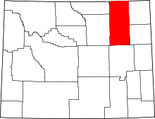 | |
| Town | ||
| CDPs | ||
| Unincorporated communities | ||
Cheyenne (capital) | |
| Topics |
|
| Society |
|
| Regions | |
| Cities | |
| Counties | |