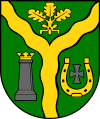
Gmina Klembów
| Gmina Klembów Klembów Commune | ||
|---|---|---|
| Gmina | ||
| ||
| Coordinates (Klembów): 52°24′22″N 21°19′52″E / 52.40611°N 21.33111°ECoordinates: 52°24′22″N 21°19′52″E / 52.40611°N 21.33111°E | ||
| Country |
| |
| Voivodeship | Masovian | |
| County | Wołomin | |
| Seat | Klembów | |
| Area | ||
| • Total | 85.79 km2 (33.12 sq mi) | |
| Population (2013[1]) | ||
| • Total | 9,493 | |
| • Density | 110/km2 (290/sq mi) | |
| Website | http://www.klembow.pl | |
Gmina Klembów is a rural gmina (administrative district) in Wołomin County, Masovian Voivodeship, in east-central Poland. Its seat is the village of Klembów, which lies approximately 10 kilometres (6 mi) north-east of Wołomin and 31 km (19 mi) north-east of Warsaw.
The gmina covers an area of 85.79 square kilometres (33.1 sq mi), and as of 2006 its total population is 8,907 (9,493 in 2013).
Villages
Gmina Klembów contains the villages and settlements of Dobczyn, Karolew, Klembów, Krusze, Krzywica, Lipka, Michałów, Nowy Kraszew, Ostrówek, Pasek, Pieńki, Rasztów, Roszczep, Sitki, Stary Kraszew, Tuł and Wola Rasztowska.
Neighbouring gminas
Gmina Klembów is bordered by the gminas of Dąbrówka, Poświętne, Radzymin, Tłuszcz and Wołomin.
References
| Seat | ||
|---|---|---|
| Other villages | ||
Seat: Wołomin | ||
| Urban gminas |  | |
| Urban-rural gminas | ||
| Rural gminas | ||
This article is issued from Wikipedia - version of the 8/26/2016. The text is available under the Creative Commons Attribution/Share Alike but additional terms may apply for the media files.