Gulf Intracoastal Waterway
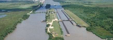
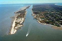
The Gulf Intracoastal Waterway is the portion of the Intracoastal Waterway located along the Gulf Coast of the United States. It is a navigable inland waterway running approximately 1,050 mi (1,690 km) from Carrabelle, Florida, to Brownsville, Texas.
The waterway provides a channel with a controlling depth of 12 ft (3.7 m), designed primarily for barge transportation. Although the U.S. government proposals for such a waterway were made in the early 19th century,[1] the Gulf Intracoastal Waterway was not completed until 1949.[2]
EHL & WHL mileages
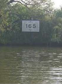
Locations along the Gulf Intracoastal Waterway are defined in terms of statute miles (as opposed to nautical miles, in which most marine routes are measured) east and west of Harvey Lock, a navigation lock in the New Orleans area located at 29°54′32″N 90°05′02″W / 29.909°N 90.084°W. The Hathaway Bridge in Panama City, Florida, for example, is at mile 284.6 EHL (East of Harvey Lock). The Queen Isabella Causeway Bridge at South Padre Island is at mile 665.1 WHL (West of Harvey Lock).[3]
Connecting waterways
The Gulf Intracoastal Waterway crosses or meets, and in some cases is confluent with, numerous other navigable rivers and waterways. They include:
- Apalachicola River
- Atchafalaya River
- Bayou Lafourche
- Bayou Terrebonne
- Calcasieu River
- Calcasieu Ship Channel
- Delcambre Canal
- Houston Ship Channel
- Industrial Canal
- Lower Mississippi River
- Mississippi River-Gulf Outlet Canal
- Mobile Bay (connecting to the Tenn-Tom Waterway)
- Pearl River
- Sabine-Neches Waterway (Includes portions of)
- Santa Rosa Sound
- The Rigolets
- Vermilion River
Ports and harbors
Many of the busiest ports in the United States in terms of tons of cargo[4] are located on or near the Gulf Intracoastal Waterway. Notable ports on or near the waterway include:
Florida
Alabama
- Mobile, Alabama - Ranked 13th busiest
Mississippi
- Gulfport, Mississippi
- Pascagoula, Mississippi - Ranked 21st busiest
Louisiana
- Baton Rouge, Louisiana - Ranked 9th busiest
- Houma, Louisiana - Ranked 88th busiest
- Intracoastal City, Louisiana
- Lake Charles, Louisiana - Ranked 12th busiest
- Larose, Louisiana
- Morgan City, Louisiana
- New Orleans, Louisiana - Ranked 7th busiest
- Port Allen, Louisiana
- Port of South Louisiana - Ranked as busiest port in the United States
Texas
- Beaumont, Texas - Ranked 4th busiest
- Brownsville, Texas - Ranked 72nd busiest
- Corpus Christi, Texas - Ranked 8th busiest
- Galveston, Texas - Ranked 48th busiest
- Houston, Texas - Ranked 2nd busiest
- Port Arthur, Texas - Ranked 18th busiest
- Port Lavaca - Point Comfort, Texas - Ranked 50th busiest
- Texas City, Texas - Ranked 14th busiest
- Victoria, Texas - Ranked 73rd busiest
See also
- Waterways along and crossings of the Gulf Intracoastal Waterway
- IHNC Lake Borgne Surge Barrier
- Gulf Intracoastal Waterway West Closure Complex
References
- ↑ "The Handbook of Texas Online". University of Texas. Retrieved 2006-03-08.
- ↑ Lynn M. Alperin. "History of the Gulf Intracoastal Waterway" (PDF). U.S. Army Corps of Engineers Office of History. Archived from the original (PDF) on 2005-12-08. Retrieved 2006-04-03.
- ↑ "33 CFR 89.25 Waters Specified by the Secretary" (PDF). U.S. Coast Guard Navigation Center. Retrieved 2006-04-21.
- ↑ "U.S. Port Ranking by Cargo Tonnage, 2013". American Association of Port Authorities. Retrieved October 22, 2015.