Hadol
For the French caricaturist, see Paul Hadol.
| Hadol | ||
|---|---|---|
|
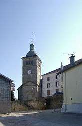
Church of Saint-Gengoult | ||
| ||
 Hadol | ||
|
Location within Grand Est region  Hadol | ||
| Coordinates: 48°05′31″N 6°28′45″E / 48.0919°N 6.4792°ECoordinates: 48°05′31″N 6°28′45″E / 48.0919°N 6.4792°E | ||
| Country | France | |
| Region | Grand Est | |
| Department | Vosges | |
| Arrondissement | Épinal | |
| Canton | Xertigny | |
| Intercommunality | Vôge vers les Rives de la Moselle | |
| Government | ||
| • Mayor (2008–2014) | Roger Colin | |
| Area1 | 49.05 km2 (18.94 sq mi) | |
| Population (2006)2 | 2,373 | |
| • Density | 48/km2 (130/sq mi) | |
| Time zone | CET (UTC+1) | |
| • Summer (DST) | CEST (UTC+2) | |
| INSEE/Postal code | 88225 / 88220 | |
| Elevation |
340–586 m (1,115–1,923 ft) (avg. 500 m or 1,600 ft) | |
|
1 French Land Register data, which excludes lakes, ponds, glaciers > 1 km² (0.386 sq mi or 247 acres) and river estuaries. 2 Population without double counting: residents of multiple communes (e.g., students and military personnel) only counted once. | ||

Hadol is a commune in the Vosges department in Grand Est in northeastern France.
See also
References
External links
| Wikimedia Commons has media related to Hadol. |
This article is issued from Wikipedia - version of the 11/6/2016. The text is available under the Creative Commons Attribution/Share Alike but additional terms may apply for the media files.