Hanks, North Dakota
| Hanks | |
|---|---|
| Unincorporated community | |
 Hanks  Hanks Location within the state of North Dakota | |
| Coordinates: 48°36′12″N 103°48′11″W / 48.60333°N 103.80306°WCoordinates: 48°36′12″N 103°48′11″W / 48.60333°N 103.80306°W | |
| Country | United States |
| State | North Dakota |
| County | Williams |
| Elevation | 2,116 ft (645 m) |
| Time zone | Central (CST) (UTC-6) |
| • Summer (DST) | CDT (UTC-5) |
Hanks is an unincorporated community in Williams County, North Dakota, United States.
| Historical population | |||
|---|---|---|---|
| Census | Pop. | %± | |
| 1930 | 213 | — | |
| 1940 | 192 | −9.9% | |
| 1950 | 115 | −40.1% | |
| 1960 | 78 | −32.2% | |
| 1970 | 13 | −83.3% | |
| 1980 | 10 | −23.1% | |
| 1990 | 11 | 10.0% | |
| U.S. Decennial Census | |||
Geography
Hanks is located on North Dakota Highway 50, and has the latitude of 48.603° N, and the longitude of −103.802° W. The elevation is 2,116 feet (645 m), and is located in the Central Time Zone.
History
Hanks was founded in 1916 along a Great Northern Railway branch line that ran from Stanley to Grenora. The name honors W.F. Hanks, a banker from Powers Lake.[1]
Hanks used to be incorporated until it disincorporated in 1992.[2]
According to a 2008 report, Hanks had only one inhabitant.[3] The town was included in the National Geographic article The Emptied Prairie, published in January 2008.[4]
Notable people
- A. R. Shaw, educator and legislator[5]
References
- ↑ Wick, Douglas A. "Hanks (Williams County)". North Dakota Place Names. Retrieved 8 May 2011.
- ↑ "Boundary Changes".
- ↑ Rubin, Richard (9 April 2006). "Not far from forsaken". The New York Times. Retrieved 25 October 2015.
- ↑ Bowden, Charles (January 2008). "The Emptied Prairie". National Geographic. Retrieved 8 May 2011.
- ↑ 'North Dakota Centennial Blue Book 1889-1989, Ben Meier (editor), North Dakota Legislative Assembly, Biosgraphical Sketch of Arch Shaw, pg. 411
Municipalities and communities of Williams County, North Dakota, United States | ||
|---|---|---|
| Cities | 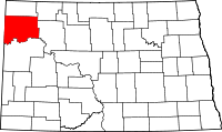 | |
| Townships |
| |
| Unorganized territories |
| |
| Unincorporated communities | ||
This article is issued from Wikipedia - version of the 11/13/2016. The text is available under the Creative Commons Attribution/Share Alike but additional terms may apply for the media files.