Williston, North Dakota
| Williston, North Dakota | |
|---|---|
| City | |
|
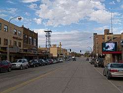
Business district of Williston | |
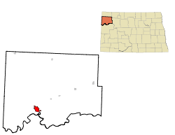 Location of Williston, North Dakota | |
| Coordinates: 48°9′23″N 103°37′41″W / 48.15639°N 103.62806°WCoordinates: 48°9′23″N 103°37′41″W / 48.15639°N 103.62806°W | |
| Country | United States |
| State | North Dakota |
| County | Williams |
| Government | |
| • Mayor | Howard Klug |
| Area[1] | |
| • Total | 7.56 sq mi (19.58 km2) |
| • Land | 7.50 sq mi (19.42 km2) |
| • Water | 0.06 sq mi (0.16 km2) |
| Elevation | 1,877 ft (572 m) |
| Population (2010)[2] | |
| • Total | 14,716 |
| • Estimate (2015)[3] | 26,977 |
| • Density | 1,962.1/sq mi (757.6/km2) |
| Time zone | Central (CST) (UTC-6) |
| • Summer (DST) | CDT (UTC-5) |
| ZIP codes | 58801-58802 |
| Area code(s) | 701 |
| FIPS code | 38-86220 |
| GNIS feature ID | 1032815[4] |
| Highways | US 2, US 2 Bus., US 85, US 85 Bus., ND 1804 |
| Website |
www |
Williston is a city in and the county seat of Williams County, North Dakota, United States.[5] The 2010 census[6] gave its population as 14,716, and the Census Bureau gave the 2015 estimated population as 26,977, making Williston the sixth largest city in North Dakota. The North Dakota oil boom is largely responsible for the sharp increase in population.
Williston's newspapers, both in print and online, are the daily Williston Herald and the weekly The Williston Trader. Sloulin Field International Airport is a public airport 3.2 km (2.0 mi) north of the business district. Williston is the home of Williston State College and the Miss North Dakota Scholarship Pageant.
History
Founded in 1887, Williston was named for Daniel Willis James, a board member of the Northern Pacific Railroad Company, by his friend, railroad owner, James J. Hill.[7][8][9]
Geography
Williston is located at the crossroads of U.S. Highways 2 and 85.
It is near the confluence of the Yellowstone and Missouri rivers, at the upper end of the Lake Sakakawea reservoir.
According to the United States Census Bureau, the city has a total area of 7.56 square miles (19.58 km2), of which 7.50 square miles (19.42 km2) is land and 0.06 square miles (0.16 km2) is water.[1]
The municipality is 18 miles (29 km) from the Montana-North Dakota border and 60 miles (97 km) from the Canada–United States border.[10]
Climate
Williston has a semi-arid climate (Köppen climate classification 'BSk'); it is part of USDA Hardiness zone 4a.[11] The normal monthly mean temperature ranges from 11.0 °F (−11.7 °C) in January to 70.1 °F (21.2 °C) in July.[12] On average, there are 2.9 days that reach 100 °F (38 °C) or higher, 25 days of 90 °F (32 °C)+ highs, 42 days with a low of 0 °F (−18 °C) or below, 9.6 days with lows plummeting to at least −20 °F (−29 °C), and 7.7 days that do not rise above 0 °F annually.[12] The average window for freezing temperatures is September 19 thru May 20,[12] allowing a growing season of 121 days; . Extreme temperatures officially range from −50 °F (−46 °C) on December 23, 1983 and February 16, 1936 up to 110 °F (43 °C) on July 5, 1936; the record cold daily maximum is −29 °F (−34 °C) on January 16, 1930, while, conversely, the record warm daily minimum is 78 °F (26 °C) last set July 19, 1974.[12]
Precipitation is greatest in June and July and averages 14.37 in (365 mm) annually, but has ranged from 6.13 in (156 mm) in 1934 to 22.04 in (560 mm) in 1896.[12] Snowfall averages 45.3 in (115 cm) per season, and has historically ranged from 8.0 in (20 cm) in 1908–09 to 107.2 in (272 cm) in 2010–11;[12] the average window for measurable (≥0.1 in or 0.25 cm) snowfall is October 20 thru April 23, although snow in May occurs at most several times per decade and September snow is a much rarer event.[12] Due to the relative aridity, there are only 4.1 days where 24-hour snowfall exceeds 3 in (7.6 cm).
| Climate data for Williston, North Dakota (Sloulin Int'l), 1981–2010 normals, extremes 1894–present[lower-alpha 1] | |||||||||||||
|---|---|---|---|---|---|---|---|---|---|---|---|---|---|
| Month | Jan | Feb | Mar | Apr | May | Jun | Jul | Aug | Sep | Oct | Nov | Dec | Year |
| Record high °F (°C) | 58 (14) |
66 (19) |
84 (29) |
92 (33) |
106 (41) |
108 (42) |
110 (43) |
108 (42) |
104 (40) |
93 (34) |
76 (24) |
63 (17) |
110 (43) |
| Average high °F (°C) | 21.9 (−5.6) |
27.5 (−2.5) |
40.4 (4.7) |
57.0 (13.9) |
67.7 (19.8) |
76.8 (24.9) |
84.4 (29.1) |
83.8 (28.8) |
71.3 (21.8) |
56.3 (13.5) |
37.9 (3.3) |
24.4 (−4.2) |
54.1 (12.3) |
| Average low °F (°C) | 0.1 (−17.7) |
6.3 (−14.3) |
18.2 (−7.7) |
29.7 (−1.3) |
40.5 (4.7) |
49.7 (9.8) |
55.8 (13.2) |
53.9 (12.2) |
42.1 (5.6) |
29.8 (−1.2) |
16.4 (−8.7) |
3.3 (−15.9) |
28.8 (−1.8) |
| Record low °F (°C) | −42 (−41) |
−50 (−46) |
−35 (−37) |
−15 (−26) |
10 (−12) |
26 (−3) |
34 (1) |
32 (0) |
13 (−11) |
−9 (−23) |
−27 (−33) |
−50 (−46) |
−50 (−46) |
| Average precipitation inches (mm) | 0.59 (15) |
0.39 (9.9) |
0.71 (18) |
1.00 (25.4) |
1.92 (48.8) |
2.52 (64) |
2.54 (64.5) |
1.45 (36.8) |
1.06 (26.9) |
0.92 (23.4) |
0.65 (16.5) |
0.62 (15.7) |
14.37 (365) |
| Average snowfall inches (cm) | 10.0 (25.4) |
5.7 (14.5) |
6.2 (15.7) |
3.7 (9.4) |
1.3 (3.3) |
0 (0) |
0 (0) |
0 (0) |
0.2 (0.5) |
2.6 (6.6) |
6.1 (15.5) |
9.5 (24.1) |
45.3 (115.1) |
| Average precipitation days (≥ 0.01 in) | 7.5 | 6.0 | 7.6 | 7.7 | 10.0 | 11.5 | 9.0 | 8.2 | 7.4 | 6.3 | 6.7 | 8.6 | 96.5 |
| Average snowy days (≥ 0.1 in) | 8.7 | 6.4 | 6.0 | 2.4 | 0.8 | 0 | 0 | 0 | 0.1 | 1.8 | 5.9 | 9.1 | 41.2 |
| Average relative humidity (%) | 76.2 | 75.6 | 72.5 | 61.4 | 58.5 | 59.6 | 56.1 | 54.9 | 61.1 | 65.2 | 74.9 | 77.1 | 66.1 |
| Mean monthly sunshine hours | 144.5 | 169.7 | 227.3 | 250.3 | 297.9 | 326.0 | 366.3 | 331.5 | 249.5 | 197.1 | 122.2 | 125.5 | 2,807.8 |
| Percent possible sunshine | 53 | 59 | 62 | 61 | 63 | 68 | 76 | 75 | 66 | 59 | 44 | 48 | 63 |
| Source: NOAA (relative humidity 1962–1990, sun 1961–1990)[lower-alpha 2][12][14][15] | |||||||||||||
Demographics
| Historical population | |||
|---|---|---|---|
| Census | Pop. | %± | |
| 1890 | 295 | — | |
| 1900 | 763 | 158.6% | |
| 1910 | 3,124 | 309.4% | |
| 1920 | 4,178 | 33.7% | |
| 1930 | 5,106 | 22.2% | |
| 1940 | 5,790 | 13.4% | |
| 1950 | 7,398 | 27.8% | |
| 1960 | 11,866 | 60.4% | |
| 1970 | 11,230 | −5.4% | |
| 1980 | 13,336 | 18.8% | |
| 1990 | 13,131 | −1.5% | |
| 2000 | 12,512 | −4.7% | |
| 2010 | 14,716 | 17.6% | |
| Est. 2015 | 26,977 | [16] | 83.3% |
| U.S. Decennial Census[17] 2015 Estimate[3] | |||
Williston is in northwestern North Dakota's booming oil patch where adequate, affordable housing has become a concern.[18] According to a February 2014 article in Business Insider, Williston had the highest apartment rents in the United States.[19] The 2010 census counted a population of 14,716, up from 12,680 in 2000, but the number of current residents is likely much higher because the count did not include those living in temporary housing. In September 2011, the mayor estimated the actual population at 20,000.[20] The aforementioned 2014 Business Insider story estimated that the population was over 30,000.[19]
2010 census
As of the census[2] of 2010, there were 14,716 people, 6,180 households, and 3,589 families residing in the city. The population density was 1,962.1 inhabitants per square mile (757.6/km2). There were 6,542 housing units at an average density of 872.3 per square mile (336.8/km2). The racial makeup of the city was 92.6% White, 0.3% African-American, 3.3% Native American or Alaska Native, 0.3% Asian, 0.4% from other races, and 3.0% from two or more races. Hispanics or Latinos of any race were 2.2% of the population.
There were 6,180 households of which 29.0% had children under the age of 18 living with them, 44.6% were married couples living together, 9.0% had a female householder with no husband present, 4.5% had a male householder with no wife present, and 41.9% were non-families. 34.6% of all households were made up of individuals and 12.3% had someone living alone who was 65 years of age or older. The average household size was 2.31 and the average family size was 2.99.
The median age in the city was 35.5 years. 23.6% of residents were under the age of 18; 10% were between the ages of 18 and 24; 26.7% were from 25 to 44; 25.4% were from 45 to 64; and 14.4% were 65 years of age or older. The gender makeup of the city was 51.0% male and 49.0% female.
2000 census
According to the census of 2000, there were 12,512 people, 5,255 households, and 3,205 families residing in the city. The population density was 1,794.1 per square mile (693.1/km²). There were 5,912 housing units at an average density of 847.7 per square mile (327.5/km²). The racial makeup of the city was 93.69% White, 0.17% African American, 3.65% Native American or Alaska Native, 0.24% Asian, 0.02% Pacific Islander, 0.17% from other races, and 2.06% from two or more races. Hispanics or Latinos of any race were 1.23% of the population.
The six leading ancestry groups in the city are Norwegian (47.8%), German (31.6%), Irish (9.6%), English (5.8%), Swedish (4.5%), Dutch (4.3%) and French (4.0%).
There were 5,255 households, of which 30.7% had children under the age of 18 living with them, 47.4% were married couples living together, 10.5% had a female householder with no husband present, and 39.0% were non-families. 34.1% of all households were made up of individuals and 13.7% had someone living alone who was 65 years of age or older. The average household size was 2.30 and the average family size was 2.96.
The age distribution was 25.6% under the age of 18, 9.3% from 18 to 24, 25.8% from 25 to 44, 22.5% from 45 to 64, and 16.8% who were 65 years of age or older. The median age was 38 years. For every 100 females there were 91.9 males. For every 100 females age 18 and over, there were 88.3 males.
The median income for a household in the city was $29,962, and the median income for a family was $38,713. Males had a median income of $29,578 versus $18,879 for females. The per capita income for the city was $16,656. About 11.3% of families and 13.4% of the population were below the poverty line, including 19.1% of those under age 18 and 7.8% of those age 65 or over.
Economy
Williston's economy, while historically agricultural, is increasingly being driven by the oil industry. Williston lends its name to the Williston Basin, a huge subterranean geologic feature known for its rich deposits of petroleum, coal and potash. Williston sits atop the Bakken formation, which by the end of 2012 was predicted to be producing more oil than any other site in the United States, surpassing even Alaska's Prudhoe Bay, the longtime leader in domestic output in the United States.[21]
(The State of North Dakota provides a website detailing daily oil activity.) In 1995, the U.S. Geological Survey estimated that there were 150 million barrels of oil "technically recoverable" from the Bakken shale. In April 2008, the number was said to be about four billion barrels; in 2010 geologists at Continental Resources, the major drilling operation in North Dakota, estimated the reserve at eight billion. In March 2012, after the discovery of a lower shelf of oil, it announced a possible 24 billion barrels. Although current technology allows for extraction of only about 6% of the oil trapped 0.99–1.99 mi (1.6–3.2 km) beneath the earth's surface, recoverable oil might eventually exceed 500 billion barrels.[21] [The recoverable oil amount in the WSJ article may be a misprint. Continental Resources estimates of original oil in place (OOIP) is 500 billion bbls of oil. Primary production using new technology could increase primary recover to 10% or 50 billion bbls of recoverable oil. Some suggest as much as 20% which would be 100 billion bbls. Other recovery rates are estimated at 3 – 8% currently, or 15 billion to 40 billion bbls of recoverable oil.]
Williston has seen a huge increase in population and infrastructure investments during the last several years with expanded drilling using the 'frac' petroleum extraction technique in the Bakken Formation and Three Forks Groups.[22] Examples of oil industry related infrastructure investments are the multi-acre branch campus of Baker Hughes, the Sand Creek Retail Center, and the Jim Bridger shops & offices.
A major regional grain elevator is served by the BNSF Railway. Williston's livestock arena has weekly auctions.
Forts Union and Buford, as well as the confluence of the Yellowstone and Missouri Rivers—a part of the history of the Lewis and Clark Expedition—encourage area tourism. Williston is also comparatively close to the North Unit of Theodore Roosevelt National Park.
Arts and culture
Sites of interest
- Fort Union Trading Post National Historic Site – a reconstructed fur-trade era fort owned and maintained by the National Park Service.
- Fort Buford – a pioneer age military fort. An interesting site is the military graveyard.
- Missouri-Yellowstone Confluence Interpretive Center – A museum highlighting the history of the area where the Missouri River and the Yellowstone River merge.
- Lake Sakakawea – a large man-made lake located close to Williston. The lake offers plenty of recreational activities.
- The Confluence – where the Missouri River and the Yellowstone River meet. A historical center, boat ramp, camp site, and bike path are located here.
- Eagle Ridge Golf Club – an eighteen-hole golf course located on Highway 2 north of Williston. It measures 6,240 yards (5,710 m) from the back tees.
- Williston Municipal Golf Course – a 9-hole golf course located at 3600 42nd Street West in Williston.
- The Links of North Dakota at Red Mike Resort – an 18-hole links course east of Williston. Golfweek ranked it 41st among America's 100 best modern courses in 1997, 75th in 1998, and 81st in 1999.
- Cut Bluff Overlook – a historic site located about two miles (3 km) east of Williston on the south side of Highway 1804. Commemorating Lewis and Clark's campsite near Cut Bluff on the south banks of the Missouri River.
- James Memorial Art Center – Originally the community library (est 1911), The James was added to the National Register of Historic Places in 1979.It now serves as an art & cultural center for the community, offering art exhibits and art classes.[23]
- Old Armory – The Old Armory was built in 1915 and listed on the National Register of Historic Places in 1985.[24] The Old Armory is now home to community theater non-profit organization Entertainment, Inc!, founded in 1981. Entertainment, Inc! produces five shows each year.[25]
- Williston Area Recreation Center – a 234,00 square foot recreation center, built in 2014, that includes an indoor surfing, golf simulators, and a water park. There are also the more traditional Tennis and Basketball courts, along with turf fields and an indoor track.[26]
Sports
- Williston Keybirds of North Dakota American League Baseball
- Williston State College Tetons: women's and men's basketball, women's volleyball, men's ice hockey, women's softball and men's baseball.
Education
The Williston Public School District#1 serves the city. The surrounding rural area is served by New Public School District 8. Trinity Christian School is a private K-12 school located in Williston. St. Joseph Catholic School is a private K-6 school located in Williston.
Williston State College is also located in Williston, off University Avenue. The college, founded in 1961 as the University of North Dakota—Williston (UND-W), is a two-year public college affiliated with the North Dakota University System (NDUS). At Williston State College, students can earn an Associate in Arts (AA), Associate in Science (AS), and/or an Associate of Applied Science (AAS) degree.
Media
- Williston Herald
- Plains Reporter
- Oil Patch Hotline
- The Christian Weekly
- The Williston Trader
- The Shopper
Television
- 4.1 KWSE (PBS) Prairie Public Television
- 4.2 World
- 4.3 Minnesota Channel
- 4.4 Lifelong Learning
- 8.1 KUMV (NBC)
- 11.1 KXMD (CBS)
- 38.1 KXND-LP (Fox; rebroadcasts KUMV-TV 8.2)
In the late 1970s and early 1980s, KXMD and KUMV were rebroadcast across Saskatchewan as part of that region's first terrestrial-based cable television system. By 1984, however, the Williston signals had been replaced by those of similar stations in Detroit.
Radio
- FM
- 88.1 K201FJ CSN network – Christian
- 89.5 KPPR North Dakota Public Radio/NPR affiliate
- 90.3 K212DW K-LOVE network – contemporary Christian music
- 90.7 KJND-FM Your Network of Praise – Christian
- 91.7 K219CB American Family Radio network – Christian
- 93.1 KGCX "Eagle 93" Classic rock – based in Sidney, Montana
- 95.1 KTHC "Power 95.1" Hot Adult Contemporary
- 96.1 KYYZ "Z96.1 Country Thunder" Country
- 101.1 KDSR "Hot 101" Jack FM
- 102.7 K274AD KHRT translator – contemporary Christian music
- AM
- 660 KEYZ "Keyz NewsRadio" News/Talk/Country
- 1070 KATQ Country – based in Plentywood, Montana
- 1090 KTGO Country – based in Tioga
Infrastructure
Transportation
Air
The city of Williston is served by the Sloulin Field International Airport, which has a customs service in its facilities. In 2012, United Airlines began offering daily codeshare jet service (via ExpressJet Airlines) to Denver, CO (KDEN) on Embraer 145 aircraft, while Delta Air Lines began daily codeshare jet service (via SkyWest Airlines) to Minneapolis, MN (MSP) on Bombardier CRJ200 aircraft. In August 2014 United began offering direct flights to Houston TX.
FedEx Express of Memphis, TN, provides cargo flights to and from the Williston, ND Airport (ISN) and Grand Forks, ND (GFK) airport utilizing Cessna 208B Caravans with CargoMaster cargo pods. These flights run Monday through Saturday. The Saturday service has an early cutoff time and pickups are limited to in-town stops and drop box locations only.
Rail
Amtrak, the national passenger rail system, serves a station in Williston via its Empire Builder, a once-daily train in each direction between Portland, Oregon/Seattle, Washington and Chicago.
Highways

US 2 and US 85 run concurrent through the city. ND 1804 runs through the southern portion of the city and is concurrent with US 2 and US 85 west of Main St.
Healthcare
Williston clinics include Craven-Hagan Clinic, Fairlight Medical Center, and Trinity Community Clinic-Western Dakota. Fairlight has the only Veteran's Affairs clinic in northwestern North Dakota and also serves residents of northeastern Montana. Fairlight includes a walk-in clinic with four health care professionals. Mercy Medical Center is the Williston hospital. It provides 24-hour emergency and trauma care but lacks a walk-in clinic.
Mercy Medical Center is home to the Leonard P. Nelson Family Cancer Treatment Center (est. 1996), providing oncology services in the region for the past seventeen years to an area of a 100-mile radius. Patients receive treatment for a wide variety of cancers including breast, gynecologic, head and neck, lung and prostate. Mercy Medical Center broke ground 24 August 2012 on an expanded cancer treatment facility. Improvements include the installation of a highly specialized linear accelerator to increase precision radiation therapy treatment delivery with decreased patient treatment time. The grand opening was 7 October 2013.[27]
Mercy Medical Center was named among the Top 100 Critical Access Hospitals (CAHs) in the United States by The Joint Commission on Accreditation of Healthcare Organizations in September 2012.[28]
Notable people
- Larry Bergh, selected by the Chicago Bulls in the 1969 NBA draft, but never played
- James R. Carrigan, United States District Court judge and Colorado Supreme Court justice, practiced law in Williston
- Sally Fraser, actress, born in Williston
- Virgil Hill, silver medalist Olympic boxer (1984), four-time world champion boxer who lost his title to Xue Li
- Darlene Hooley, congresswoman from Oregon
- Phil Jackson, 11-time NBA championship head coach
- Mark Lee, pitcher with the Kansas City Royals, Milwaukee Brewers, and Baltimore Orioles
- Brent Qvale, professional football player
See also
Notes
References
- 1 2 "US Gazetteer files 2010". United States Census Bureau. Retrieved 14 June 2012.
- 1 2 "American FactFinder". United States Census Bureau. Retrieved 14 June 2012.
- 1 2 "Population Estimates". United States Census Bureau. Retrieved June 1, 2016.
- ↑ "US Board on Geographic Names". United States Geological Survey. 2007-10-25. Retrieved 2008-01-31.
- ↑ "Find a County". National Association of Counties. Retrieved 2011-06-07.
- ↑ "2010 Census Redistricting Data (Public Law 94-171) Summary File". American FactFinder. United States Census Bureau. Retrieved 2 May 2011.
- ↑ John Matzko, Reconstructing Fort Union (Lincoln: University of Nebraska Press, 2001), 26; Ben Innis, Sagas of the Smoky-Water (Williston, ND: privately published, 1985), 344.
- ↑ Wick, Douglas A. (1988). North Dakota Place Names. Bismarck, North Dakota: Hedemarken Collectibles. ISBN 0-9620968-0-6. OCLC 191277027.
- ↑ Williams, Mary Ann (Barnes) (1966). Origins of North Dakota Place Names. Bismarck, North Dakota: Bismarck Tribune, 1966. OCLC 431626.
- ↑ "Overview" (Archive). Sloulin Field International Airport. Retrieved on June 2, 2014.
- ↑ "USDA Plant Hardiness Zone Map". http://planthardiness.ars.usda.gov/PHZMWeb/. United States Department of Agriculture. External link in
|website=(help); - 1 2 3 4 5 6 7 8 "NowData - NOAA Online Weather Data". National Oceanic and Atmospheric Administration. Retrieved 2013-06-28.
- ↑ ThreadEx
- ↑ "Station Name: ND WILLISTON SLOULIN INTL AP". National Oceanic and Atmospheric Administration. Retrieved 2014-03-26.
- ↑ "WMO Climate Normals for WILLISTON/SLOULIN FIELD, ND 1961–1990". National Oceanic and Atmospheric Administration. Retrieved 2014-03-10.
- ↑ "Annual Estimates of the Resident Population for Incorporated Places: April 1, 2010 to July 1, 2015". Retrieved July 2, 2016.
- ↑ "U.S. Decennial Census". Census.gov. Retrieved May 25, 2013.
- ↑ Meg Lindholm, "Flock To N.D. Oil Town Leads To Housing Crisis," NPR, 28 May 2010
- 1 2 Johnson, Robert (February 13, 2014). "What Life Is Like In Williston, The North Dakota Oil Boomtown Where Tiny Apartments Top $2,000 A Month". Business Insider. Retrieved September 1, 2014.
- ↑ NPR website.
- 1 2 Moore, Stephen (11 March 2012). "What North Dakota Could Teach California". Wall Street Journal. Retrieved 19 March 2012.
- ↑ Seattle Times.
- ↑ http://thejamesmemorial.org/historical-notes/
- ↑ http://nrhp.focus.nps.gov/natreg/docs/All_Data.html
- ↑ http://www.entertainmentinc.org/AboutUs.aspx
- ↑ http://www.businessweek.com/articles/2014-06-18/a-70-million-rec-center-brings-indoor-surfing-golf-to-north-dakota
- ↑ http://www.mercy-williston.org/News/Leonard-P-Nelson-Cancer-Center-Grand-Opening
- ↑ http://www.beckershospitalreview.com/news-analysis/top-100-critical-access-hospitals-named-by-ivantage.html
External links
| Wikimedia Commons has media related to Williston, North Dakota. |
| Wikivoyage has a travel guide for Williston (North Dakota). |
Municipalities and communities of Williams County, North Dakota, United States | ||
|---|---|---|
| Cities | 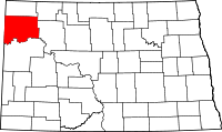 | |
| Townships |
| |
| Unorganized territories |
| |
| Unincorporated communities | ||