Harrison, Vigo County, Indiana
This article is about the historical community of Harrison, Vigo County, Indiana. For Harrison Township, Vigo County, Indiana, see Harrison Township, Vigo County, Indiana.
| Harrison | |
|---|---|
| Unincorporated community | |
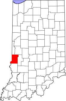 Vigo County's location in Indiana | |
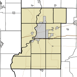 Harrison location in Vigo County, Indiana | |
| Coordinates: 39°31′43″N 87°25′20″W / 39.52861°N 87.42222°WCoordinates: 39°31′43″N 87°25′20″W / 39.52861°N 87.42222°W | |
| Country |
|
| State |
|
| County | Vigo County |
| Township | Fayette Township |
| Elevation[1] | 139 m (456 ft) |
| Area code(s) | 812 |
| GNIS feature ID | 452218 |
Harrison is an unincorporated community in southeastern Fayette Township, Vigo County, Indiana, United States.[2]
It is part of the Terre Haute metropolitan area.
History
Harrison was platted August 4, 1837, by Ann Potts, on the west side of the river from Fort Harrison, a military outpost in the region built in 1811 by General William Henry Harrison.[3][4]
Geography
Harrison is located at 39°31′43″N 87°25′20″W / 39.52861°N 87.42222°W at an elevation of 456 feet.
References
- ↑ "US Board on Geographic Names". United States Geological Survey. October 25, 2007. Retrieved 2016-07-14.
- ↑ "Harrison, Indiana". Geographic Names Information System. United States Geological Survey. Retrieved 2010-06-25.
- ↑ "Fort Harrison (historical)". Geographic Names Information System. United States Geological Survey. Retrieved 2010-06-25.
- ↑ Bradsby, H.C. (1891). History of Vigo County, Indiana, with Biographical Selections. Chicago: S. B. Nelson & Co. p. 476.
Municipalities and communities of Vigo County, Indiana, United States | ||
|---|---|---|
| City | ||
| Towns | ||
| Townships | ||
| CDPs | ||
| Other unincorporated communities |
| |
| Footnotes | ‡This populated place also has portions in an adjacent county or counties | |
This article is issued from Wikipedia - version of the 8/2/2016. The text is available under the Creative Commons Attribution/Share Alike but additional terms may apply for the media files.