Taylorville, Indiana
| Taylorville | |
|---|---|
| Unincorporated community | |
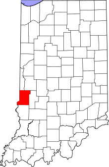 Vigo County's location in Indiana | |
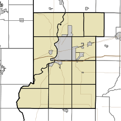 Taylorville location in Vigo County, Indiana | |
| Coordinates: 39°27′45″N 87°25′25″W / 39.46250°N 87.42361°WCoordinates: 39°27′45″N 87°25′25″W / 39.46250°N 87.42361°W | |
| Country |
|
| State |
|
| County | Vigo County |
| Township | Sugar Creek Township |
| Elevation[1] | 180 m (591 ft) |
| ZIP code | 47885 |
| Area code(s) | 812 |
| GNIS feature ID | 444608 |
Taylorville, also known as Taylorsville or Dresser, is an unincorporated community in eastern Sugar Creek Township, Vigo County, Indiana, United States.[2] It is part of the Terre Haute metropolitan area. Though the United States Board on Geographic Names has officially designated the area as Taylorville, the 2010 United States Census considered the area a census designated place called Dresser.[3]
History
A post office was established under the name Dresser in 1932, and remained in operation until it was discontinued in 1935.[4]
Geography
Taylorville is located at 39°21′44″N 87°22′56″W / 39.36222°N 87.38222°W at an elevation of 591 feet. Located very near the Wabash River, the town is nestled between Terre Haute and West Terre Haute.
References
- ↑ "US Board on Geographic Names". United States Geological Survey. October 25, 2007. Retrieved 2016-07-13.
- ↑ "Taylorville". Geographic Names Information System. United States Geological Survey. Retrieved 2010-06-25.
- ↑ "Dresser Census Designated Place". Geographic Names Information System. United States Geological Survey. Retrieved 2010-06-25.
- ↑ "Vigo County". Jim Forte Postal History. Retrieved July 13, 2016.
Municipalities and communities of Vigo County, Indiana, United States | ||
|---|---|---|
| City | ||
| Towns | ||
| Townships | ||
| CDPs | ||
| Other unincorporated communities |
| |
| Footnotes | ‡This populated place also has portions in an adjacent county or counties | |