Harrison Township, New Jersey
| Harrison Township, New Jersey | |
|---|---|
| Township | |
| Township of Harrison | |
|
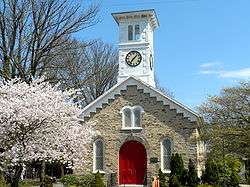
St. Stephens in Mullica Hill | |
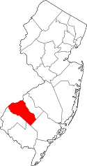
 Harrison Township highlighted in Gloucester County. Inset map: Gloucester County highlighted in the State of New Jersey. | |
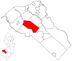
 Census Bureau map of Harrison Township, New Jersey | |
| Coordinates: 39°43′34″N 75°12′18″W / 39.72601°N 75.20505°WCoordinates: 39°43′34″N 75°12′18″W / 39.72601°N 75.20505°W[1][2] | |
| Country |
|
| State |
|
| County |
|
| Incorporated | March 13, 1844 as Spicer Township |
| Renamed | April 1, 1845 as Harrison Township |
| Named for | William Henry Harrison |
| Government[3] | |
| • Type | Township |
| • Body | Township Committee |
| • Mayor | Dennis Clowney (R, term ends December 31, 2016)[4][5] |
| • Administrator | Mark L. Gravinese[6] |
| • Clerk | Diane Malloy[7] |
| Area[1] | |
| • Total | 19.228 sq mi (49.798 km2) |
| • Land | 19.141 sq mi (49.574 km2) |
| • Water | 0.087 sq mi (0.224 km2) 0.45% |
| Area rank |
146th of 566 in state 7th of 24 in county[1] |
| Elevation[8] | 46 ft (14 m) |
| Population (2010 Census)[9][10][11] | |
| • Total | 12,417 |
| • Estimate (2015)[12] | 12,984 |
| • Rank |
195th of 566 in state 8th of 24 in county[13] |
| • Density | 648.7/sq mi (250.5/km2) |
| • Density rank |
420th of 566 in state 18th of 24 in county[13] |
| Time zone | Eastern (EST) (UTC-5) |
| • Summer (DST) | Eastern (EDT) (UTC-4) |
| ZIP code | 08062 - Mullica Hill[14][15] |
| Area code(s) | 856[16] |
| FIPS code | 3401530180[1][17][18] |
| GNIS feature ID | 0882146[1][19] |
| Website |
www |
Harrison Township is a township in Gloucester County, New Jersey, United States. As of the 2010 United States Census, the township's population was 12,417,[9][10][11] reflecting an increase of 3,629 (+41.3%) from the 8,788 counted in the 2000 Census, which had in turn increased by 4,073 (+86.4%) from the 4,715 counted in the 1990 Census.[20]
Harrison Township was originally formed as Spicer Township by an act of the New Jersey Legislature on March 13, 1844, from portions of Greenwich Township and Woolwich Township. That name lasted for less than a year, with Harrison Township adopted as of April 1, 1845.[21] The township was named for President William Henry Harrison.[22][23]
Harrison is a dry township where alcohol cannot be sold.[24][25]
Geography
According to the United States Census Bureau, the township had a total area of 19.228 square miles (49.798 km2), including 19.141 square miles (49.574 km2) of land and 0.087 square miles (0.224 km2) of water (0.45%).[1][2]
Mullica Hill is an unincorporated community and census designated place (CDP) located within Harrison Township that had a 2010 Census population of 3,982.[26] Richwood is a CDP that is in portions of both Harrison Township and Mantua Township, which had a 2010 population of 3,459, of which 3,400 were in Harrison Township and 59 in Mantua Township.[27][28]
Other unincorporated communities, localities and place names located partially or completely within the township include Ewan, Ewans Mills, Heritage, Jefferson and Sherwin.[29]
The township borders Woolwich Township, East Greenwich Township, Mantua Township, Glassboro, Elk Township, and South Harrison Township.
Demographics
| Historical population | |||
|---|---|---|---|
| Census | Pop. | %± | |
| 1850 | 1,984 | — | |
| 1860 | 2,544 | 28.2% | |
| 1870 | 3,038 | 19.4% | |
| 1880 | 2,841 | −6.5% | |
| 1890 | 1,545 | −45.6% | |
| 1900 | 1,569 | 1.6% | |
| 1910 | 1,682 | 7.2% | |
| 1920 | 1,633 | −2.9% | |
| 1930 | 1,827 | 11.9% | |
| 1940 | 1,805 | −1.2% | |
| 1950 | 2,225 | 23.3% | |
| 1960 | 2,410 | 8.3% | |
| 1970 | 2,661 | 10.4% | |
| 1980 | 3,585 | 34.7% | |
| 1990 | 4,715 | 31.5% | |
| 2000 | 8,788 | 86.4% | |
| 2010 | 12,417 | 41.3% | |
| Est. 2015 | 12,984 | [12][30] | 4.6% |
| Population sources: 1850-2000[31] 1850-1920[32] 1850-1870[33] 1850[34] 1870[35] 1880-1890[36] 1890-1910[37] 1910-1930[38] 1930-1990[39] 2000[40][41] 2010[9][10][11] | |||
Census 2010
At the 2010 United States Census, there were 12,417 people, 3,942 households, and 3,315 families residing in the township. The population density was 648.7 per square mile (250.5/km2). There were 4,089 housing units at an average density of 213.6 per square mile (82.5/km2). The racial makeup of the township was 90.57% (11,246) White, 3.83% (475) Black or African American, 0.09% (11) Native American, 3.38% (420) Asian, 0.00% (0) Pacific Islander, 0.48% (59) from other races, and 1.66% (206) from two or more races. Hispanics or Latinos of any race were 3.01% (374) of the population.[9]
There were 3,942 households, of which 49.9% had children under the age of 18 living with them, 72.7% were married couples living together, 7.9% had a female householder with no husband present, and 15.9% were non-families. 13.3% of all households were made up of individuals, and 5.4% had someone living alone who was 65 years of age or older. The average household size was 3.15 and the average family size was 3.47.[9]
In the township, 31.8% of the population were under the age of 18, 7.5% from 18 to 24, 22.8% from 25 to 44, 29.6% from 45 to 64, and 8.4% who were 65 years of age or older. The median age was 38.1 years. For every 100 females there were 95.9 males. For every 100 females age 18 and over, there were 94.2 males.[9]
The Census Bureau's 2006-2010 American Community Survey showed that (in 2010 inflation-adjusted dollars) median household income was $102,162 (with a margin of error of +/- $10,851) and the median family income was $121,366 (+/- $9,400). Males had a median income of $88,157 (+/- $6,618) versus $47,857 (+/- $10,273) for females. The per capita income for the borough was $36,354 (+/- $2,640). About 5.0% of families and 5.5% of the population were below the poverty line, including 7.4% of those under age 18 and 2.8% of those age 65 or over.[42]
Census 2000
As of the 2000 United States Census[17] there were 8,788 people, 2,848 households, and 2,323 families residing in the township. The population density was 459.3 people per square mile (177.4/km²). There were 2,939 housing units at an average density of 153.6 per square mile (59.3/km²). The racial makeup of the township was 95.16% White, 2.96% African American, 0.13% Native American, 0.73% Asian, 0.41% from other races, and 0.61% from two or more races. Hispanic or Latino of any race were 1.78% of the population.[40][41]
There were 2,848 households out of which 49.9% had children under the age of 18 living with them, 71.8% were married couples living together, 7.3% had a female householder with no husband present, and 18.4% were non-families. 15.3% of all households were made up of individuals and 5.0% had someone living alone who was 65 years of age or older. The average household size was 3.06 and the average family size was 3.44.[40][41]
In the township the population was spread out with 33.2% under the age of 18, 5.6% from 18 to 24, 33.7% from 25 to 44, 20.8% from 45 to 64, and 6.6% who were 65 years of age or older. The median age was 35 years. For every 100 females there were 98.5 males. For every 100 females age 18 and over, there were 95.5 males.[40][41]
The median income for a household in the township was $77,143, and the median income for a family was $84,379. Males had a median income of $61,770 versus $39,583 for females. The per capita income for the township was $28,645. About 2.1% of families and 3.2% of the population were below the poverty line, including 2.5% of those under age 18 and 7.7% of those age 65 or over.[40][41]
Government
Local government
Harrison Township is governed under the Township form of government. The five-member Township Committee is elected directly by the voters at-large in partisan elections to serve three-year terms of office on a staggered basis, with either one or two seats coming up for election each year as part of the November general election in a three-year cycle.[3][43] At an annual reorganization meeting held each January, the Township Committee selects one of its members to serve as Mayor and another as Deputy Mayor.
As of 2016, the members of the Harrison Township Committee are Mayor Dennis Clowney (R, term on committee ends December 31, 2017 and as mayor ends December 31, 2016), Deputy Mayor Donald Heim (R, term on committee ends 2018; term as deputy mayor ends 2016), Matt Diggons (R, 2016), Louis Manzo (R, 2017) and David Undercuffler (R, 2016).[4][44][45][46][47][48]
Federal, state and county representation
Harrison Township is located in the 2nd Congressional District[49] and is part of New Jersey's 5th state legislative district.[10][50][51] Prior to the 2011 reapportionment following the 2010 Census, Harrison Township had been in the 3rd state legislative district.[52]
New Jersey's Second Congressional District is represented by Frank LoBiondo (R, Ventnor City).[53] New Jersey is represented in the United States Senate by Cory Booker (D, Newark, term ends 2021)[54] and Bob Menendez (D, Paramus, 2019).[55][56]
For the 2016–2017 session (Senate, General Assembly), the 5th Legislative District of the New Jersey Legislature is represented in the State Senate by Nilsa Cruz-Perez (D, Barrington) and in the General Assembly by Arthur Barclay (D, Camden) and Patricia Egan Jones (D, Barrington).[57] The Governor of New Jersey is Chris Christie (R, Mendham Township).[58] The Lieutenant Governor of New Jersey is Kim Guadagno (R, Monmouth Beach).[59]
Gloucester County is governed by a Board of Chosen Freeholders, whose seven members are elected at-large to three-year terms of office on a staggered basis in partisan elections, with two or three seats coming up for election each year. At a reorganization meeting held each January, the Board selects a Freeholder Director and a Deputy Freeholder Director from among its members. As of 2016, Gloucester County's Freeholders are Freeholder Director Robert M. Damminger (D, West Deptford Township; term ends December 31, 2018),[60] Deputy Freeholder Director Giuseppe "Joe" Chila (D, Woolwich Township; 2018),[61] Lyman J. Barnes (D, Logan Township; 2017),[62] Daniel Christy (D, Washington Township; 2016),[63] Frank J. DiMarco (D, Deptford Township; 2016),[64] Heather Simmons (D, Glassboro; 2017)[65] and Jim Jefferson (D, Woodbury; 2017).[66][67][68][69] Constitutional officers elected countywide are County Clerk James N. Hogan,[70] Surrogate Helene M. Reed (Monroe Township)[71] and Sheriff Carmel Morina (Greenwich Township).[72][73][68]
Politics
As of March 23, 2011, there were a total of 7,889 registered voters in Harrison Township, of which 1,903 (24.1%) were registered as Democrats, 2,533 (32.1%) were registered as Republicans and 3,447 (43.7%) were registered as Unaffiliated. There were 6 voters registered to other parties.[74]
In the 2012 presidential election, Republican Mitt Romney received 56.9% of the vote (3,561 cast), ahead of Democrat Barack Obama with 41.8% (2,612 votes), and other candidates with 1.3% (81 votes), among the 6,292 ballots cast by the township's 8,439 registered voters (38 ballots were spoiled), for a turnout of 74.6%.[75][76] In the 2008 presidential election, Republican John McCain received 52.3% of the vote (3,280 cast), ahead of Democrat Barack Obama with 45.7% (2,867 votes) and other candidates with 1.1% (68 votes), among the 6,273 ballots cast by the township's 7,975 registered voters, for a turnout of 78.7%.[77] In the 2004 presidential election, Republican George W. Bush received 58.0% of the vote (3,039 ballots cast), outpolling Democrat John Kerry with 40.7% (2,132 votes) and other candidates with 0.6% (42 votes), among the 5,236 ballots cast by the township's 6,540 registered voters, for a turnout percentage of 80.1.[78]
In the 2013 gubernatorial election, Republican Chris Christie received 73.8% of the vote (2,515 cast), ahead of Democrat Barbara Buono with 24.6% (839 votes), and other candidates with 1.5% (52 votes), among the 3,454 ballots cast by the township's 8,407 registered voters (48 ballots were spoiled), for a turnout of 41.1%.[79][80] In the 2009 gubernatorial election, Republican Chris Christie received 59.5% of the vote (2,214 ballots cast), ahead of Democrat Jon Corzine with 31.7% (1,178 votes), Independent Chris Daggett with 7.1% (265 votes) and other candidates with 0.6% (23 votes), among the 3,718 ballots cast by the township's 7,900 registered voters, yielding a 47.1% turnout.[81]
Education
The Harrison Township School District serves students in public school for pre-Kindergarten through sixth grade. As of the 2011-12 school year, the district's two schools had an enrollment of 1,481 students and 111.3 classroom teachers (on an FTE basis), for a student–teacher ratio of 13.31:1.[82] Schools in the district (with 2011-12 enrollment data from the National Center for Education Statistics[83]) are Harrison Township Elementary School[84] (827 students in grades PreK-3) and Pleasant Valley School[85] (654 students in grades 4-6).[86][87]
Public school students in seventh through twelfth grades attend the schools of the Clearview Regional High School District, which serves students from Harrison Township and Mantua Township.[88][89] Schools in the district (with 2013-14 enrollment data from the National Center for Education Statistics[90]) are Clearview Regional Middle School[91] with 867 students (grades 7 and 8) and Clearview Regional High School[92] with 1,623 students (grades 9-12).[93]
Friends School Mullica Hill is a private, nonsectarian, coeducational day school located in the Mullica Hill section of Harrison Township that was established in 1969 and now serves students pre-Kindergarten through eighth grade.[94]
Transportation
Roads and highways
As of May 2010, the township had a total of 93.60 miles (150.63 km) of roadways, of which 56.92 miles (91.60 km) were maintained by the municipality, 29.64 miles (47.70 km) by Gloucester County, 6.94 miles (11.17 km) by the New Jersey Department of Transportation and 0.10 miles (0.16 km) by the New Jersey Turnpike Authority.[95]
The major county road that goes through is CR 581. State routes include Route 45, Route 55, and Route 77. U.S. Route 322 passes through the center of town. The New Jersey Turnpike runs through the township for a tenth of a mile, but the nearest interchange is just over the border in neighboring Woolwich Township.
Public transportation
New Jersey Transit bus service is available between Bridgeton and Philadelphia on the 410 route.[96][97]
Wineries
Notable people
People who were born in, residents of, or otherwise closely associated with Harrison Township include:
- Jay Accorsi (born 1963), college football coach at Rowan University.[98]
- Wilbur Evans (1905-1987), actor and singer who performed on the radio, in opera, on Broadway, in films, and in early live television.[99]
- Bob Folwell (1885-1928), pioneering football player and coach.[100]
- Samuel Gibbs French (1818-1910), author and Confederate General during the Civil War.[101]
- John W. Hazelton (1814–1878), represented New Jersey's 1st congressional district from 1871-1875.[102]
- Nathan T. Stratton (1813–1887), represented New Jersey's 1st congressional district in the United States House of Representatives from 1851 to 1855.[103]
- Al Szolack (born c. 1950), retired basketball player best known for his time spent on the Washington Generals, the traveling exhibition team best known for their spectacular losing streak in exhibition games against the Harlem Globetrotters.[104]
- Lawrie Tatum (1822-1900), Quaker who was best known as an Indian agent to the Kiowa and Comanche tribes at the Fort Sill agency in Indian Territory.[105]
References
- 1 2 3 4 5 6 2010 Census Gazetteer Files: New Jersey County Subdivisions, United States Census Bureau. Accessed May 21, 2015.
- 1 2 US Gazetteer files: 2010, 2000, and 1990, United States Census Bureau. Accessed September 4, 2014.
- 1 2 2012 New Jersey Legislative District Data Book, Rutgers University Edward J. Bloustein School of Planning and Public Policy, March 2013, p. 19.
- 1 2 Township Committee, Harrison Township. Accessed November 11, 2016.
- ↑ 2016 New Jersey Mayors Directory, New Jersey Department of Community Affairs. Accessed June 14, 2016.
- ↑ Township Administrator, Harrison Township. Accessed July 5, 2016.
- ↑ Municipal Clerk's Office, Harrison Township. Accessed July 5, 2016.
- ↑ U.S. Geological Survey Geographic Names Information System: Township of Harrison, Geographic Names Information System. Accessed March 5, 2013.
- 1 2 3 4 5 6 DP-1 - Profile of General Population and Housing Characteristics: 2010 for Harrison township, Gloucester County, New Jersey, United States Census Bureau. Accessed July 26, 2012.
- 1 2 3 4 Municipalities Grouped by 2011-2020 Legislative Districts, New Jersey Department of State, p. 3. Accessed January 6, 2013.
- 1 2 3 Profile of General Demographic Characteristics: 2010 for Harrison township, New Jersey Department of Labor and Workforce Development. Accessed July 26, 2012.
- 1 2 PEPANNRES - Annual Estimates of the Resident Population: April 1, 2010 to July 1, 2015 - 2015 Population Estimates for New Jersey municipalities, United States Census Bureau. Accessed May 22, 2016.
- 1 2 GCT-PH1 Population, Housing Units, Area, and Density: 2010 - State -- County Subdivision from the 2010 Census Summary File 1 for New Jersey, United States Census Bureau. Accessed November 7, 2012.
- ↑ Look Up a ZIP Code for Mullica Hill, NJ, United States Postal Service. Accessed July 26, 2012.
- ↑ Zip Codes, State of New Jersey. Accessed September 11, 2013.
- ↑ Area Code Lookup - NPA NXX for Mullica Hill, NJ, Area-Codes.com. Accessed September 11, 2013.
- 1 2 American FactFinder, United States Census Bureau. Accessed September 4, 2014.
- ↑ A Cure for the Common Codes: New Jersey, Missouri Census Data Center. Accessed July 26, 2012.
- ↑ US Board on Geographic Names, United States Geological Survey. Accessed September 4, 2014.
- ↑ Table 7. Population for the Counties and Municipalities in New Jersey: 1990, 2000 and 2010, New Jersey Department of Labor and Workforce Development, February 2011. Accessed July 26, 2012.
- ↑ Snyder, John P. The Story of New Jersey's Civil Boundaries: 1606-1968, Bureau of Geology and Topography; Trenton, New Jersey; 1969. p. 139. Accessed October 26, 2012.
- ↑ Hutchinson, Viola L. The Origin of New Jersey Place Names, New Jersey Public Library Commission, May 1945. Accessed August 31, 2015.
- ↑ Gannett, Henry. The Origin of Certain Place Names in the United States, p. 150. United States Government Printing Office, 1905. Accessed August 31, 2015.
- ↑ New Jersey Division of Alcoholic Beverage Control. New Jersey ABC list of dry towns (May 1, 2013)
- ↑ Giordano, Rita. "More towns catching liquor-license buzz; Moorestown considers ending its dry spell", The Philadelphia Inquirer, June 24, 2007. Accessed February 16, 2014.
- ↑ DP-1 - Profile of General Population and Housing Characteristics: 2010 Demographic Profile Data for Mullica Hill CDP, New Jersey, United States Census Bureau. Accessed July 26, 2012.
- ↑ DP-1 - Profile of General Population and Housing Characteristics: 2010 Demographic Profile Data for Richwood CDP, New Jersey, United States Census Bureau. Accessed July 26, 2012.
- ↑ New Jersey: 2010 - Population and Housing Unit Counts - 2010 Census of Population and Housing (CPH-2-32), United States Census Bureau, August 2012. Accessed November 7, 2012.
- ↑ Locality Search, State of New Jersey. Accessed January 1, 2015.
- ↑ Census Estimates for New Jersey April 1, 2010 to July 1, 2015, United States Census Bureau. Accessed May 22, 2016.
- ↑ Barnett, Bob. Population Data for Gloucester County Municipalities, 1800 - 2000, WestJersey.org, January 6, 2011. Accessed July 26, 2012.
- ↑ Compendium of censuses 1726-1905: together with the tabulated returns of 1905, New Jersey Department of State, 1906. Accessed September 11, 2013.
- ↑ Raum, John O. The History of New Jersey: From Its Earliest Settlement to the Present Time, Volume 1, p. 257, J. E. Potter and company, 1877. Accessed September 11, 2013. "Harrison township contained in 1850 a population of 1,984; in 1860, 2,544; and in 1870, 3,038. Mullica Hill is in this township."
- ↑ Debow, James Dunwoody Brownson. The Seventh Census of the United States: 1850, p. 138. R. Armstrong, 1853. Accessed September 11, 2013.
- ↑ Staff. A compendium of the ninth census, 1870, p. 258. United States Census Bureau, 1872. Accessed September 11, 2013.
- ↑ Porter, Robert Percival. Preliminary Results as Contained in the Eleventh Census Bulletins: Volume III - 51 to 75, p. 98. United States Census Bureau, 1890. Accessed July 26, 2012.
- ↑ Thirteenth Census of the United States, 1910: Population by Counties and Minor Civil Divisions, 1910, 1900, 1890, United States Census Bureau, p. 336. Accessed July 26, 2012.
- ↑ Fifteenth Census of the United States : 1930 - Population Volume I, United States Census Bureau, p. 716. Accessed July 26, 2012.
- ↑ New Jersey Resident Population by Municipality: 1930 - 1990, Workforce New Jersey Public Information Network. Accessed June 28, 2015.
- 1 2 3 4 5 Census 2000 Profiles of Demographic / Social / Economic / Housing Characteristics for Harrison township, Gloucester County, New Jersey, United States Census Bureau. Accessed July 26, 2012.
- 1 2 3 4 5 DP-1: Profile of General Demographic Characteristics: 2000 - Census 2000 Summary File 1 (SF 1) 100-Percent Data for Harrison township, Gloucester County, New Jersey, United States Census Bureau. Accessed July 26, 2012.
- ↑ DP03: Selected Economic Characteristics from the 2006-2010 American Community Survey 5-Year Estimates for Harrison township, Gloucester County, New Jersey, United States Census Bureau. Accessed July 26, 2012.
- ↑ "Forms of Municipal Government in New Jersey", p. 7. Rutgers University Center for Government Studies. Accessed June 3, 2015.
- ↑ 2016 Municipal User Friendly Budget, Harrison Township. Accessed July 5, 2016.
- ↑ Gloucester County 2016 Official Directory, Gloucester County, New Jersey. Accessed July 5, 2016.
- ↑ General Election November 3, 2015 Unofficial Results, Gloucester County, New Jersey Clerk, updated November 9, 2015. Accessed July 5, 2016.
- ↑ 2014 General Election Unofficial Results, Gloucester County, New Jersey Clerk, updated November 13, 2014. Accessed July 5, 2016.
- ↑ 2013 General Election November 5, 2013 Summary Report Gloucester County, Gloucester County, New Jersey Clerk, updated March 10, 2014. Accessed July 5, 2016.
- ↑ Plan Components Report, New Jersey Redistricting Commission, December 23, 2011. Accessed January 6, 2013.
- ↑ 2016 New Jersey Citizen's Guide to Government, p. 58, New Jersey League of Women Voters. Accessed July 20, 2016.
- ↑ Districts by Number for 2011-2020, New Jersey Legislature. Accessed January 6, 2013.
- ↑ 2011 New Jersey Citizen's Guide to Government, p. 58, New Jersey League of Women Voters. Accessed May 22, 2015.
- ↑ Directory of Representatives: New Jersey, United States House of Representatives. Accessed January 5, 2012.
- ↑ About Cory Booker, United States Senate. Accessed January 26, 2015. "He now owns a home and lives in Newark's Central Ward community."
- ↑ Biography of Bob Menendez, United States Senate, January 26, 2015. "He currently lives in Paramus and has two children, Alicia and Robert."
- ↑ Senators of the 114th Congress from New Jersey. United States Senate. Accessed January 26, 2015. "Booker, Cory A. - (D - NJ) Class II; Menendez, Robert - (D - NJ) Class I"
- ↑ Legislative Roster 2016-2017 Session, New Jersey Legislature. Accessed January 17, 2016.
- ↑ "About the Governor". State of New Jersey. Retrieved 2010-01-21.
- ↑ "About the Lieutenant Governor". State of New Jersey. Retrieved 2010-01-21.
- ↑ Robert M. Damminger, Gloucester County, New Jersey. Accessed February 3, 2016.
- ↑ Giuseppe (Joe) Chila, Gloucester County, New Jersey. Accessed February 3, 2016.
- ↑ Lyman Barnes, Gloucester County, New Jersey. Accessed February 3, 2016.
- ↑ Daniel Christy, Gloucester County, New Jersey. Accessed February 3, 2016.
- ↑ Frank J. DiMarco, Gloucester County, New Jersey. Accessed February 3, 2016.
- ↑ Heather Simmons, Gloucester County, New Jersey. Accessed February 3, 2016.
- ↑ Jim Jefferson, Gloucester County, New Jersey. Accessed February 3, 2016.
- ↑ Board of Freeholders, Gloucester County, New Jersey. Accessed February 3, 2016.
- 1 2 2014 Gloucester County Official Directory, Gloucester County, New Jersey. Accessed September 12, 2014.
- ↑ 2014 County Data Sheet, Gloucester County, New Jersey. Accessed September 12, 2014.
- ↑ James N. Hogan, Gloucester County, New Jersey. Accessed February 3, 2016.
- ↑ Surrogate Helene M. Reed, Gloucester County, New Jersey. Accessed February 3, 2016.
- ↑ Sheriff Carmel M. Morina, Gloucester County, New Jersey. Accessed February 3, 2016.
- ↑ Row Officers, Gloucester County, New Jersey. Accessed February 3, 2016.
- ↑ Voter Registration Summary - Gloucester, New Jersey Department of State Division of Elections, March 23, 2011. Accessed November 7, 2012.
- ↑ "Presidential General Election Results - November 6, 2012 - Gloucester County" (PDF). New Jersey Department of Elections. March 15, 2013. Retrieved December 24, 2014.
- ↑ "Number of Registered Voters and Ballots Cast - November 6, 2012 - General Election Results - Gloucester County" (PDF). New Jersey Department of Elections. March 15, 2013. Retrieved December 24, 2014.
- ↑ 2008 Presidential General Election Results: Gloucester County, New Jersey Department of State Division of Elections, December 23, 2008. Accessed November 7, 2012.
- ↑ 2004 Presidential Election: Gloucester County, New Jersey Department of State Division of Elections, December 13, 2004. Accessed November 7, 2012.
- ↑ "Governor - Gloucester County" (PDF). New Jersey Department of Elections. January 29, 2014. Retrieved December 24, 2014.
- ↑ "Number of Registered Voters and Ballots Cast - November 5, 2013 - General Election Results - Gloucester County" (PDF). New Jersey Department of Elections. January 29, 2014. Retrieved December 24, 2014.
- ↑ 2009 Governor: Gloucester County, New Jersey Department of State Division of Elections, December 31, 2009. Accessed November 7, 2012.
- ↑ District information for Harrison Township School District, National Center for Education Statistics. Accessed November 3, 2014.
- ↑ School Data for the Harrison Township School District, National Center for Education Statistics. Accessed November 3, 2014.
- ↑ Harrison Township Elementary School, Harrison Township School District. Accessed September 11, 2013.
- ↑ Pleasant Valley School, Harrison Township School District. Accessed September 11, 2013.
- ↑ Home Page, Harrison Township School District. Accessed November 3, 2014. " The district has two school buildings. Harrison Township Elementary School (grades K through 3, and a pre-school handicapped program) houses over 800 students. Pleasant Valley Elementary School (grades 4 through 6), houses nearly 700 students."
- ↑ New Jersey School Directory for the Harrison Township School District, New Jersey Department of Education. Accessed September 11, 2013.
- ↑ Clearview Regional High School District 2015 Report Card Narrative, New Jersey Department of Education. Accessed June 8, 2016. "The Clearview Regional High School District serves the townships of Harrison and Mantua. The district is comprised of a Middle School (7-8) and High School (9-12), serving approximately 2,500 students."
- ↑ About Us, Clearview Regional High School District. Accessed June 8, 2016. "The Clearview Regional High School District is comprised of two schools: Middle School (grades 7-8) and High School (grades 9-12). We serve both the Harrison and Mantua municipalities."
- ↑ School Data for the Clearview Regional School District, National Center for Education Statistics. Accessed June 8, 2016.
- ↑ Clearview Regional Middle School, Clearview Regional School District. Accessed June 8, 2016.
- ↑ Clearview Regional High School, Clearview Regional School District. Accessed June 8, 2016.
- ↑ New Jersey School Directory for the Clearview Regional School District, New Jersey Department of Education. Accessed June 8, 2016.
- ↑ Our Founding, Friends School Mullica Hill. Accessed July 26, 2012.
- ↑ Gloucester County Mileage by Municipality and Jurisdiction, New Jersey Department of Transportation, May 2010. Accessed July 18, 2014.
- ↑ Gloucester County Bus / Rail Connections, New Jersey Transit, backed up by the Internet Archive as of July 26, 2010. Accessed November 6, 2012.
- ↑ South Jersey Transit Guide, Cross County Connection, as of April 1, 2010. Accessed November 3, 2014.
- ↑ Jay Accorsi, Rowan University. Accessed March 29, 2016. "Accorsi resides in Mullica Hill, NJ with his wife Nancy and daughters, Gabrielle and Rachel and son, Jack."
- ↑ Staff. "Wilbur Evans Is Dead; A Singer on Broadway", The New York Times, June 3, 1987. Accessed March 29, 2016. "Wilbur Evans, a singer and actor who starred opposite Mary Martin in the London production of South Pacific, died Sunday at his home in Mullica Hill, N.J."
- ↑ Staff. "W. AND J. TO KEEP FOLWELL.; Coach Has Made Wonderful Record in Three Years.", The New York Times, December 1, 1914. Accessed November 3, 2014. "With the return of the Washington and Jefferson football team from New York following the post-season game with Rutgers, Graduate Manager R.M. Murphy announced that Bob Folwell, the old Penn star, had signed a contract to coach the team again in 1915. Folwell did not return here, going direct to his home at Mullica Hill, N.J., where he will spend the Winter on his farm."
- ↑ Historical Sites, Gloucester County, New Jersey. Accessed March 29, 2016. "The General French House 136 South Broad Street, Woodbury Built ca. 1766, this house gained fame during the Civil War because it was owned by a General in the Confederate Army. General Samuel Gibbs French, though born in Mullica Hill, chose to fight on the side of the Confederacy."
- ↑ John Wright Hazelton, Biographical Directory of the United States Congress. Accessed August 16, 2007.
- ↑ Nathan Taylor Stratton, Biographical Directory of the United States Congress. Accessed August 25, 2007.
- ↑ Williams, Victoria. "Under Control", Gloucester County Times, January 15, 2009. Accessed March 29, 2016. "Big Al, wife Carol, and their daughters, Karolena, 18, and Olivia, 11, reside in Mullica Hill."
- ↑ Lawrie Tatum Collection, Herbert Hoover Presidential Library and Museum. Accessed November 11, 2016. "Lawrie Tatum was born on May 22, 1822 near Mullica Hill, New Jersey."
External links
| Wikimedia Commons has media related to Harrison Township, New Jersey. |
- Official website
- Harrison Township School District's 2014–15 School Report Card from the New Jersey Department of Education