Hebgen Lake
| Hebgen Lake | |
|---|---|
 Hebgen Lake | |
| Location |
Gallatin County, Montana, United States |
| Coordinates | 44°51′50″N 111°20′07″W / 44.86389°N 111.33528°WCoordinates: 44°51′50″N 111°20′07″W / 44.86389°N 111.33528°W |
| Primary inflows | Madison River |
| Catchment area | 905 square miles (2,340 km2) |
| Basin countries | United States |
| Max. length | 15 miles (24 km) |
| Max. width | 4 miles (6.4 km) |
| Surface area | 21 square miles (54 km2) |
| Water volume | 524,333,333 cubic yards (400,881,597 m3)[1] |
| Shore length1 | 65 miles (105 km) |
| 1 Shore length is not a well-defined measure. | |
Hebgen Lake is a lake located in Southwest Montana and is created by Hebgen Dam. It is well known for the 1959 Hebgen Lake earthquake (magnitude 7.1 to 7.5) which occurred nearby on August 17, 1959, forming Quake Lake which is located immediately downstream.
Recreation
Hebgen Lake and the surrounding area offer many recreational activities: camping, fishing, boating, and hiking. Campgrounds include Rainbow Point and Cherry Creek. Rainbow Point is the largest campground on the lake, offering four "loops." Each loop contains approximately 20 campsites. Each campsite can accommodate a full-size camper and one or two vehicles.
See also
Images
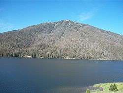
 Madison Arm, looking towards Cherry Creek Campground
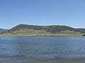 Hebgen Lake, looking North from Rainbow Point Campground
References
- ↑ "HEBGEN LAKE IS 65 MILES AROUND". Montana Standard. 19 August 1959. Retrieved 11 July 2010.
External links
This article is issued from Wikipedia - version of the 9/4/2015. The text is available under the Creative Commons Attribution/Share Alike but additional terms may apply for the media files.