Pondera County, Montana
| Pondera County, Montana | |
|---|---|
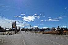 Conrad, Pondera County, Montana | |
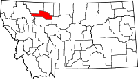 Location in the U.S. state of Montana | |
 Montana's location in the U.S. | |
| Founded | 1919[1] |
| Seat | Conrad |
| Largest city | Conrad |
| Area | |
| • Total | 1,640 sq mi (4,248 km2) |
| • Land | 1,623 sq mi (4,204 km2) |
| • Water | 17 sq mi (44 km2), 1.0% |
| Population (est.) | |
| • (2015) | 6,184 |
| • Density | 3.8/sq mi (1/km²) |
| Congressional district | At-large |
| Time zone | Mountain: UTC-7/-6 |
| Website |
www |
Pondera County is a county located in the U.S. state of Montana. As of the 2010 census, the population was 6,153.[2] Its county seat is Conrad.[3]
Geography
According to the U.S. Census Bureau, the county has a total area of 1,640 square miles (4,200 km2), of which 1,623 square miles (4,200 km2) is land and 17 square miles (44 km2) (1.0%) is water.[4]
Adjacent counties
- Glacier County, Montana – north
- Toole County, Montana – north
- Liberty County, Montana – east
- Chouteau County, Montana – east
- Teton County, Montana – south
- Flathead County, Montana – west
National protected area
- Lewis and Clark National Forest (part)
- Rocky Mountain Front Conservation Area (part)
Demographics
| Historical population | |||
|---|---|---|---|
| Census | Pop. | %± | |
| 1920 | 5,741 | — | |
| 1930 | 6,964 | 21.3% | |
| 1940 | 6,716 | −3.6% | |
| 1950 | 6,392 | −4.8% | |
| 1960 | 7,653 | 19.7% | |
| 1970 | 6,611 | −13.6% | |
| 1980 | 6,731 | 1.8% | |
| 1990 | 6,433 | −4.4% | |
| 2000 | 6,424 | −0.1% | |
| 2010 | 6,153 | −4.2% | |
| Est. 2015 | 6,184 | [5] | 0.5% |
| U.S. Decennial Census[6] 1790–1960[7] 1900–1990[8] 1990–2000[9] 2010–2015[2] | |||
2000 census
As of the census[10] of 2000, there were 6,424 people, 2,410 households, and 1,740 families residing in the county. The population density was 4 people per square mile (2/km²). There were 2,834 housing units at an average density of 2 per square mile (1/km²). The racial makeup of the county was 83.66% White, 0.09% Black or African American, 14.46% Native American, 0.14% Asian, 0.05% Pacific Islander, 0.12% from other races, and 1.48% from two or more races. 0.84% of the population were Hispanic or Latino of any race. 24.1% were of German, 13.8% Norwegian, 8.3% Irish, 5.7% American and 5.1% English ancestry. 92.0% spoke English, 5.1% German and 1.8% Blackfoot as their first language.
There were 2,410 households out of which 35.30% had children under the age of 18 living with them, 60.00% were married couples living together, 8.40% had a female householder with no husband present, and 27.80% were non-families. 25.50% of all households were made up of individuals and 12.30% had someone living alone who was 65 years of age or older. The average household size was 2.63 and the average family size was 3.18.
In the county the population was spread out with 29.60% under the age of 18, 6.40% from 18 to 24, 24.80% from 25 to 44, 22.90% from 45 to 64, and 16.30% who were 65 years of age or older. The median age was 39 years. For every 100 females there were 97.40 males. For every 100 females age 18 and over, there were 95.40 males.
The median income for a household in the county was $30,464, and the median income for a family was $36,484. Males had a median income of $27,125 versus $19,314 for females. The per capita income for the county was $14,276. About 15.00% of families and 18.80% of the population were below the poverty line, including 23.40% of those under age 18 and 8.30% of those age 65 or over.
2010 census
As of the 2010 United States Census, there were 6,153 people, 2,285 households, and 1,528 families residing in the county.[11] The population density was 3.8 inhabitants per square mile (1.5/km2). There were 2,659 housing units at an average density of 1.6 per square mile (0.62/km2).[12] The racial makeup of the county was 82.7% white, 14.5% American Indian, 0.2% Asian, 0.1% black or African American, 0.2% from other races, and 2.4% from two or more races. Those of Hispanic or Latino origin made up 1.4% of the population.[11] In terms of ancestry, 31.9% were German, 14.7% were Norwegian, 13.2% were Irish, 9.3% were English, 5.7% were Dutch, and 5.6% were American.[13]
Of the 2,285 households, 30.0% had children under the age of 18 living with them, 53.3% were married couples living together, 9.4% had a female householder with no husband present, 33.1% were non-families, and 29.9% of all households were made up of individuals. The average household size was 2.41 and the average family size was 3.01. The median age was 42.8 years.[11]
The median income for a household in the county was $36,419 and the median income for a family was $47,656. Males had a median income of $34,259 versus $26,903 for females. The per capita income for the county was $18,989. About 14.9% of families and 21.5% of the population were below the poverty line, including 32.5% of those under age 18 and 10.7% of those age 65 or over.[14]
Communities
City
- Conrad (county seat)
Town
Census-designated places
Unincorporated communities
- Fowler
- Ledger
- Manson
- Robare
- Williams
Notable residents
- Ivan Doig, author; resided in Dupuyer, Pondera County.
- George Montgomery – film/television actor; born and raised in Brady, Pondera County.
See also
- List of cemeteries in Pondera County, Montana
- List of lakes in Pondera County, Montana
- List of mountains in Pondera County, Montana
- National Register of Historic Places listings in Pondera County, Montana
References
- ↑ Pondera County official website
- 1 2 "State & County QuickFacts". United States Census Bureau. Retrieved September 16, 2013.
- ↑ "Find a County". National Association of Counties. Retrieved 2011-06-07.
- ↑ "2010 Census Gazetteer Files". United States Census Bureau. August 22, 2012. Retrieved November 29, 2014.
- ↑ "County Totals Dataset: Population, Population Change and Estimated Components of Population Change: April 1, 2010 to July 1, 2015". Retrieved July 2, 2016.
- ↑ "U.S. Decennial Census". United States Census Bureau. Retrieved November 29, 2014.
- ↑ "Historical Census Browser". University of Virginia Library. Retrieved November 29, 2014.
- ↑ "Population of Counties by Decennial Census: 1900 to 1990". United States Census Bureau. Retrieved November 29, 2014.
- ↑ "Census 2000 PHC-T-4. Ranking Tables for Counties: 1990 and 2000" (PDF). United States Census Bureau. Retrieved November 29, 2014.
- ↑ "American FactFinder". United States Census Bureau. Retrieved 2008-01-31.
- 1 2 3 "DP-1 Profile of General Population and Housing Characteristics: 2010 Demographic Profile Data". United States Census Bureau. Retrieved 2016-01-10.
- ↑ "Population, Housing Units, Area, and Density: 2010 – County". United States Census Bureau. Retrieved 2016-01-10.
- ↑ "DP02 SELECTED SOCIAL CHARACTERISTICS IN THE UNITED STATES – 2006–2010 American Community Survey 5-Year Estimates". United States Census Bureau. Retrieved 2016-01-10.
- ↑ "DP03 SELECTED ECONOMIC CHARACTERISTICS – 2006–2010 American Community Survey 5-Year Estimates". United States Census Bureau. Retrieved 2016-01-10.
External links
 |
Glacier County and Toole County | | ||
| Flathead County | |
Liberty County and Chouteau County | ||
| ||||
| | ||||
| Teton County |
Municipalities and communities of Pondera County, Montana, United States | ||
|---|---|---|
| City | | |
| Town | ||
| CDPs | ||
| Unincorporated community | ||
| Indian reservation | ||
| Footnotes | ‡This populated place also has portions in an adjacent county or counties | |
Coordinates: 48°14′N 112°13′W / 48.24°N 112.22°W