Arkansas Highway 159
| ||||
|---|---|---|---|---|
| Route information | ||||
| Maintained by AHTD | ||||
| Highway system | ||||
| ||||

Highway 159 (AR 159, Ark. 159, and Hwy. 159) is a designation for eight state highways in Chicot and Desha Counties.[1]
Route description
Louisiana to Eudora
| |
|---|---|
| Location: | LA 17–Eudora |
| Length: | 7.81 mi[1] (12.57 km) |
Between Chanticleer and Eudora, Arkansas, Highway 159 follows the original 1926 alignment of U.S. 65.
Jennie to Lake Village
| |
|---|---|
| Location: | Jennie–Lake Village |
| Length: | 5.48 mi[1] (8.82 km) |
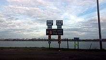
Highway 159 begins at Highway 144 and runs south along Lake Chicot in Lake Village
Halley to Trippe Junction
| |
|---|---|
| Location: | Halley–Trippe Junction |
| Length: | 4.92 mi[1] (7.92 km) |
US 65 to McGehee
| |
|---|---|
| Location: | US 65–McGehee |
| Length: | 4.60 mi[1] (7.40 km) |
From US 278 north, McGehee
| |
|---|---|
| Location: | US 65–McGehee |
| Length: | 1.53 mi[1] (2.46 km) |
Downtown McGehee
| |
|---|---|
| Location: | Downtown McGehee |
| Length: | 0.80 mi[1] (1.29 km) |
AR 138 to Omega
| |
|---|---|
| Location: | AR 138–Omega |
| Length: | 4.41 mi[1] (7.10 km) |
Dumas to Mitchellville
| |
|---|---|
| Location: | Dumas–Mitchellville |
| Length: | 1.74 mi[1] (2.80 km) |
See also
| Wikimedia Commons has media related to Arkansas Highway 159. |
-
 Arkansas portal
 -
 U.S. Roads portal
References
This article is issued from Wikipedia - version of the 9/16/2015. The text is available under the Creative Commons Attribution/Share Alike but additional terms may apply for the media files.