Hopewell Township, Mercer County, New Jersey
- Not be confused with the Borough of Hopewell, New Jersey, Hopewell Township, Cumberland County, New Jersey, or Hopewell, Sussex County, New Jersey.
| Hopewell Township, New Jersey | |
|---|---|
| Township | |
| Township of Hopewell | |
|
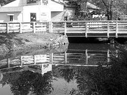
The Delaware and Raritan Canal in Hopewell Township | |
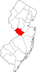
 Location in Mercer County and the state of New Jersey. | |
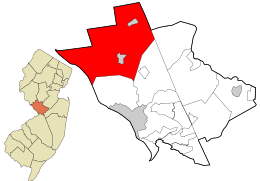
 Census Bureau map of Hopewell Township, Mercer County, New Jersey | |
| Coordinates: 40°21′23″N 74°48′43″W / 40.356361°N 74.812002°WCoordinates: 40°21′23″N 74°48′43″W / 40.356361°N 74.812002°W[1][2] | |
| Country |
|
| State |
|
| County | Mercer |
| Founded | February 20, 1700 |
| Royal charter | March 1, 1755 |
| Incorporated | February 21, 1798 |
| Government[3] | |
| • Type | Township |
| • Body | Township Committee |
| • Mayor | Kevin Kuchinski (D, term ends December 31, 2016)[4][5] |
| • Administrator | Paul Pogorzelski[6] |
| • clerk | Laurie E. Gompf[7] |
| Area[1] | |
| • Total | 58.911 sq mi (152.580 km2) |
| • Land | 58.031 sq mi (150.300 km2) |
| • Water | 0.880 sq mi (2.279 km2) 1.49% |
| Area rank |
22nd of 565 in state 1st of 12 in county[1] |
| Elevation[8] | 217 ft (66 m) |
| Population (2010 Census)[9][10][11] | |
| • Total | 17,304 |
| • Estimate (2015)[12] | 18,606 |
| • Rank |
147th of 565 in state 7th of 12 in county[13] |
| • Density | 298.2/sq mi (115.1/km2) |
| • Density rank |
478th of 565 in state 12th of 12 in county[13] |
| Time zone | EST (UTC-5) |
| • Summer (DST) | EDT (UTC-4) |
| ZIP code | 08560 - Titusville[14][15] |
| Area code(s) | 609 exchanges: 730, 737, 18[16] |
| FIPS code | 3402133180[1][17][18] |
| GNIS feature ID | 0882129[1][19] |
| Website |
www |
Hopewell Township is a township in Mercer County, New Jersey, United States. The township is within the New York metropolitan area as defined by the United States Census Bureau,[20] but directly borders the Philadelphia metropolitan area and is part of the Federal Communications Commission's Philadelphia Designated Market Area.[21] As of the 2010 United States Census, the township's population was 17,304,[9][10][11] reflecting an increase of 1,199 (+7.4%) from the 16,105 counted in the 2000 Census, which had in turn increased by 4,515 (+39.0%) from the 11,590 counted in the 1990 Census.[22]
The township dates back to February 20, 1700, when the area was still part of Burlington County. It was formerly the name for one of two portions of 800 acres (3.2 km2) of land purchased in 1714 by William Trent, and was formally set off to Hunterdon County, when that county was created on March 11, 1714. Trenton Township was formed out of this estate on June 3, 1719, later to become the City of Trenton. Hopewell Township was incorporated by Royal charter on March 1, 1755, and was re-incorporated by an act of the New Jersey Legislature on February 21, 1798, as one of the state's initial group of 104 townships. Hopewell Township became part of Mercer County at its creation on February 22, 1838. Portions of the township were taken to form Marion Township (February 22, 1838, reverted to Hopewell Township on February 14, 1839), the Borough of Pennington (January 31, 1890) and Hopewell Borough (April 14, 1891), with additional portions of the township transferred to both Pennington and Hopewell Borough in 1915.[23]
Hopewell Township includes the location (now known as Washington Crossing) along the east side of the Delaware River to which George Washington and the Continental Army crossed from Pennsylvania. Once in Hopewell Township, the army marched to Trenton on December 26, 1776. The Battle of Trenton followed. Today, Washington Crossing State Park commemorates this important milestone in American history.
Hopewell Township was also the location where, two months after being abducted from his home in neighboring East Amwell, the body of Charles Lindbergh, Jr. was discovered on May 12, 1932.[24]
Geography
According to the United States Census Bureau, the township had a total area of 58.911 square miles (152.580 km2), including 58.031 square miles (150.300 km2) of it is land and 0.880 square miles (2.279 km2) of water (1.49%) is water.[1][2]
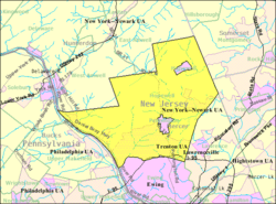
The township completely surrounds Hopewell Borough and Pennington. The township borders Ewing Township, Lawrence Township and Princeton in Mercer County; East Amwell Township and West Amwell Township in Hunterdon County; Montgomery Township in Somerset County; and Solebury Township and Upper Makesfield Township in Bucks County, Pennsylvania, across the Delaware River.[25]
Akers Corner, Baldwins Corner, Bear Tavern, Centerville, Coopers Corner, Federal City, Glenmoore, Harbourton, Harts Corner, Marshalls Corner, Moore, Mount Rose, Pleasant Valley, Stoutsburg, Titusville, Washington Crossing and Woodsville are unincorporated communities, localities and place names located within Hopewell Township.[26] Some neighborhoods in the township include Hopewell Hunt, Brandon Farms and Elm Ridge.[27]
Washington Crossing State Park is located in the western part of the township.
Demographics
| Historical population | |||
|---|---|---|---|
| Census | Pop. | %± | |
| 1790 | 2,320 | — | |
| 1810 | 2,565 | — | |
| 1820 | 2,881 | 12.3% | |
| 1830 | 3,154 | 9.5% | |
| 1840 | 3,205 | 1.6% | |
| 1850 | 3,698 | 15.4% | |
| 1860 | 3,900 | 5.5% | |
| 1870 | 4,276 | 9.6% | |
| 1880 | 4,462 | 4.3% | |
| 1890 | 4,338 | −2.8% | |
| 1900 | 3,360 | * | −22.5% |
| 1910 | 3,171 | * | −5.6% |
| 1920 | 3,249 | 2.5% | |
| 1930 | 3,907 | 20.3% | |
| 1940 | 3,738 | −4.3% | |
| 1950 | 4,731 | 26.6% | |
| 1960 | 7,818 | 65.3% | |
| 1970 | 10,030 | 28.3% | |
| 1980 | 10,893 | 8.6% | |
| 1990 | 11,590 | 6.4% | |
| 2000 | 16,105 | 39.0% | |
| 2010 | 17,304 | 7.4% | |
| Est. 2015 | 18,606 | [12][28] | 7.5% |
| Population sources: 1790-1920[29] 1840[30] 1850-1870[31] 1850[32] 1870[33] 1880-1890[34] 1890-1910[35] 1910-1930[36] 1930-1990[37] 2000[38][39] 2010[9][10][11] * = Lost territory in previous decade[23] | |||
Census 2010
At the 2010 United States Census, there were 17,304 people, 6,282 households, and 4,925 families residing in the township. The population density was 298.2 per square mile (115.1/km2). There were 6,551 housing units at an average density of 112.9 per square mile (43.6/km2). The racial makeup of the township was 86.74% (15,010) White, 2.10% (364) Black or African American, 0.07% (12) Native American, 8.89% (1,539) Asian, 0.01% (1) Pacific Islander, 0.52% (90) from other races, and 1.66% (288) from two or more races. Hispanics or Latinos of any race were 3.31% (573) of the population.[9]
There were 6,282 households, of which 39.0% had children under the age of 18 living with them, 69.1% were married couples living together, 6.6% had a female householder with no husband present, and 21.6% were non-families. 17.8% of all households were made up of individuals, and 7.9% had someone living alone who was 65 years of age or older. The average household size was 2.75 and the average family size was 3.14.[9]
In the township, 26.4% of the population were under the age of 18, 5.0% from 18 to 24, 19.8% from 25 to 44, 34.6% from 45 to 64, and 14.2% who were 65 years of age or older. The median age was 44.4 years. For every 100 females there were 96.7 males. For every 100 females age 18 and over, there were 93.4 males.[9]
The Census Bureau's 2006-2010 American Community Survey showed that (in 2010 inflation-adjusted dollars) median household income was $132,813 (with a margin of error of +/- $15,634) and the median family income was $151,394 (+/- $9,062). Males had a median income of $106,431 (+/- $9,830) versus $66,285 (+/- $11,820) for females. The per capita income for the borough was $55,219 (+/- $3,466). About 0.6% of families and 1.7% of the population were below the poverty line, including 1.9% of those under age 18 and 1.3% of those age 65 or over.[40]
Census 2000
As of the 2000 United States Census[17] there were 16,105 people, 5,498 households, and 4,431 families residing in the township. The population density was 277.1 people per square mile (107.0/km²). There were 5,629 housing units at an average density of 96.9 per square mile (37.4/km²). The racial makeup of the township was 77.30% White, 15.83% African American, 0.12% Native American, 3.97% Asian, 0.02% Pacific Islander, 0.66% from other races, and 1.09% from two or more races. Hispanic or Latino of any race were 2.45% of the population.[38][39]
There were 5,498 households out of which 40.6% had children under the age of 18 living with them, 71.6% were married couples living together, 6.8% had a female householder with no husband present, and 19.4% were non-families. 16.0% of all households were made up of individuals and 6.5% had someone living alone who was 65 years of age or older. The average household size was 2.77 and the average family size was 3.11.[38][39]
In the township the population was spread out with 26.5% under the age of 18, 5.4% from 18 to 24, 29.9% from 25 to 44, 26.8% from 45 to 64, and 11.5% who were 65 years of age or older. The median age was 39 years. For every 100 females there were 103.9 males. For every 100 females age 18 and over, there were 104.3 males.[38][39]
The median income for a household in the township was $93,640, and the median income for a family was $101,579. Males had a median income of $66,849 versus $47,701 for females. The per capita income for the township was $43,947. About 0.9% of families and 1.1% of the population were below the poverty line, including 1.5% of those under age 18 and none of those age 65 or over.[38][39]
Parks and recreation

- Stony Brook-Millstone Watershed Association[41]
- Washington Crossing State Park is a state park covering 3,575 acres (1,447 ha) in portions of both Hunterdon County and Mercer County that commemorates "one of the pivotal events of the American Revolution."[42]
Government
Local government
Hopewell Township is governed under the Township form of government. The five-member Township Committee is elected directly by the voters at-large in partisan elections to serve three-year terms of office on a staggered basis, with either one or two seats coming up for election each year as part of the November general election in a three-year cycle.[3][43] At an annual reorganization meeting, the Township Committee selects one of its members to serve as Mayor.[44]
As of 2016, the members of the Hopewell Township Committee are Mayor Kevin Kuchinski (D, term on committee ends December 31, 2017; term as mayor ends 2016), Deputy mayor Vanessa Sandom (D, term on committee ends 2017; term as deputy mayor ends 2016), Julie Blake (D, 2016), Todd Brant (R, 2016) and John R. Hart (R, 2016).[4][45][46][47][48][49][50]
Citing differences with local party leadership, Mayor Harvey Lester changed his party affiliation in March 2015 from Democrat to Republican.[51] In the November 2015 general election, Democrat Julie Blake defeated incumbent Mayor Harvey Lester, with affordable housing, development and taxes as key issues in the race.[52]
Hopewell Township is served by the New Jersey Agricultural Experiment Station & Rutgers Cooperative Extension of Mercer County, located in Trenton.[53]
Federal, state and county representation
Hopewell Township is located in the 12th Congressional District[54] and is part of New Jersey's 15th state legislative district.[10][55][56]
New Jersey's Twelfth Congressional District is represented by Bonnie Watson Coleman (D, Ewing Township).[57] New Jersey is represented in the United States Senate by Cory Booker (D, Newark, term ends 2021)[58] and Bob Menendez (D, Paramus, 2019).[59][60]
For the 2016–2017 session (Senate, General Assembly), the 15th Legislative District of the New Jersey Legislature is represented in the State Senate by Shirley Turner (D, Lawrence Township, Mercer County) and in the General Assembly by Reed Gusciora (D, Trenton) and Elizabeth Maher Muoio (D, Pennington).[61] The Governor of New Jersey is Chris Christie (R, Mendham Township).[62] The Lieutenant Governor of New Jersey is Kim Guadagno (R, Monmouth Beach).[63]
Mercer County is governed by a County Executive who oversees the day-to-day operations of the county and by a seven-member Board of Chosen Freeholders that acts in a legislative capacity, setting policy. All officials are chosen at-large in partisan elections, with the executive serving a four-year term of office while the freeholders serve three-year terms of office on a staggered basis, with either two or three seats up for election each year.[64] As of 2014, the County Executive is Brian M. Hughes (D, term ends December 31, 2015; Princeton).[65] Mercer County's Freeholders are Freeholder Chair Andrew Koontz (D, 2016; Princeton),[66] Freeholder Vice Chair Samuel T. Frisby, Sr. (2015; Trenton),[67] Ann M. Cannon (2015; East Windsor Township),[68] Anthony P. Carabelli (2016; Trenton),[69] John A. Cimino (2014, Hamilton Township),[70] Pasquale "Pat" Colavita, Jr. (2015; Lawrence Township)[71] and Lucylle R. S. Walter (2014; Ewing Township)[72][73][74] Mercer County's constitutional officers are County Clerk Paula Sollami-Covello (D, 2015),[75] Sheriff John A. Kemler (D, 2014)[76] and Surrogate Diane Gerofsky (D, 2016).[77][78]
Politics
As of March 23, 2011, there were a total of 12,218 registered voters in Hopewell Township, of which 3,949 (32.3%) were registered as Democrats, 3,088 (25.3%) were registered as Republicans and 5,178 (42.4%) were registered as Unaffiliated. There were 3 voters registered to other parties.[79]
In the 2012 presidential election, Democrat Barack Obama received 54.9% of the vote (5,223 cast), ahead of Republican Mitt Romney with 43.8% (4,171 votes), and other candidates with 1.3% (123 votes), among the 10,697 ballots cast by the township's 12,983 registered voters (1,180 ballots were spoiled), for a turnout of 82.4%.[80][81] In the 2008 presidential election, Democrat Barack Obama received 56.5% of the vote here (5,517 cast), ahead of Republican John McCain with 41.4% (4,042 votes) and other candidates with 1.4% (133 votes), among the 9,765 ballots cast by the township's 12,615 registered voters, for a turnout of 77.4%.[82] In the 2004 presidential election, Democrat John Kerry received 51.3% of the vote here (4,974 ballots cast), outpolling Republican George W. Bush with 46.2% (4,476 votes) and other candidates with 0.7% (80 votes), among the 9,698 ballots cast by the township's 11,780 registered voters, for a turnout percentage of 82.3.[83]
In the 2013 gubernatorial election, Republican Chris Christie received 61.8% of the vote (3,826 cast), ahead of Democrat Barbara Buono with 36.5% (2,257 votes), and other candidates with 1.7% (107 votes), among the 6,322 ballots cast by the township's 12,818 registered voters (132 ballots were spoiled), for a turnout of 49.3%.[84][85] In the 2009 gubernatorial election, Republican Chris Christie received 48.9% of the vote here (3,503 ballots cast), ahead of Democrat Jon Corzine with 42.9% (3,074 votes), Independent Chris Daggett with 6.9% (497 votes) and other candidates with 0.5% (36 votes), among the 7,158 ballots cast by the township's 12,441 registered voters, yielding a 57.5% turnout.[86]
Neighboring municipalities
 |
West Amwell Township | East Amwell Township | Montgomery Township | |
| Upper Makesfield Township, PA Solebury Township, PA |
|
Princeton | ||
| ||||
| | ||||
| Ewing Township | Lawrence Township |
Hopewell Township surrounds both Pennington and Hopewell Borough.

Education
Public school students in pre-Kindergarten through twelfth grade attend the Hopewell Valley Regional School District, a comprehensive regional public school district serving students from Hopewell Borough, Hopewell Township and Pennington Borough.[87][88] As of the 2011-12 school year, the district's six schools had an enrollment of 3,797 students and 329.9 classroom teachers (on an FTE basis), for a student–teacher ratio of 11.51:1.[89] Schools in the district (with 2011-12 enrollment data from the National Center for Education Statistics[90]) include four elementary schools — Bear Tavern Elementary School[91] (grades PreK-5; 429 students), Hopewell Elementary School[92] (PreK-5; 474), Stony Brook Elementary School[93] (K-5; 418) and Toll Gate Grammar School[94] (K-5; 300) — Timberlane Middle School[95] with 951 students in grades 6-8 and Hopewell Valley Central High School[96] with an enrollment of 1,225 students in grades 9 - 12.[97][98]
Transportation
Roads and highways
As of May 2010, the township had a total of 189.67 miles (305.24 km) of roadways, of which 136.96 miles (220.42 km) are maintained by the municipality, 36.68 miles (59.03 km) by Mercer County and 16.03 miles (25.80 km) by the New Jersey Department of Transportation.[99]
Route 29 passes through the southwestern part of Hopewell alongside the Delaware and Raritan Canal. Route 31 is the main north-south road that goes through the township. Interstate 95 also passes through in the southern part with two interchanges: Exits 3 (Scotch Road) and 4 (Route 31).[100] Interstate 295 is outside the municipality in neighboring Lawrence Township. A few major county roads that go through are County Route 518, County Route 546, County Route 569 and County Route 579.
_overpass_in_Hopewell_Township%2C_New_Jersey.JPG)
Hopewell Township was supposed to be where the Somerset Freeway would have started in the south, ending in the north in either Piscataway or Franklin. This would have completed I-95 in New Jersey. But the cancellation of this project led to having the New Jersey Turnpike carry the interstate numbering instead. Originally, I-295 had extended into Hopewell and ended where the supposed Somerset Freeway interchange was to be built. Ultimately, the Somerset Freeway was canceled in 1982. I-295 was redesignated I-95 from the canceled interchange to the exit at U.S. Route 1 in 1993.
Public transportation
NJ Transit provides bus service between the township and Trenton on the 602, 606 and 608 routes.[101]
The Hopewell Project
Hopewell is home to an experimental renewable energy project called The Hopewell Project, which uses solar power to generate hydrogen that is used to provide 100% of a home's heating, cooling and electrical needs. The Hopewell Solar-Hydrogen Residence was dedicated on October 20, 2006.[102]
Media
- Hopewell Valley News
- Pennington Post
- Town Topics
- The Hopewell Sun
Winery
Notable people
People who were born in, residents of, or otherwise closely associated with Hopewell Township include:
- John Gano (1727–1804), Baptist minister who is said to have baptized George Washington.[103]
- John Hart (c. 1711-1779), signer of the United States Declaration of Independence.[104]
- Thomas Stoltz Harvey (1912-2007), pathologist who conducted the autopsy on Albert Einstein in 1955.[105]
- Rush D. Holt Jr. (born 1948), former U.S. Congressman for the 12th Congressional District of New Jersey. Represented district from 1999 to 2015.[106]
- James W. Marshall (1810–1885), sawmill operator, whose 1848 find of gold in the American River in California was the impetus for the California Gold Rush.[107]
- Debbie Ryan (born 1952), former head coach of the women's basketball team at the University of Virginia who was inducted into the Women's Basketball Hall of Fame in 2008 [108]
References
- 1 2 3 4 5 6 2010 Census Gazetteer Files: New Jersey County Subdivisions, United States Census Bureau. Accessed May 21, 2015.
- 1 2 US Gazetteer files: 2010, 2000, and 1990, United States Census Bureau. Accessed September 4, 2014.
- 1 2 2012 New Jersey Legislative District Data Book, Rutgers University Edward J. Bloustein School of Planning and Public Policy, March 2013, p. 103.
- 1 2 Hopewell Township Committee, Township of Hopewell. Accessed July 11, 2016.
- ↑ 2016 New Jersey Mayors Directory, New Jersey Department of Community Affairs. Accessed June 14, 2016.
- ↑ Administration, Hopewell Township. Accessed July 11, 2016.
- ↑ Clerk's Office, Hopewell Township. Accessed July 11, 2016.
- ↑ U.S. Geological Survey Geographic Names Information System: Township of Hopewell, Geographic Names Information System. Accessed March 6, 2013.
- 1 2 3 4 5 6 DP-1 - Profile of General Population and Housing Characteristics: 2010 for Hopewell township, Mercer County, New Jersey, United States Census Bureau. Accessed September 23, 2012.
- 1 2 3 4 Municipalities Grouped by 2011-2020 Legislative Districts, New Jersey Department of State, p. 8. Accessed January 6, 2013.
- 1 2 3 Profile of General Demographic Characteristics: 2010 for Hopewell township, New Jersey Department of Labor and Workforce Development. Accessed September 23, 2012.
- 1 2 PEPANNRES - Annual Estimates of the Resident Population: April 1, 2010 to July 1, 2015 - 2015 Population Estimates for New Jersey municipalities, United States Census Bureau. Accessed May 22, 2016.
- 1 2 GCT-PH1 Population, Housing Units, Area, and Density: 2010 - State -- County Subdivision from the 2010 Census Summary File 1 for New Jersey, United States Census Bureau. Accessed September 23, 2012.
- ↑ Look Up a ZIP Code for Titusville, NJ, United States Postal Service. Accessed September 24, 2011.
- ↑ Zip Codes, State of New Jersey. Accessed September 11, 2013.
- ↑ Area Code Lookup - NPA NXX for Titusville, NJ, Area-Codes.com. Accessed September 11, 2013.
- 1 2 American FactFinder, United States Census Bureau. Accessed September 4, 2014.
- ↑ A Cure for the Common Codes: New Jersey, Missouri Census Data Center. Accessed September 23, 2012.
- ↑ US Board on Geographic Names, United States Geological Survey. Accessed September 4, 2014.
- ↑ New York-Newark, NY-NJ-CT-PA Combined Statistical Area, United States Census Bureau. Accessed December 28, 2014.
- ↑ - Philadelphia Market Area Coverage Maps, Federal Communications Commission. Accessed December 28, 2014.
- ↑ Table 7. Population for the Counties and Municipalities in New Jersey: 1990, 2000 and 2010, New Jersey Department of Labor and Workforce Development, February 2011. Accessed September 23, 2012.
- 1 2 Snyder, John P. The Story of New Jersey's Civil Boundaries: 1606-1968, Bureau of Geology and Topography; Trenton, New Jersey; 1969. p. 162. Accessed September 23, 2012.
- ↑ Gill, Barbara. "Lindbergh kidnapping rocked the world 50 years ago; Worldwide Story Was Hometown News For Hunterdon", Hunterdon County Democrat, 1981. Accessed September 1, 2014. "When the body of the baby identified as the Lingbergh child was finally discovered in Hopewell Township well away from the county line the story appeared on Page 4 of the Democrat's May 19, 1932, issue."
- 1 2 Areas touching Hopewell Township, MapIt. Accessed July 11, 2016.
- ↑ Locality Search, State of New Jersey. Accessed December 13, 2014.
- ↑ Neighborhoods in Mercer County New Jersey, Living Places. Accessed January 11, 2015.
- ↑ Census Estimates for New Jersey April 1, 2010 to July 1, 2015, United States Census Bureau. Accessed May 22, 2016.
- ↑ Compendium of censuses 1726-1905: together with the tabulated returns of 1905, New Jersey Department of State, 1906. Accessed July 11, 2013.
- ↑ Bowen, Francis. American Almanac and Repository of Useful Knowledge for the Year 1843, p. 231, David H. Williams, 1842. Accessed July 11, 2013. Population of 3,213 is listed, in conflict with data in table.
- ↑ Raum, John O. The History of New Jersey: From Its Earliest Settlement to the Present Time, Volume 1, p. 275, J. E. Potter and company, 1877. Accessed July 11, 2013. Hopewell contained in 1850, 3,698 inhabitants; in 1860, 3,900; and in 1870, 4,276."
- ↑ Debow, James Dunwoody Brownson. The Seventh Census of the United States: 1850, p. 139. R. Armstrong, 1853. Accessed July 11, 2013.
- ↑ Staff. A compendium of the ninth census, 1870, p. 260. United States Census Bureau, 1872. Accessed November 19, 2012.
- ↑ Porter, Robert Percival. Preliminary Results as Contained in the Eleventh Census Bulletins: Volume III - 51 to 75, p. 98. United States Census Bureau, 1890. Accessed September 23, 2012.
- ↑ Thirteenth Census of the United States, 1910: Population by Counties and Minor Civil Divisions, 1910, 1900, 1890, United States Census Bureau, p. 337. Accessed September 23, 2012. Source lists population of 3,750 for 1980, in conflict with the data shown for the 1890 Census.
- ↑ Fifteenth Census of the United States: 1930 - Population Volume I, United States Census Bureau, p. 716. Accessed September 23, 2012.
- ↑ Table 6. New Jersey Resident Population by Municipality: 1930 - 1990, New Jersey Department of Labor and Workforce Development. Accessed June 28, 2015.
- 1 2 3 4 5 Census 2000 Profiles of Demographic / Social / Economic / Housing Characteristics for Hopewell township, Mercer County, New Jersey, United States Census Bureau. Accessed September 23, 2012.
- 1 2 3 4 5 DP-1: Profile of General Demographic Characteristics: 2000 - Census 2000 Summary File 1 (SF 1) 100-Percent Data for Hopewell township, Mercer County, New Jersey, United States Census Bureau. Accessed September 23, 2012.
- ↑ DP03: Selected Economic Characteristics from the 2006-2010 American Community Survey 5-Year Estimates for Hopewell township, Mercer County, New Jersey, United States Census Bureau. Accessed September 23, 2012.
- ↑ About Us, Stony Brook-Millstone Watershed Association. Accessed November 19, 2012.
- ↑ Washington Crossing State Park, New Jersey Department of Environmental Protection. Accessed December 13, 2014.
- ↑ "Forms of Municipal Government in New Jersey", p. 7. Rutgers University Center for Government Studies. Accessed June 3, 2015.
- ↑ Form of Municipal Government, Township of Hopewell. Accessed July 11, 2016. "Hopewell Township has a Township Committee form of municipal government. All Committee members are elected at large for three year terms. Each year, the Township Committee elects one of its members as Mayor."
- ↑ 2016 Municipal User Friendly Budget, Township of Hopewell. Accessed July 11, 2016.
- ↑ Mercer County Elected Officials, Mercer County, New Jersey, as of January 1, 2016. Accessed July 11, 2016.
- ↑ Guide to Hopewell Township Officials, Mercer County Library System. Accessed July 11, 2016.
- ↑ Mercer County November 3, 2015 General Election Results, Mercer County, New Jersey, updated November 17, 2015. Accessed July 11, 2016.
- ↑ Mercer County November 4, 2014 General Election Results, Mercer County, New Jersey, updated November 10, 2014. Accessed July 11, 2016.
- ↑ Mercer County November 5, 2013 General Election Results, Mercer County, New Jersey, updated November 13, 2013. Accessed July 11, 2016.
- ↑ Rojas, Cristina. "Hopewell Township mayor switches party affiliation to Republican", NJ.com, March 11, 2015. Accessed August 16, 2015. "Hopewell Township Mayor Harvey Lester announced this week he is switching his party affiliation to Republican, citing ongoing disagreements with township Democratic Party officials."
- ↑ Mustac, Frank. “Julie Blake defeated incumbent Mayor Harvey Lester for a seat on the council in the 2015 general election", CentralJersey.com, November 3, 2015. Accessed November 28, 2016.
- ↑ Cooperative Extension of Mercer County, Rutgers University. Accessed October 12, 2007.
- ↑ Plan Components Report, New Jersey Redistricting Commission, December 23, 2011. Accessed January 6, 2013.
- ↑ 2016 New Jersey Citizen's Guide to Government, p. 59, New Jersey League of Women Voters. Accessed July 20, 2016.
- ↑ Districts by Number for 2011-2020, New Jersey Legislature. Accessed January 6, 2013.
- ↑ Bonnie Watson Coleman Biography, United States House of Representatives. Accessed January 7, 2015.
- ↑ About Cory Booker, United States Senate. Accessed January 26, 2015. "He now owns a home and lives in Newark's Central Ward community."
- ↑ Biography of Bob Menendez, United States Senate, January 26, 2015. "He currently lives in Paramus and has two children, Alicia and Robert."
- ↑ Senators of the 114th Congress from New Jersey. United States Senate. Accessed January 26, 2015. "Booker, Cory A. - (D - NJ) Class II; Menendez, Robert - (D - NJ) Class I"
- ↑ Legislative Roster 2016-2017 Session, New Jersey Legislature. Accessed January 17, 2016.
- ↑ "About the Governor". State of New Jersey. Retrieved 2010-01-21.
- ↑ "About the Lieutenant Governor". State of New Jersey. Retrieved 2010-01-21.
- ↑ Elected Officials, Mercer County, New Jersey. Accessed September 6, 2014.
- ↑ Brian M. Hughes, County Executive, Mercer County, New Jersey. Accessed September 6, 2014.
- ↑ Andrew Koontz, Mercer County. Accessed September 6, 2014.
- ↑ Samuel T. Frisby, Sr., Mercer County. Accessed September 6, 2014.
- ↑ Ann M. Cannon, Mercer County. Accessed September 6, 2014.
- ↑ Anthony P. Carabelli, Mercer County. Accessed September 6, 2014.
- ↑ John A. Cimono, Mercer County. Accessed September 6, 2014.
- ↑ Pasquale "Pat" Colavita, Jr., Mercer County. Accessed September 6, 2014.
- ↑ Lucylle R. S. Walter, Mercer County. Accessed September 6, 2014.
- ↑ Meet the Freeholders, Mercer County. Accessed September 6, 2014.
- ↑ 2014 County Data Sheet, Mercer County. Accessed September 6, 2014.
- ↑ County Clerk, Mercer County. Accessed September 6, 2014.
- ↑ Sheriff, Mercer County. Accessed September 6, 2014.
- ↑ County Surrogate, Mercer County. Accessed September 6, 2014.
- ↑ Elected Officials for Mercer County, State of New Jersey. Accessed September 6, 2014.
- ↑ Voter Registration Summary - Mercer, New Jersey Department of State Division of Elections, March 23, 2011. Accessed November 21, 2012.
- ↑ "Presidential General Election Results - November 6, 2012 - Mercer County" (PDF). New Jersey Department of Elections. March 15, 2013. Retrieved December 23, 2014.
- ↑ "Number of Registered Voters and Ballots Cast - November 6, 2012 - General Election Results - Mercer County" (PDF). New Jersey Department of Elections. March 15, 2013. Retrieved December 23, 2014.
- ↑ 2008 Presidential General Election Results: Mercer County, New Jersey Department of State Division of Elections, December 23, 2008. Accessed November 21, 2012.
- ↑ 2004 Presidential Election: Mercer County, New Jersey Department of State Division of Elections, December 13, 2004. Accessed November 21, 2012.
- ↑ "Governor - Mercer County" (PDF). New Jersey Department of Elections. January 31, 2014. Retrieved December 23, 2014.
- ↑ "Number of Registered Voters and Ballots Cast - November 5, 2013 - General Election Results - Mercer County" (PDF). New Jersey Department of Elections. January 31, 2014. Retrieved December 23, 2014.
- ↑ 2009 Governor: Mercer County, New Jersey Department of State Division of Elections, December 31, 2009. Accessed November 21, 2012.
- ↑ Hopewell Valley Regional School District 2015 Report Card Narrative, New Jersey Department of Education. Accessed June 6, 2016. "Hopewell Valley serves the two boroughs of Pennington and Hopewell and the much larger Hopewell Township, an area of nearly 60 square miles with a population exceeding 20,000. Six schools comprise the district -- four elementary schools, a middle school, and a high school."
- ↑ About, Hopewell Valley Regional High School. Accessed June 6, 2016. "The district, as it functions today, has been a regionalized operation since 1965 when voters of Hopewell Township, Hopewell Borough and Pennington Borough approved a plan to consolidate their schools. But the first consolidation of local schools actually occurred in 1894 when the 14 separate districts, operating one-room schoolhouses throughout the valley, agreed to merge and be governed by a single school board."
- ↑ District information for Hopewell Valley Regional School District, National Center for Education Statistics. Accessed September 1, 2014.
- ↑ School Data for the Hopewell Valley Regional School District, National Center for Education Statistics. Accessed September 1, 2014.
- ↑ Bear Tavern Elementary School, Hopewell Valley Regional School District. Accessed September 11, 2013.
- ↑ Hopewell Elementary School, Hopewell Valley Regional School District. Accessed September 11, 2013.
- ↑ Stony Brook Elementary School, Hopewell Valley Regional School District. Accessed September 11, 2013.
- ↑ Toll Gate Grammar School, Hopewell Valley Regional School District. Accessed September 11, 2013.
- ↑ Timberlane Middle School, Hopewell Valley Regional School District. Accessed September 11, 2013.
- ↑ Hopewell Valey Central High School, Hopewell Valley Regional School District. Accessed September 11, 2013.
- ↑ Hopewell Valley Schools, Hopewell Valley Regional School District. Accessed September 1, 2014.
- ↑ New Jersey School Directory for the Hopewell Valley Regional School District, New Jersey Department of Education. Accessed September 1, 2014.
- ↑ Mercer County Mileage by Municipality and Jurisdiction, New Jersey Department of Transportation, May 2010. Accessed July 18, 2014.
- ↑ Travel Resources: Interchanges, Service Areas & Commuter Lots, New Jersey Turnpike Authority. Accessed September 1, 2014.
- ↑ Mercer County Bus / Rail Connections, NJ Transit, backed up by the Internet Archive as of May 22, 2009. Accessed September 23, 2012.
- ↑ Hurdle, Jon. "Solar power eliminates utility bills in U.S. home", Reuters, January 19, 2007. Accessed September 23, 2012.
- ↑ Rasmussen, Dr. Mark. "Baptists We Should Know: John Gano", The Baptist Voice. Accessed February 2, 2011.
- ↑ John Hart, Biographical Directory of the United States Congress. Accessed June 17, 2007.
- ↑ Grabell, Michael. "Exploring Einstein's Brain", The Daily Princetonian, September 13, 2000. Accessed December 13, 2014. "Paterniti, a young journalist who won a 1998 National Magazine Award for feature writing, chauffeured Harvey in his rented Buick on the journey from Harvey's ranch home in Titusville, just outside of Princeton, to Berkeley, Calif."
- ↑ Staff. "HOLT CLAIMS WIN IN 12TH DISTRICT, BUT ZIMMER DECLINES TO CONCEDE PRELIMINARY RETURNS PUT THE U.S. HOUSE INCUMBENT AHEAD BY 581 VOTES - WITH ABOUT 400 BALLOTS TO GO.", The Philadelphia Inquirer, November 18, 2000. Accessed February 2, 2011. "U.S. Rep. Rush Holt, the physicist from Hopewell Township, declared victory yesterday in his hard-fought 12th District contest against Republican challenger Dick Zimmer."
- ↑ Proceedings of the New Jersey Historical Society. 7. New Jersey Historical Society. 1922. p. 278. Retrieved February 2, 2011.
- ↑ "Hopewell Valley Central High To Induct Four into Hall of Fame", Hopewell Valley Regional School District, October 8, 2013. Accessed December 13, 2014. "Debbie Ryan grew up in Titusville and attended the Hopewell Valley Regional Schools, graduating with the HoVal Class of 1971."
External links
- Hopewell Township web site
- Hopewell Valley School District
- Hopewell Valley Regional School District's 2014–15 School Report Card from the New Jersey Department of Education
- Data for the Hopewell Valley Regional School District, National Center for Education Statistics
- Hopewell Township Fire District