Hrdlív
| Hrdlív | |||
| Village | |||
|
|||
| Name origin: Hrlej's (property) | |||
| Country | Czech Republic | ||
|---|---|---|---|
| Region | Central Bohemian | ||
| District | Kladno | ||
| Commune | Slaný | ||
| Elevation | 285 m (935 ft) | ||
| Coordinates | CZ 50°11′58″N 14°04′20″E / 50.19944°N 14.07222°ECoordinates: CZ 50°11′58″N 14°04′20″E / 50.19944°N 14.07222°E | ||
| Area | 1.70 km2 (0.66 sq mi) | ||
| Population | 435 (31-12-2008) | ||
| Density | 256/km2 (663/sq mi) | ||
| First mention | 1316 | ||
| Mayor | Roman Janyš | ||
| Timezone | CET (UTC+1) | ||
| - summer (DST) | CEST (UTC+2) | ||
| Postal code | 273 06 | ||
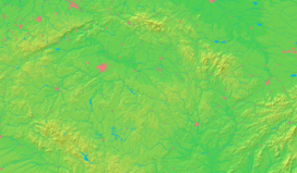
  Location in the Czech Republic | |||
| Wikimedia Commons: Hrdlív | |||
| Statistics: statnisprava.cz | |||
| Website: www.hrdliv.cz/ | |||
Hrdlív (pronounced [ˈɦr̩dliːf]) is a village and municipality in Kladno District in the Central Bohemian Region of the Czech Republic. It is located about 27 km northwest of Prague on road connecting Kladno and Slaný. The municipality covers an area of 1.7 km² and as of 2008 it had a population of 435.
The village has been indirectly attested since 1316 through a mention of a nobleman called Michael of Hrdlív (Michal de Hyrlewa). Since 1466 part of Hrdlív (and later the whole village) belonged to the family of Martinic (since 1792 Clam-Martinitz) whose members resided at nearby Smečno Castle. After 1848 abolition of feudalism Hrdlív became part of Třebichovice municipality (1850) and later a municipality of its own (1906).
In the past Hrdlív was known for occurrence of a rare yellow Eglantine Rose. Considered extinct for a long time (painter Josef Mánes wished to see it before his death in 1871) the rose was rediscovered in 1954. Nowadays it features in municipal symbols, together with silver leaves of water lily from arms of the Martinic family.
There is also a small Baroque chapel from 1745 in the village.
External links
- Municipal website (Czech)
- Culturally Historical Wandering around Slaný #3 (also available in Czech with images)
| Wikimedia Commons has media related to Hrdlív. |

