Koleč
| Koleč | |||
| Village | |||
|
|||
| Country | Czech Republic | ||
|---|---|---|---|
| Region | Central Bohemian | ||
| District | Kladno | ||
| Commune | Kladno | ||
| Municipality | Kladno | ||
| Elevation | 259 m (850 ft) | ||
| Coordinates | CZ 50°11′53″N 14°13′22″E / 50.19806°N 14.22278°ECoordinates: CZ 50°11′53″N 14°13′22″E / 50.19806°N 14.22278°E | ||
| Highest point | |||
| - elevation | 295 m (968 ft) | ||
| Area | 5.24 km2 (2.02 sq mi) | ||
| Population | 588 (2006) | ||
| Density | 112/km2 (290/sq mi) | ||
| First mention | after 1125 | ||
| Mayor | Radek Moulis | ||
| Timezone | CET (UTC+1) | ||
| - summer (DST) | CEST (UTC+2) | ||
| Postal code | 273 29 | ||
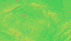
  Location in the Czech Republic | |||
 Location in Kladno District | |||
| Wikimedia Commons: Koleč | |||
| Statistics: statnisprava.cz | |||
| Website: www.kolec.cz | |||
Koleč is a village in Central Bohemian Region of the Czech Republic. It is located about 19 km northwest of Prague an 11 km northeast of Kladno and has a population of 588 (2006). Hamlets of Týnec and Mozolín, both located in a neighbouring valley just under remains of early medieval fortified settlement of Budeč, are administrative parts of Koleč.
The first mention of the village dates back to 12th century. In a document from about 1125-1140 it was stated to be in property of the Vyšehrad Chapter.
There is a small Baroque chateau with chapel of Holy Trinity in Koleč, built in the 1710s on the site of an older fort. The chapel, serving as a church for the growing village, was enlarged in 1898-1899. The privately owned chateau has been neglected and heavily dilapidated since the 1990s. Now it belongs among the most endangered listed buildings in the region.
External links
- Municipal website (Czech)
- Photogallery of Koleč Chateau (2007) (Czech)
| Wikimedia Commons has media related to Koleč. |

