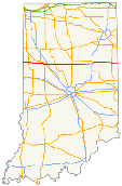
Indiana State Road 26
| ||||
|---|---|---|---|---|
 | ||||
| Route information | ||||
| Maintained by INDOT | ||||
| Length: | 150.05 mi[1] (241.48 km) | |||
| Existed: | October 1, 1926[2] – present | |||
| Major junctions | ||||
| West end: |
| |||
|
| ||||
| East end: |
| |||
| Highway system | ||||
| ||||

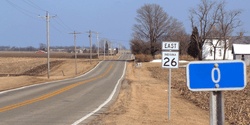
State Road 26 is an east–west road in central Indiana in the United States that crosses the entire state from east to west, covering a distance of about 150 miles (240 km).
Route description
State Road 26 begins on Indiana's western border with Illinois near the town of Ambia. It ends on Indiana's eastern border near the town of Fort Recovery, Ohio. In Illinois, State Road 26 becomes Illinois Route 9 and in Ohio it turns into Ohio State Route 119.
With the exception of a stretch on the east side of Lafayette, State Road 26 is an undivided surface road.
State Road 26 formerly passed through the campus of Purdue University in West Lafayette, where it was concurrent with State Street, and through Lafayette as South Street and Columbia Street. The segments between the Interstate 65 interchange in the east and the U.S. Route 231 junction in the west were redesignated as city streets in December 2013;[3] the route is now discontinuous.[4]
It has an interchange with Interstate 65 east of Lafayette and with Interstate 69 east of Fairmount. Other significant intersections are with U.S. Route 41 in western Warren County, near the Illinois state line, and with U.S. Route 31 west of Kokomo.
Major intersections
| County | Location | mi[1] | km | Destinations | Notes | ||
|---|---|---|---|---|---|---|---|
| Vermilion | | Continuation into Illinois | |||||
| Warren–Vermilion county line | Indiana–Illinois line | 0.00 | 0.00 | Western terminus | |||
| Warren | Pine Township | 7.84 | 12.62 | West end of US 41 concurrency | |||
| 8.40 | 13.52 | East end of US 41 concurrency | |||||
| Adams Township | 15.70 | 25.27 | West end of SR 55 concurrency | ||||
| Pine Village | 15.93 | 25.64 | East end of SR 55 concurrency | ||||
| Tippecanoe | Wabash Township | ||||||
| Gap in route | |||||||
| Lafayette | 39.63 | 63.78 | I-65 exit 172 | ||||
| Clinton | Rossville | 51.60 | 83.04 | ||||
| Owen Township | 55.26 | 88.93 | |||||
| Middlefork | 62.23 | 100.15 | |||||
| Howard | Kokomo | 76.24 | 122.70 | ||||
| Taylor Township | US 31 exit 158 | ||||||
| 81.29 | 130.82 | ||||||
| Union Township | 85.25 | 137.20 | |||||
| Grant | Point Isabel | 92.22 | 148.41 | ||||
| Liberty Township | 96.93 | 155.99 | |||||
| Liberty–Fairmount township line | 100.24 | 161.32 | |||||
| Jefferson Township | 106.70 | 171.72 | I-69 exit 255 | ||||
| Upland | 111.71 | 179.78 | Eastern terminus of SR 22 | ||||
| Blackford | Hartford City | 118.24 | 190.29 | ||||
| Blackford–Jay county line | Jackson–Knox township line | 126.91 | 204.24 | Northern terminus of SR 167 | |||
| Jay | Knox Township | 129.88 | 209.02 | west end of SR 1 concurrency | |||
| 130.38 | 209.83 | east end of SR 1 concurrency | |||||
| Wayne Township | 137.98 | 222.06 | Western end of SR 67 concurrency | ||||
| Portland | 139.94 | 225.21 | Eastern end of SR 67 concurrency; west end of US 27 concurrency | ||||
| 140.43 | 226.00 | east end of US 27 concurrency | |||||
| Noble Township | 150.05 | 241.48 | Ohio state line | ||||
1.000 mi = 1.609 km; 1.000 km = 0.621 mi
| |||||||
References
- 1 2 "INDOT Roadway Referencing System" (PDF).
- ↑ "Road Numbers to Be Changed". The Hancock-Democrat. The Indianapolis News. September 30, 1926. Retrieved June 9, 2016 – via Newspapers.com.

- ↑ Wilkins, Ron (2013-12-17). "West Lafayette, INDOT Agree on Road Relinquishment". Journal & Courier. Retrieved 2014-01-22. (subscription required (help)).
- ↑ Smith, Dave (2014-03-20). "State highway rerouting in Lafayette area causes confusion". Journal & Courier. Retrieved 2015-08-02.