Interstate 49
| |
|---|---|
|
Route of completed sections of I-49 as of 2014 in red | |
| Route information | |
| Length: | 528.02 mi[1] (849.77 km) |
| Existed: | 1984 – present |
| Original segment | |
| South end: |
|
| North end: |
|
| Northern Louisiana–southern Arkansas segment | |
| South end: |
|
| Major junctions: |
|
| North end: |
|
| Northern Arkansas segment | |
| South end: |
|
| North end: |
|
| Missouri segment | |
| South end: |
|
| Major junctions: |
|
| North end: |
|
| Location | |
| States: | Louisiana, Arkansas, Missouri |
| Highway system | |


Interstate 49 (I-49) is an Interstate Highway that exists in multiple segments: the original portion entirely within the state of Louisiana with an additional signed portion extending from LA 1 in Shreveport to the Arkansas state line, four newer sections in Arkansas, and a new section that opened in Missouri. Its southern terminus is in Lafayette, Louisiana, at Interstate 10 while its northern terminus is in Kansas City, Missouri at Interstate 435 and Interstate 470. Portions of the remaining roadway in Louisiana, Arkansas, Missouri, and Texas, which will link Kansas City with New Orleans, are in various stages of planning or construction.
Although not part of the original 1957 interstate highway plan, residents of Missouri, Arkansas and Louisiana began campaigning for the highway in 1965 via the "US 71 - I-29 Association."[2] The campaign called for Interstate 29 to be extended south from Kansas City to New Orleans following much of the route along US 71. The plan called for creating a limited access expressway from New Orleans to the Canadian border and on to Winnipeg (via Manitoba Highway 75). The highway is not named Interstate 29 because of interstate naming rules. The rules state that north-south roads are odd numbered and the highways are named in increasing order from west to east. Since there are an Interstate 35 and an Interstate 45 to the west and an Interstate 55 to the east Interstate 49 was chosen for the name.[3]
Route description
Louisiana
The current southern terminus of I-49 is located at a cloverleaf interchange with I-10 and US 167 in the southern Louisiana city of Lafayette. Southbound motorists continue through the interchange onto the Evangeline Thruway, which transitions from a limited-access portion of US 167 to a major divided thoroughfare that picks up the US 90 corridor heading through the heart of Lafayette. I-49 begins its journey concurrent with US 167 as it travels northward through Carencro, Sunset, Grand Coteau, and Opelousas. US 167 departs from the interstate's alignment at exit 23 between Opelousas and Washington, and I-49 begins to take a northwesterly path through the heavily wooded rural terrain. Various state highways provide access to the small towns and cities located along the parallel US 71 and US 167 corridors, such as Lebeau, Ville Platte, Bunkie, and Cheneyville. After crossing US 167, I-49 travels between US 71 and US 165 into the Alexandria metropolitan area in central Louisiana.
I-49 travels through downtown Alexandria doubling as US 71 Byp. and is also concurrent with portions of US 167 and LA 28. Major interchanges with US 167 and US 71 lead to bridges that cross the Red River into the neighboring city of Pineville. Continuing northwest from Alexandria, I-49 parallels the Red River and LA 1 through Boyce and passes just west of the historic city of Natchitoches, which is reached via LA 6 at exit 138. Between Natchitoches and Shreveport, I-49 travels between LA 1 and US 171 and has junctions with US 371 and US 84, connecting with Coushatta and Mansfield, respectively.
In Shreveport, the interstate heads directly into the downtown area and terminates at I-20, a route which facilitates eastbound traffic. However, through traffic bound for I-20 west and the northern segment of I-49 is directed to transfer onto LA 3132 at an interchange located about 5.5 miles (8.9 km) south of this terminus. LA 3132 is a western freeway bypass of Shreveport known as the Inner Loop Expressway that becomes I-220 upon intersecting I-20. On the north side of town, motorists may exit I-220 and follow US 71/LA 1 for 4.3 miles (6.9 km) to reach the next segment of I-49, which parallels US 71 into Arkansas.
The heaviest traffic on I-49 occurs within the cities of Shreveport and Opelousas. The stretch of freeway in Shreveport sees an average of 70,000 vehicles per day, while the stretch of freeway between Lafayette and Carencro sees an average of 55,000 vehicles per day, and the stretch of freeway through Opelousas sees an average of 45,000 vehicles per day between the Judson Walsh Drive and Creswell Lane exits.
Arkansas and Texas
The southern segment of I-49 enters Arkansas from Louisiana. It progresses northward to a temporary terminus at US 71 and US 59 at the Texas state line north of Texarkana.
The northern segment of I-49 in Arkansas, formerly signed as part of I-540, begins at I-40 in Alma and runs north into the Boston Mountains. The freeway passes through steep, sparsely populated terrain before entering the Bobby Hopper Tunnel in Washington County. Entering the Northwest Arkansas metropolitan area, I-49 has six exits for Fayetteville and three exits for Springdale before entering Benton County. The route serves as the boundary between Bentonville and Rogers, with seven exits for the two cities before terminating at US 71. The roadway continues as a divided highway with stoplights into Bella Vista, although a bypass is under construction.
I-49 is designated as the Boston Mountains Scenic Loop between Alma and Fayetteville. The I-49 designation replaced the I-540 designation through Northwest Arkansas in March 2014.[4]
Missouri
I-49 begins in Pineville. It passes through many smaller communities before reaching Joplin. In Joplin, I-49 junctions with I-44 and begins a short concurrency with I-44 for exits 11 through 18.
Just a few miles east of Joplin, I-49 leaves I-44 and heads north and enters Carthage. I-49 then passes through Nevada and other communities before reaching the Kansas City area. I-49 intersects with I-435, which provides connection to I-35 and I-29.
In south Kansas City, at Bannister Road just north of the Grandview Triangle, the I-49 designation ends, and the expressway continues as US 71, which proceeds into downtown Kansas City as Bruce R. Watkins Memorial Drive.
History
Louisiana
The original plans for the Interstate Highway System did not include a north–south connection between Interstates 10 and 20 within Louisiana. In 1965, Governor John McKeithen proposed a toll road to perform this function and extend to New Orleans as well, but the idea was never carried out.[5] In the mid-1970s, the Federal Highway Administration approved an Interstate Highway to run between US 190 in Opelousas and I-20 in Shreveport, a route that was designated as I-49 by the American Association of State Highway and Transportation Officials (AASHTO) in the summer of 1977.[6] The mileage was gained from mileage released from other highways the states did not build as well as 153 miles (246 km) from a supplemental reserve.[7] In 1981, AASHTO approved a slight extension of the designation along the existing route of US 167 from Opelousas south to I-10 in Lafayette.[8] In its early history, I-49 was commonly referred to as the North–South Expressway.[5]
Construction of I-49 began in 1981 between Opelousas and the small town of Washington.[9][10] This segment joined the portion running concurrent with US 167, an existing limited-access highway, and was completed by 1983.[10][11] By the following year, virtually all remaining rural portions of the route were under construction,[11][12] and 95% of this mileage was completed and opened to traffic between late 1987 and late 1989.[13][14] The remaining portions running through the urban centers of Alexandria and Shreveport required a much greater expenditure of time and funding. The entire length of the 212-mile (341 km) road was completed on May 1, 1996 with the opening of a 16.6-mile (26.7 km) section in downtown Alexandria named the Martin Luther King Jr. Highway. The total cost of I-49's construction was about $1.38 billion.[7]
"Interstate 49 North" is a 36-mile construction project that will extend the highway from I-20 in Shreveport to the Arkansas state line. This project has been divided into 11 segments, one of which is still under construction. As of January 2015, $460 million of $622 million needed to complete the project has been secured. An 18.9-mile section between LA 1 and US 71 opened on November 27, 2013,[15] and the extension to a point just south of the Arkansas state line opened in March 2014.[16]
Arkansas and Missouri
Arkansas and Missouri have been pursuing an I-49 designation for U.S. 71 and I-540 for a number of years. In the early-2000s, there were plans by both states to rename the roadway as such between Interstate 44 west of Joplin and Interstate 40 at Fort Smith, once new roadway had been completed around Bella Vista, Arkansas and north to Pineville, Missouri.[17] However, the AASHTO Special Committee on U.S. Route Numbers and Interstate Highways denied the I-49 designation at their annual meeting in September 2007 because none of the new roadway was under construction.[18] During this time, there was also some debate as to whether the Interstate 29 designation should be extended farther south from its current terminus in Kansas City, to either Joplin or all the way to Fort Smith.[19]


The I-49 designation, consisting of 180 miles (290 km) in Missouri, became official at noon on December 12, 2012.[20] The designation applies to current US 71 between I-435 in south Kansas City and Route H at Pineville (McDonald County), which was upgraded to Interstate standards beginning in 2010.[21] The last of the upgrade projects was completed in December 2012. I-49 also runs concurrently with I-44 between interchanges 11 and 18 east of Joplin.
MoDOT began installing I-49 trailblazer signage (without shields) plus gantry signs and mile markers, about 1200 signs in all, in February 2012. Signage bearing I-49 shields was covered or turned from view until the I-49 designation received final approval by FHWA. This includes mile markers at 0.2-mile (0.32 km) intervals along the entire alignment apart from I-44.[21]
The US 71 upgrade involved removing all at-grade intersections and constructing interchanges and overpasses at 15 sites between Harrisonville and Lamar. The two-year project represented a shift in funding priorities for MoDOT which in 2007, announced indefinite postponement of its portion of the Bella Vista bypass project, citing a $139-million dollar funding gap in Arkansas between construction costs and toll revenues, and Arkansas' commitment to only a two-lane bypass constructed over six years.[22] MoDOT announced the Joplin-to-Kansas City upgrade of US 71 in August 2010, to be done with the intention of bringing the I-49 designation to Missouri.[23]
Most of the 10.2-mile corridor, constructed between 1990[24] and 2001, was built to Interstate standards. However, three at-grade intersections—at Gregory Boulevard (71st Street), 59th Street and 55th Street—prevent the I-49 designation from being extended all the way to downtown. All three of these intersections were on the Kansas City Police Department's 2010 list of "Top 20 Crash Sites in Kansas City", at #9, #6 and #4 respectively[25] and Watkins Drive has the reputation among commuters as "one of the city's most accident-prone stretches of road".[26] Many neighborhood associations in Kansas City have historically objected to upgrading Watkins Drive to a freeway.[27] MoDOT has gone on record stating a court order keeps them from removing the stoplights, making conversion of this stretch unlikely. As for any future upgrade, a MoDOT blog post says "Ample right of way was acquired to someday allow MoDOT to reconstruct the three signal-controlled, at-grade intersections to grade-separated interchanges, allowing traffic on Bruce R. Watkins Drive to flow unimpeded. Neither MoDOT nor the city of Kansas City can initiate this change. It is up to the citizens, who must raise the issue again through the court system to amend the class-action agreement."[28]
The I-49 designation carries through the Three Trails Crossing (aka the Grandview Triangle) interchange to guide motorists onto US 71 north of I-435 and terminates north of I-435 and south of Bannister Road (Route W) around the 190.0 mile marker. From this point north, US 71 follows Bruce R. Watkins Drive,[29] a parkway which directly connects the I-70 / I-670 interchange in downtown Kansas City, as well as the I-35 / I-29 / I-70 interchange just to the north, to south Kansas City and I-435, I-470 and I-49.
I-130, the former designation from 1999-2000, was removed and no longer exists as part of the Texarkana Loop.
Arkansas 549 between AR-72 and County Road 34 opened on August 22, 2015.[30]
Southern Arkansas segment
A temporary designation of Highway 549 has been assigned to I-49 between US 71 north of Texarkana and Doddridge, 5 miles (8.0 km) from the state line.[31]
It is being constructed to complete the routing to the state line. "Future I-49" segments extending northward from Texarkana, AR plus segments from Doddridge south into Louisiana are shown on the official Arkansas 2013 Highway Map.[32]
Future
.svg.png)
Southern Louisiana segment
State transportation officials in Louisiana are working on plans to extend Interstate 49 to the south and east, from Lafayette to New Orleans roughly following the path of the current U.S. 90, which is at present a four-lane divided highway between the two cities. However, from Morgan City to near Raceland, U.S. 90 is an interstate-standard freeway, bypassing Houma to the north.

In the Lafayette area, the project is divided into two projects, the I-49 Connector and the rest of the interstate from the Lafayette Regional Airport to LA 88. The I-49 Connector has a record of decision and is formulating the Environmental Impact Study. It is planned to be a six-lane elevated freeway, passing to the West of the current Evangeline Thruway corridor, as to be closer to the Central Business District in Downtown Lafayette. The rest of the freeway from the airport to LA 88 will be an at grade six-lane freeway with a two-mile (3 km) segment of eight-lane elevated freeway through the suburb of Broussard.
In the immediate New Orleans area, I-49 is planned to follow the route of the U.S. 90 Business (also known locally as the Westbank Expressway) through Westwego, Gretna and across the Crescent City Connection into downtown New Orleans, ending at I-10. "Future I-49" signage is visible along U.S. 90 and U.S. 90 Business, although as of December 2014, construction had yet to begin.
Northern Louisiana segment
In addition to the southeastward extension, Louisiana officials are also working on clearing, grubbing and drainage for the new extension from Shreveport to the Arkansas line. The construction roughly parallels U.S. 71 on the west northward from I-220. In Shreveport, a no-build proposal is to reroute I-49 along Louisiana 3132/Inner Loop Expressway and concurrent with I-220 from I-20 to its proposed alignment near U.S. 71,[33][34] which could make the existing I-49 between LA 3132 and I-20 a spur of I-49. The other alternative is to connect I-49 at the I-20 interchange with I-49 North at the I-220 interchange.[34]
The section of I-49 extending north from I-220 to LA 1 is scheduled to open to traffic in 2017 or 2018.[16]
Central Arkansas segment
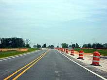
[35] The 180-mile section between Texarkana and Fort Smith remains largely incomplete. Right-of-way has been acquired and engineering has been completed, but construction is contingent upon allocating funding to the corridor. After applying for and receiving assistance from the 2012 Transportation Investment Generating Economic Recovery (TIGER) grant program, AHTD has begun construction on a new highway location for I-49 between the current I-40/I-540 interchange and US 71 south of Fort Smith, bypassing Van Buren and Fort Smith. Work is underway between US 71 and Highway 22 near Fort Chaffee as the first and southernmost phase of the extension of I-49 south of I-540. The project is explicitly mentioned as an effort to complete I-49 in the TIGER grant application.[36] Colloquially referred to as "Chaffee Crossing", this first phase was completed on July 15, 2015 at 10:00am at the AR-549 and AR-22 Interchange. I-49 is planned to follow the general route of US 71 through the state between Interstate 30 and Interstate 40.
Northern Arkansas segment and Bella Vista Bypass

North of I-40, Interstate 49 ends south of Bella Vista, about 8 miles south of the Missouri state line. Here, motorists continue north 15 miles of four-lane US 71 with intersections, traffic signals, lower speed limits and congestion before the present northern segment of I-49 begins at Pineville, Missouri. Motorists are eager to see completion of the 19-mile "Bella Vista Bypass" between Bella Vista, Arkansas and Pineville, Missouri.
A major hurdle to construction of the bypass over the years has been funding. The 2010 TIGER grant application submitted by the Arkansas Highway and Transportation Department (AHTD) estimated total cost for completion in Arkansas as $291.8 million. The document states the portion of the bypass in Arkansas is "proposed to be constructed as a toll facility, while the Missouri portion of the Bypass will be constructed as a free route".[37]
On August 11, 2010, the U.S. Department of Transportation (USDOT) announced $10 million in Transportation Investment Generating Economic Recovery (TIGER) grant funding to construct a portion of the new four-lane bypass, though the funding covers only a two-lane segment 2.5 miles long. Groundbreaking occurred on July 8, 2011 with a public ceremony that included Transportation Secretary Ray LaHood, Arkansas Governor Mike Beebe, and Senator Mark Pryor. The USDOT news release refers to the project as part of the "I-49 corridor", effectively ending questions about how the new highway would be numbered.[38] The following year, the segment between Highway 72 north and County Road 34 was let.[39] As of March 2014, AHTD anticipates completion of this first segment between Highway 72 north and Highway 72 south in spring 2014, and the next section in fall 2014.[40]
Following the passing of a ten-year half-cent sales tax measure in 2012, AHTD had acquired sufficient additional revenue to fund the southbound half of the Bella Vista Bypass without tolls.[41] Since design work had been completed prior to passing the measure, AHTD was able to let the segment between Highway 72 and US 71B in February 2014 as the first job of the Connecting Arkansas Program.[42][43] AHTD anticipates completion of this project in 2016.[40]
The only Arkansas projects remaining for a fully operational two-lane bypass are between County Road 34/Missouri state line and a roundabout connector with US 71B. Both of these projects are listed as TBD by AHTD.[40] Design work is complete for the roadway project, and is anticipated to be complete in 2015 for the interchange. Construction of the roadway is anticipated to be complete in 2017, assuming a one-year delay related to Missouri funding.[44] Construction on the interchange is tentatively scheduled to be complete in 2018.[44] Missouri DOT is responsible for a segment between the Missouri state line and I-49, with no clear path to funding at present. The Bella Vista Bypass is now on hold again because on August 5, 2014, an amendment bill intended to raise the sales tax failed at the ballot box. Not wanting to build an destination-less stub road, the Arkansas State Highway Commission officially postponed the construction of the segment between the Missouri state line and County Road 34 in September 2013 pending Missouri acquiring funding.[45]
Texas
North of Texarkana, Interstate 49 will briefly venture into Texas for about 5 miles before turning northwest and crossing the Red River of the South to reenter Arkansas. How the mileposts and the exits will be numbered once the Interstate returns to Arkansas have yet to be determined.[46]
Bella Vista Bypass in Missouri
In 2012, Missouri still had $40 million available for construction of its portion of the Bella Vista bypass from Pineville to the Arkansas state line. MoDOT's I-49 project manager said in an interview that "[MoDOT has] told Arkansas that whatever schedule it sets, we will meet them at the state line."[47] However, once Arkansas began building toward the state line it was revealed that Missouri was $25 million short of the necessary funds to complete their section.[48] A ballot initiative was defeated in August 2014 in Missouri, meaning funds will not be forthcoming soon.[45]
Junction list
- Louisiana
-

 I‑10 / US 167 in Lafayette. I-49 and US 167 travel concurrently to a point between Opelousas and Washington.
 -
 US 190 east of Opelousas
 - US 167 south of Lecompte
-
 US 71 / US 167 in Alexandria. I-49 and US 167 travel concurrently into downtown Alexandria.
 -
 US 71 / US 165 in Alexandria
 -
 US 371 southwest of Coushatta
 -
 US 84 west of Grand Bayou
 -
.svg.png) LA 3132 in Shreveport. Freeway carrying through traffic bound for I-20 west and northern segment of I-49.
LA 3132 in Shreveport. Freeway carrying through traffic bound for I-20 west and northern segment of I-49. -
 I‑20 in Shreveport
 - Gap in route
- US 71 between Gilliam and Hosston
- Arkansas
- US 71 south-southeast of Doddridge
- US 71 south of Fouke
- US 71 in Texarkana
-
 US 82 in Texarkana
 -
 US 67 in Texarkana
 -
 I‑30 in Texarkana
 - Texas
-
 US 59 / US 71 north of Texarkana
 - Gap in route
- Arkansas
- Gap in route
- US 71 in Fort Smith
- Gap in route
-
 I‑40 / US 71 in Alma
 - US 71 in Fayetteville. The highways travel concurrently to Bentonville.
-
 US 62 in Fayetteville. The highways travel concurrently to Bentonville.
 -
 US 412 in Springdale
 -
 US 71B / US 71 in Bentonville
 - Gap in route
- Arkansas
- No major intersections
- Missouri
- US 71 south of Pineville. The highways travel concurrently to Kansas City.
-
 US 60 in Neosho
 -
 I‑44 south-southwest of Duenweg. The highways travel concurrently to Fidelity.
 -
 US 160 in Lamar
 -
 US 54 in Nevada
 -


 I‑435 / I‑470 / US 50 / US 71 in Kansas City
See also
 Arkansas portal
 Louisiana portal
 Missouri portal
 U.S. Roads portal
References
- ↑ Staff (December 31, 2014). "Table 1: Main Routes of the Dwight D. Eisenhower National System Of Interstate and Defense Highways as of December 31, 2015". Route Log and Finder List. Federal Highway Administration. Retrieved February 5, 2016.
- ↑ "Newspapers.com search". Newspapers.com.
- ↑ "I-49 Conversion".
- ↑ Nadeau, Gregory G (March 28, 2014). "Letter Approving I-49 Designation" (PDF) (Letter). Letter to Scott E. Bennett. Federal Highway Administration. Retrieved May 26, 2014.
- 1 2 "Moving northward". Morning Advocate. Baton Rouge. April 9, 1986. p. 3B.
- ↑ Special Committee on U.S. Route Numbering (June 20, 1977). "Route Numbering Committee Agenda" (PDF) (Report). Lake of the Ozarks, MO: American Association of State Highway and Transportation Officials. p. 2. Retrieved January 19, 2016 – via Wikimedia Commons.
- 1 2 "Previous Facts of the Day". 50th Anniversary Interstate Highway System. Federal Highway Administration. Retrieved January 19, 2016.
- ↑ Special Committee on U.S. Route Numbering (October 3, 1981). "Route Numbering Committee Agenda" (PDF) (Report). Chicago, IL: American Association of State Highway and Transportation Officials. p. 2. Retrieved January 19, 2016 – via Wikimedia Commons.
- ↑ Louisiana Department of Transportation and Development (1979). Louisiana (Map) (1980 ed.). Louisiana Department of Transportation and Development.
- 1 2 Louisiana Department of Transportation and Development (1981). Louisiana (Map). Louisiana Department of Transportation and Development.
- 1 2 Louisiana Department of Transportation and Development (1983). Louisiana (Map). Louisiana Department of Transportation and Development.
- ↑ Louisiana Department of Transportation and Development (1984). Louisiana (Map). Louisiana Department of Transportation and Development.
- ↑ Leblanc, Doug (March 29, 1987). "Interstate 49 Expected to be Finished by 1991". Sunday Advocate. Baton Rouge. p. 1B.
- ↑ "New Stretch of Interstate to be Opened". Morning Advocate. Baton Rouge. November 10, 1989. p. 7B.
- ↑ "I-49 North". Louisiana Department of Transportation and Development. Retrieved November 29, 2012.
- 1 2 Louisiana Department of Transportation and Development. "I-49 North". Louisiana Department of Transportation and Development. Retrieved August 16, 2016.
- ↑ Kennedy, Wally (May 11, 2007). "Plan Holds 2008 Finish for Range Line Bypass". The Joplin Globe. Retrieved November 29, 2012.
- ↑ Keith, Kevin (September 29, 2007). "Report for SCOH" (PDF) (Report). Milwaukee, WI: American Association of State Highway and Transportation Officials.
- ↑ "Interstate 49 (Corridors 1 and 37)". AARoads. June 9, 2002. Retrieved November 29, 2012.
- ↑ "US 71 from Kansas City to Joplin to become Interstate 49". Kansas City Star. September 2, 2012. Archived from the original on September 6, 2012.
- 1 2 Southwest District Office. "New I-49 Signs Being Installed Along US 71" (Press release). Missouri Department of Transportation. Retrieved December 23, 2012.
- ↑ "Missouri Gateway to Bella Vista Bypass Scrapped". Joplin Independent. October 15, 2007.
- ↑ Community Relations Office (August 4, 2010). "I-49 Coming to Missouri" (Press release). Missouri Department of Transportation. Retrieved November 29, 2012.
- ↑ Porter, Steve (July 28, 2009). "Bruce R. Watkins Drive Is Smoother Months Ahead of Schedule" (Press release). Missouri Department of Transportation.
- ↑ "Kansas City PD Top 20 Crash Sites, 2010" (PDF). Kansas City, MO: KMBC-TV.
- ↑ Wilson, Susan B. (June 15, 2010). "No Changes in Store for Controversial Bruce R Watkins Drive". Kansas City, MO: KCUR-FM. Retrieved November 29, 2012.
- ↑ Ortega, Tony (May 26, 2005). "Road Rage". The Pitch. Kansas City, MO. Retrieved November 29, 2012.
- ↑ "Comments and responses from MoDOT's blog relating to ARRA" (PDF). Summary of American Recovery and Reinvestment Act Briefings. Missouri Department of Transportation. March 10, 2009. Retrieved November 29, 2012.
- ↑ "Kansas City's Vital Link" (PDF). Pathways. Missouri Department of Transportation. Fall 2001.
- ↑ "Second section of Bella Vista Bypass opened to traffic". NWADG.com.
- ↑ Whatley, Jeff (May 13, 2013). "Highway 549 Opens to Traffic in Texarkana Wednesday" (PDF) (Press release). Arkansas State Highway and Transportation Department. Retrieved May 27, 2013.
- ↑ State Highway Map (PDF) (Map). Cartography by Planning and Research Division. Arkansas State Highway and Transportation Department. 2013.
- ↑ "Interstate 49 Northbound (Shreveport Vicinity)". Louisiana @ SouthEastRoads. February 27, 2004. Retrieved January 28, 2013.
- 1 2 "I-49 Inner-City Connector-Shreveport". I-49 Inner-City Connector-Shreveport. Retrieved January 15, 2014.
- ↑ Johnson, Kelly (July 14, 2015). "New Section of I-49 Opened". Fort Smith, AR: KHBS-TV. Retrieved July 15, 2015.
- ↑ "Highway 71 New Location (Future Interstate 49)" (PDF). Transportation Investment Generating Economic Recovery Discretionary Grant Program Fiscal Year 2012 Application. Arkansas State Highway and Transportation Department. p. 2. Retrieved May 27, 2013.
- ↑ Staff (August 23, 2010). "Highway 71: Bella Vista Bypass" (PDF). TIGER II Discretionary Grant Program 2010. Arkansas State Highway and Transportation Department.
- ↑ "U.S. Department of Transportation, Arkansas Agreement Clears Way for Construction on Bella Vista Bypass" (Press release). Federal Highway Administration. August 11, 2010. Retrieved May 27, 2013.
- ↑ "Route 71, Section 19, Hwy. 72 North-Co. Rd. 34 (B.V. Bypass) (F)" (PDF). Construction Documents. Arkansas State Highway and Transportation Department. March 7, 2012. Retrieved March 10, 2014.
- 1 2 3 Bennett, Scott (March 5, 2014). "AHTD Presentation to ASCE Day of Training" (PDF). Fayetteville, AR: Arkansas State Highway and Transportation Department. Retrieved March 10, 2014.
- ↑ Smith, Jamie (April 9, 2013). "Half-Cent Sales Tax Projects Coming into Fruition". The City Wire. Retrieved May 27, 2012.
- ↑ "Route 71, Section 19, Hwy. 71B-Hwy. 72 South (Bella Vista Bypass) (S)" (PDF). Construction Documents. Arkansas State Highway and Transportation Department. Retrieved March 10, 2014.
- ↑ "Bids opened for next phase of Bella Vista Bypass". Little Rock, AR: KTHV. February 26, 2014. Retrieved March 10, 2014.
- 1 2 "Highway 71: Benton County". Connecting Arkansas Program. Arkansas State Highway and Transportation Department. February 26, 2014. Retrieved March 10, 2014.
- 1 2 Moritz, Rob (September 12, 2013). "Highway Commission Postpones Part Of Bella Vista Bypass Project". The Southwest Times Record. Fort Smith, AR. Arkansas News Bureau. Retrieved November 29, 2013.
- ↑ State Highway Map (PDF) (Map). Cartography by Planning and Research Division. Arkansas State Highway and Transportation Department. 2012.
- ↑ "US 71 Highway to become I-49 on Wednesday". Kansas City, MO: KMBC-TV. December 11, 2012.
- ↑ Kargas, Marissa; Leach, Sean (September 12, 2013). "Bella Vista Bypass Hits $25M Bump in the Road". NWA Homepage. Retrieved November 29, 2013.
External links
| Wikimedia Commons has media related to Interstate 49. |
- Interstate Guide: I-49
- I-49 Energy Corridor
- I-49 North (Louisiana Department of Transportation and Development)
- I-49 Report
- Interstate49.org
- I-49 Inner-City Connector-Shreveport
- I-49 Inner City Connector map (Shreveport, LA)
- I-49 Connector (Lafayette, LA)
- Future I-49 South Pictures (Stephen Gantry)
- Future I-49 South Pictures (Andy P. Jung)
- Arkansas Highway & Transportation Dept. - Bella Vista Bypass
| Signed | |||||||||||
|---|---|---|---|---|---|---|---|---|---|---|---|
| Unsigned | |||||||||||
| Lists |
| ||||||||||
Major Interstates highlighted | |||||||||||