Isa, Nigeria
| Isa | |
|---|---|
| LGA and town | |
 Isa | |
| Coordinates: 13°12′1″N 6°24′26″E / 13.20028°N 6.40722°ECoordinates: 13°12′1″N 6°24′26″E / 13.20028°N 6.40722°E | |
| Country |
|
| State | Sokoto State |
| Area | |
| • Total | 2,158 km2 (833 sq mi) |
| Population (2006 Census) | |
| • Total | 146,103 |
| Time zone | WAT (UTC+1) |
| 3-digit postal code prefix | 842 |
| ISO 3166 code | NG.SO.IS |
Isa is a town and Local Government Area in the state of Sokoto in Nigeria. It shares borders with Shinkafi in Zamfara State, Sabon Birni in Sokoto and the Republic of Niger in the east.
It has an area of 2,158 km² and a population of 146,103 at the 2006 census.
The postal code of the area is 842.[1]
The Isa LGA is made up of the capital town of Isa and other towns and villages such as Turba, Bafarawa (birthplace of former Sokoto State governor and 2007 presidential candidate Attahiru Bafarawa). Historically, the area was a part of the ancient kingdom of Gobir and is inhabited by members of the Gobirawa and Fulani ethnic groups.
References
- ↑ "Post Offices- with map of LGA". NIPOST. Retrieved 2009-10-20.
State capital: Sokoto | ||
| LGAs | 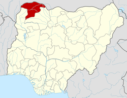 | |
This article is issued from Wikipedia - version of the 3/19/2013. The text is available under the Creative Commons Attribution/Share Alike but additional terms may apply for the media files.