Joliet, Montana
| Joliet, Montana | |
|---|---|
| Town | |
 Location of Joliet, Montana | |
| Coordinates: 45°29′4″N 108°58′17″W / 45.48444°N 108.97139°WCoordinates: 45°29′4″N 108°58′17″W / 45.48444°N 108.97139°W | |
| Country | United States |
| State | Montana |
| County | Carbon |
| Area[1] | |
| • Total | 0.30 sq mi (0.78 km2) |
| • Land | 0.30 sq mi (0.78 km2) |
| • Water | 0 sq mi (0 km2) |
| Elevation | 3,737 ft (1,139 m) |
| Population (2010)[2] | |
| • Total | 595 |
| • Estimate (2012[3]) | 625 |
| • Density | 1,983.3/sq mi (765.8/km2) |
| Time zone | Mountain (MST) (UTC-7) |
| • Summer (DST) | MDT (UTC-6) |
| ZIP code | 59041 |
| Area code(s) | 406 |
| FIPS code | 30-39700 |
| GNIS feature ID | 0772882 |
Joliet is a town in Carbon County, Montana, United States. It is part of the Billings, Montana Metropolitan Statistical Area. The population was 595 at the 2010 census.
Geography
Joliet is located at 45°29′4″N 108°58′17″W / 45.48444°N 108.97139°W (45.484520, −108.971257).[4]
According to the United States Census Bureau, the town has a total area of 0.30 square miles (0.78 km2), all of it land.[1]
Demographics
| Historical population | |||
|---|---|---|---|
| Census | Pop. | %± | |
| 1910 | 389 | — | |
| 1920 | 440 | 13.1% | |
| 1930 | 359 | −18.4% | |
| 1940 | 476 | 32.6% | |
| 1950 | 410 | −13.9% | |
| 1960 | 452 | 10.2% | |
| 1970 | 412 | −8.8% | |
| 1980 | 580 | 40.8% | |
| 1990 | 522 | −10.0% | |
| 2000 | 575 | 10.2% | |
| 2010 | 595 | 3.5% | |
| Est. 2015 | 638 | [5] | 7.2% |
2010 census
As of the census[2] of 2010, there were 595 people, 260 households, and 165 families residing in the town. The population density was 178.3 inhabitants per square mile (68.8/km2). There were 285 housing units at an average density of 950.0 per square mile (366.8/km2). The racial makeup of the town was 97.3% White, 0.3% African American, 0.8% Native American, 0.2% Asian, 0.7% from other races, and 0.7% from two or more races. Hispanic or Latino of any race were 1.8% of the population.
There were 260 households of which 28.8% had children under the age of 18 living with them, 48.1% were married couples living together, 11.9% had a female householder with no husband present, 3.5% had a male householder with no wife present, and 36.5% were non-families. 32.3% of all households were made up of individuals and 19.2% had someone living alone who was 65 years of age or older. The average household size was 2.29 and the average family size was 2.91.
The median age in the town was 41.1 years. 24.9% of residents were under the age of 18; 5.9% were between the ages of 18 and 24; 22.7% were from 25 to 44; 27% were from 45 to 64; and 19.7% were 65 years of age or older. The gender makeup of the town was 50.4% male and 49.6% female.
Notable residents
- Chet Blaylock, former member of the Montana State Senate and candidate for Governor of Montana
- Jack Waddell, test pilot on the maiden flight of the Boeing 747.
Schools
Joliet High School
Fire Hall
Fire Hall (Joliet, Montana) is listed on the National Register of Historic Places in Carbon County, Montana
Climate
The Köppen Climate Classification subtype for this climate is "BSk" (Tropical and Subtropical Steppe Climate).[8]
| Climate data for Joliet, Montana | |||||||||||||
|---|---|---|---|---|---|---|---|---|---|---|---|---|---|
| Month | Jan | Feb | Mar | Apr | May | Jun | Jul | Aug | Sep | Oct | Nov | Dec | Year |
| Average high °C (°F) | 2 (36) |
6 (42) |
10 (50) |
15 (59) |
21 (69) |
26 (78) |
31 (87) |
30 (86) |
23 (74) |
17 (62) |
8 (46) |
3 (38) |
16 (60) |
| Average low °C (°F) | −11 (12) |
−8 (17) |
−6 (22) |
−1 (30) |
4 (39) |
8 (47) |
11 (52) |
10 (50) |
5 (41) |
0 (32) |
−6 (22) |
−10 (14) |
0 (32) |
| Average precipitation mm (inches) | 15 (0.6) |
15 (0.6) |
28 (1.1) |
50 (2) |
71 (2.8) |
53 (2.1) |
23 (0.9) |
30 (1) |
33 (1.3) |
36 (1.4) |
18 (0.7) |
15 (0.6) |
380 (15) |
| Source: Weatherbase [9] | |||||||||||||
References
| Wikimedia Commons has media related to Joliet, Montana. |
- 1 2 "US Gazetteer files 2010". United States Census Bureau. Retrieved 2012-12-18.
- 1 2 "American FactFinder". United States Census Bureau. Retrieved 2012-12-18.
- ↑ "Population Estimates". United States Census Bureau. Retrieved 2013-06-03.
- ↑ "US Gazetteer files: 2010, 2000, and 1990". United States Census Bureau. 2011-02-12. Retrieved 2011-04-23.
- ↑ "Annual Estimates of the Resident Population for Incorporated Places: April 1, 2010 to July 1, 2015". Retrieved July 2, 2016.
- ↑ "Census of Population and Housing". Census.gov. Retrieved June 4, 2015.
- ↑ "Census & Economic Information Center". Retrieved July 3, 2015.
- ↑ Climate Summary for Joliet, Montana
- ↑ "Weatherbase.com". Weatherbase. 2013. Retrieved on August 19, 2013.
Municipalities and communities of Carbon County, Montana, United States | ||
|---|---|---|
| City | 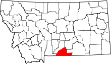 | |
| Towns | ||
| CDPs | ||
| Other unincorporated communities | ||