Kabale–Kisoro–Bunagana Road
| Kabale–Kisoro–Bunagana Road | |
|---|---|
| Route information | |
| Length: | 62.5 mi (100.6 km) |
| History: |
Designated in 2007 Completed in 2012[1] |
| Major junctions | |
| East end: | Kabale |
| Kisoro | |
| West end: | Bunagana |
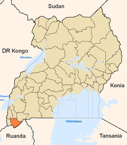
Kabale–Kisoro–Bunagana Road is a road in Western Uganda, connecting the towns of Kabale with the towns of Kisoro, Bunagana, at the border with the Democratic Republic of the Congo and Kyanika at the border with Rwanda.[2]
Location
The road starts at Kabale, (2014 pop. 49,667), the largest town in Kigezi sub-region,[3] and continues westwards through Kisoro, ending in Bunagana, a distance of approximately 88.5 kilometres (55 mi). There is a 5.4 kilometres (3 mi) loop around the southern part of Kisoro Airport, added for safety concerns. Also at Kisoro, a 6.3 kilometres (4 mi) spur of the road connects to Kyanika, at the border with Rwanda. The road connects the countries of DRCongo, Uganda and Rwanda.[1][4] The coordinates of the road near Kisoro are:1°16'58.0"S, 29°42'05.0"E (Latitude:-1.282778; Longitude:29.701389).[5]
Upgrading to bitumen
The government of Uganda earmarked this road for upgrading through the conversion of the existing gravel road to bitumen surface and the building of bridges and drainage channels. The construction contract with SBI International Holdings AG of Switzerland was signed in 2007.[6] The contract price was USh: 195,445,535,968/- (approx. US$107 million at that time). 89.5 per cent of the cost was loaned to Uganda by the African Development Bank, while the Ugandan government funded the remaining 10.5 percent.[1] The road improvements were completed in 2012.[7]
See also
References
- 1 2 3 UNRA, . (17 July 2015). "Kabale–Kisoro–Bunagana Road (100Km): Project Profile". Uganda National Roads Authority (UNRA). Retrieved 17 July 2015.
- ↑ Ochan, Maxwell (20 December 2009). "Kabale-Kisoro Road Gets Tarmac". The Observer (Uganda). Retrieved 17 July 2015.
- ↑ UBOS, . (27 August 2014). "The Population of The Regions of the Republic of Uganda And All Cities And Towns of More Than 15,000 Inhabitants". Citypopulation.de Quoting Uganda Bureau of Statistics (UBOS). Retrieved 17 July 2015.
- ↑ Muhereza, Robert (26 July 2013). "New Kabale-Kisoro Road Spurs Growth". Daily Monitor. Kampala.
- ↑ Google (17 July 2015). "Location of Kabale–Kisoro–Bunagana Road At Google Maps" (Map). Google Maps. Google. Retrieved 17 July 2015.
- ↑ Musinguzi, Goodluck (12 March 2007). "Nassasira Signs Kisoro-Bunagana Road Construction Contract". Uganda Radio Network. Retrieved 17 July 2015.
- ↑ Balagadde, Samuel (7 October 2012). "Kabale-Kisoro Road Upgraded". New Vision. Kampala. Retrieved 17 July 2015.
External links
Capital: Kisoro | ||
| Parishes |
| |
| Towns and villages | ||
| Economy | ||
| Transport | ||
| Notable landmarks | ||
| Health | ||
| Education |
| |
| Notable people | ||
Capital: Kabale | ||
| Counties and sub-counties |
|  |
| Towns and villages | ||
| Banking | ||
| Energy | ||
| Transport | ||
| Health | ||
| Notable landmarks | ||
| Education | ||
| Notable people | ||
Coordinates: 01°16′58″S 29°42′05″E / 1.28278°S 29.70139°E