Kabale Airport
| Kabale Airport Batuma Memorial Airstrip | |||||||||||
|---|---|---|---|---|---|---|---|---|---|---|---|
| IATA: none – ICAO: HUKB | |||||||||||
| Summary | |||||||||||
| Airport type | Public | ||||||||||
| Owner | Kabale Municipality | ||||||||||
| Serves | Kabale, Uganda | ||||||||||
| Elevation AMSL | 5,850 ft / 1,783 m | ||||||||||
| Coordinates | 01°13′33″S 29°57′36″E / 1.22583°S 29.96000°ECoordinates: 01°13′33″S 29°57′36″E / 1.22583°S 29.96000°E | ||||||||||
| Map | |||||||||||
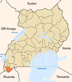
 HUKB Location of airport in Uganda | |||||||||||
| Runways | |||||||||||
| |||||||||||
Kabale Airport (ICAO: HUKB) is an airstrip serving Kabale,[4] a town in the Kabale District in the Western Region of Uganda. It is one of the 46 airports in the country.[5]
The airport is about 5 kilometres (3 mi) by road west of Kabale, on the Kabale-Kisoro Road.[6] It is approximately 311 kilometres (193 mi) by air south-west of Entebbe International Airport, Uganda's largest civilian and military airport.[7]
As of January 2010, the airport was not under the administration of the Civil Aviation Authority of Uganda.[8]
Facilities
The airport has a single unpaved runway. Aeronautical charts show the runway length at 610 metres (2,000 ft),[2] and satellite images indicate a maximum length of 1,400 metres (4,600 ft),[3] while a newspaper article stated the land set aside for the runway was 1.5 kilometres (0.93 mi).[6]
References
- ↑ OurAirports - Kabale
- 1 2 "Aeronautical chart showing HUKB with elevation and runway length". SkyVector. Retrieved 15 November 2015.
- 1 2 "Google satellite image with overlay measuring runway length". Wikimapia. Retrieved 14 August 2013.
- ↑ "Kabale, Uganda (ICAO: HUKB)". Great Circle Mapper. Retrieved 8 March 2010.
- ↑ "Uganda". CIA World Factbook.
Airports: 46 (2010)
- 1 2 "Kabale to get first airstrip". The New Vision. 4 February 2010. Archived from the original on November 17, 2015.
The Civil Aviation Authority (CAA) has approved the construction of the first airstrip in Kabale district ... the Batuma Memorial Airstrip will be constructed in memory of the late Canon Dr. John Sedrack Batuma ... the airstrip site is located in Rubanda county, about 5Km from Kabale town on the Kabale-Kisoro highway.
- ↑ "Distance between Entebbe and Kabale with map". Distance Calculator. Globefeed.com.
311 km (approximate travel/road distance 357.6 km to 388.7 km)
- ↑ "Aerodromes". Uganda Civil Aviation Authority. Retrieved January 15, 2010.
External links
- Airstrip planned for Kabale. eTurboNews. 10 February 2010.
Capital: Kabale | ||
| Counties and sub-counties |
|  |
| Towns and villages | ||
| Banking | ||
| Energy | ||
| Transport | ||
| Health | ||
| Notable landmarks | ||
| Education | ||
| Notable people | ||