Kalpasar Project
The Kalpasar Project envisages building a dam across the Gulf of Khambat for establishing a huge fresh water reservoir for irrigation, drinking and industrial purposes. A 10 lane road link will also be set up over the dam, greatly reducing the distance between Saurashtra and South Gujarat.[1]
History
The Gulf of Khambhat was identified as a promising site for tidal power generation by UNDP Expert, Mr. Eric Wilson in the year 1975. Successive governments were then presented in details the possibility of a project, aptly named Kalpasar Project by its visionary Dr. Anil Kane, who conceptualised it in 80s as a feasible project. In 1988-89 a reconnaissance report was prepared for the dam across the Gulf of Khambhat. The report concluded that, assuming sound foundation conditions, the closure of the Gulf was technically feasible.
It was reported that construction will begin in 2014.[2]
Economics
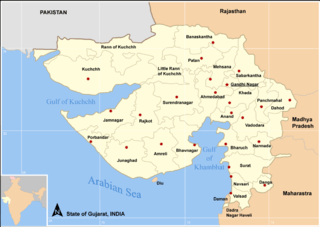
A state government release said the Rs 55,000 crore (US$ 11.7 billion) project, to be completed by 2020, will have a vast fresh water reservoir with gross storage of 16,791 million cubic metres of water, 64 km long dam across the Gulf of Khambhat connecting Ghogha in Bhavnagar with Hansot in Bharuch District, reducing the distance between the two by 225 km. It will have tidal power generation house with an installed capacity of 5,880 MW. Another estimate was given by the Government in October, 2010 which stated the proposed dam to be build just north of Bhavnagar in the west to Alandar in Dahej on the east.[3]
Current status
- Originally conceptualised & visualised by Dr. Anil Kane, on a call by the Government of Gujarat for water solution for Saurashtra region in 80s, the Kalpasar project of the Gujarat government, which envisages building of dam over the Gulf of Khambhat to establish huge reservoir, will commence in 2012, a year later than expected.[4]
- M S Patel, Secretary Kalpasar project, Government of Gujarat, said: “The project has been put on the fast track and will commence by 2012. It will take around seven years to complete it.”
- In 2008, B N Navalawala, advisor to Chief Minister Narendra Modi, had said the project would be launched by 2010-11. The new announcement was made while Patel was addressing a workshop on groundwater management in the coastal areas of Gujarat.
- The alignment of kalpsar has been changed towards north between Kala Talav, Bhavnagar to Aladar, Dahej near Bharuch. Idea of tidal power project is dropped. Only fresh water reservoir is proposed. Narmada river is excluded but its water will be diverted to kalpsar by constructing a check dam near Bhadbhut, Bharuch; with an about 30 km long, one lac cusecs canal off taking from it to kalpsar. Plan of fresh water distribution is changed and now focused to Saurashtra.
- As per a report published on 20 December 2011, in the newspaper The Times Of India, the commencement has been further pushed to year 2013.[5]
- Now the entire Gulf of Khambhat area is undergoing Bathymatric and Land Survey for determining sea bed levels under the supervision of NIOT, Chennai.[6]
See also
References
- ↑ "South Korea to Build Sea Wall in India". Retrieved 23 March 2016.
- ↑ "Work on Gujarats Kalpasar project likely to commence by next year". Retrieved 29 May 2014.
- ↑ "Gujarat plans first over the sea dam". Retrieved 29 May 2014.
- ↑ "Modi's hankering for illusory legacy of mega water project" (PDF). Retrieved 29 May 2014.
- ↑ "Kalpasar to break ground in 2013". Retrieved 29 May 2014.
- ↑ "Kalpasar Project". Retrieved 29 May 2014.
Coordinates: 21°27′21″N 72°24′57″E / 21.45583°N 72.41583°E