Kampala District
| Kampala District | |
|---|---|
| District | |
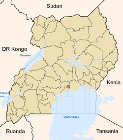 District location in Uganda | |
| Coordinates: 00°19′N 32°35′E / 0.317°N 32.583°ECoordinates: 00°19′N 32°35′E / 0.317°N 32.583°E | |
| Country |
|
| Regions | Central Uganda |
| Capital | Kampala |
| Elevation | 1,200 m (3,900 ft) |
| Population (2011 Estimate) | |
| • Total | 1,659,600 |
| Time zone | EAT (UTC+3) |
| Website |
www |
Kampala District is a district in Uganda that is partly coterminous with the country's capital city, Kampala.
Location
Kampala District is within the Kingdom of Buganda, in the Central Region. The district is bordered by Wakiso District to the south, west, and north and by Kira Municipality to the east.
Demographics
According to the provisional results of the 2014 national census, the district had a population of 1,516,210. The Uganda Bureau of Statistics estimated that the population had grown at a rate of 2.02 percent since the last national census in 2002.[1]
Administrative units
Kampala District is divided into five administrative divisions:[1]
- Kampala Central Division
- Kawempe Division
- Nakawa Division
- Makindye Division
- Lubaga Division
See also
- Districts of Uganda
- Kampala City
- Nakasero
- Kololo
- Old Kampala
- Mengo, Uganda
- Makerere
- Mulago Hill
- Katwe
- Kibuye
- Kibuli
- Kiswa
- Makindye
- Kyambogo
- Namugongo
References
- 1 2 Uganda Bureau Of Statistics (UBOS) (November 2014). National Population And Housing Census 2014. Provisional Results. (PDF) (Revised ed.). Kampala, Uganda. pp. 7, 22. Retrieved 29 March 2015.
External links
This article is issued from Wikipedia - version of the 7/30/2016. The text is available under the Creative Commons Attribution/Share Alike but additional terms may apply for the media files.