Kayunga District
| Kayunga District | |
|---|---|
| District | |
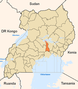 District location in Uganda | |
| Coordinates: 01°00′N 32°52′E / 1.000°N 32.867°ECoordinates: 01°00′N 32°52′E / 1.000°N 32.867°E | |
| Country |
|
| Region | Central Uganda |
| Capital | Kayunga |
| Area | |
| • Land | 1,587.8 km2 (613.1 sq mi) |
| Population (2012 Estimate) | |
| • Total | 358,700 |
| • Density | 225.9/km2 (585/sq mi) |
| Time zone | EAT (UTC+3) |
| Website |
www |
Kayunga District is a district in Central Uganda. Like most other Ugandan districts, it is named after its 'chief town', Kayunga.
Location
Kayunga District is bordered by Amolatar District to the north, Buyende District to the northeast, Kamuli District to the east, Jinja District to the southeast, Buikwe District to the south, Mukono District to the southwest, Luweero District to the west, Nakasongola District to the northwest. Kayunga, where the district headquarters are located, lies approximately 74 kilometres (46 mi) northeast of Kampala, on an all-weather tarmac highway.[1] The coordinates of the district are:01 00N, 32 52E.
Overview
Kayunga District was carved out of Mukono District in December 2000. The district consists of two counties, Bbaale County and Ntenjeru County.[2] The land mass in the district measures approximately 1,587.8 square kilometres (613.1 sq mi).
Population
According to the 1991 national census, the district had a population of about 236,200. During the 2002 national census, Kayunga District had a total population of approximately 294,600. In 2012, the district population was estimated at about 358,700.[3]
Economic Activity
Agriculture is the main economic activity in Kayunga district and represents 90% of the total employment. Kayunga practices two types of agriculture: (a) animal husbandry or livestock farming and (b) crop husbandry of subsistence agriculture. Some of the crops raised in the district include:[4]
Secession from Buganda
| Wikinews has related news: Violence in Uganda enters second day |
In September 2009, Kayunga attempted to secede from the traditional Kingdom of Buganda. The King attempted to visit but was banned by the Ugandan government, provoking riots in Kampala.[5] A total of thirty people were killed.
See also
References
- ↑ "Distance from Kampala to Kayunga with Map". Globefeed.com. Retrieved 1 May 2014.
- ↑ "Map of Kayunga District At Google Maps". Google Maps. Retrieved 1 May 2014.
- ↑ "Estimated Population of Kayunga District In 1991, 2002 &2012". Citypopulation.de. Retrieved 1 May 2014.
- ↑ "Economic Activity In Kayunga District". Uganda Travel Guide. Retrieved 1 May 2014.
- ↑ "Kampala Hit By Renewed Violence". BBC News. Retrieved 1 May 2014.