Mbale District
| Mbale District | |
|---|---|
| District | |
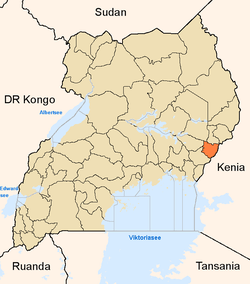 District location in Uganda | |
| Coordinates: 00°57′N 34°20′E / 0.950°N 34.333°ECoordinates: 00°57′N 34°20′E / 0.950°N 34.333°E | |
| Country |
|
| Region | Eastern Uganda |
| Sub-region | Bugisu sub-region |
| Capital | Mbale |
| Area | |
| • Land | 518.8 km2 (200.3 sq mi) |
| Population (2012 Estimate) | |
| • Total | 441,300 |
| • Density | 850.6/km2 (2,203/sq mi) |
| Time zone | EAT (UTC+3) |
| Website |
www |
Mbale District is a district in Eastern Uganda. It is named after the largest city in the district, Mbale, which also serves as the main administrative and commercial center in the sub-region.
Location
Mbale District is bordered by Sironko District to the north, Bududa District to the northeast, Manafwa District to the southeast, Tororo District to the south, Butaleja District to the southwest and Budaka District to the west. Pallisa District and Kumi District lie to the northwest of Mbale District. Mbale, the largest town in the district and the location of the district headquarters, is located approximately 245 kilometres (152 mi), by road, northeast of Kampala, the capital of Uganda, and the largest city in that country.[1] The coordinates of the district are:00 57N, 34 20E. It has an area of 518.8 square kilometres (200.3 sq mi). The districts of Bududa, Manafwa and Sironko were part of Mbale District before they were split off as independent districts of their own.
Population
The national census of 1991 estimated the district population at about 240,900. Eleven years later, in 2002, the national census that year put the population in the district at 332,600, with an annual population growth rate of 2.5%. In 2012, the mid-year population of Mbale District was estimated at 441,300.[2] A new national population census is planned for August 2014.[3] The district population is 92% rural. The main ethnic group in the district are the Bamasaba or Bagisu. The main language spoken in the district is Lugisu also known as Lumasaba.
Economic activity
The primary economic activity in the district is agriculture. Some of the main crops are coffee, beans, matooke, maize, onions, potatoes, carrots, and sweet potatoes.
Education
As of May 2014 there are several university campuses in Mbale, including the following:
- The Islamic University in Uganda (IUIU), which was established in 1988, maintains its main campus here.
- The Uganda Christian University (UCU), with its main campus in Mukono, established its Mbale campus in 2003.
- LivingStone International University (LIU), was established in 2012 and has its main campus in Mbale as well.
- Uganda Martyrs University (umu),with its main campus in Nkozi,established ts mbale campus in 2009.
Other institutions of leaning in town, include Mbale Secondary School, a mixed day middle and high school (grades 8 to 13), with about 4,000 students. The high school graduates about 250 students in mathematics and sciences, making it one of major science schools in Eastern Uganda. Bungokho Rural Development Centre (BRDC), located 3 miles (4.8 km), by road, outside of the town center, offers vocational training.
Twinning
Mbale was formally linked with the town Pontypridd, Wales through local and regional twinning ceremonies in 2005. The link was intended to associate professionals and organizations in Pontypridd with their counterparts in Africa, under the auspices of charity Partnerships Overseas Networking Trust (PONT).[4]
Prominent people from Mbale
Some of the people rom Mbale District are prominent, including the following:
- Werikhe Kafabusa - Uganda's State Minister for Housing, 2006 - 2011
- Zandya Mutwalibi Mafabi - Mayor of Mbale, 2011 - 2016[5]
- Davis Wamawungo, Country Program Manager, International Programs, World Vision Australia
- Buziba Gaius, Senior Database Engineer, Oracle Corporation, Redwood City, California, United States.
See also
References
- ↑ "Road Distance Between Kampala And Mbale With Map". Globefeed.com. Retrieved 9 May 2014.
- ↑ "Estimated Population of Mbale In 1991, 2002 & 2012". Citypopulation.de. Retrieved 9 May 2014.
- ↑ Baguma, Raymond (12 September 2013). "National Population Census for 2014". New Vision. Retrieved 9 May 2014.
- ↑ "Background About Partnerships Overseas Networking Trust". Partnerships Overseas Networking Trust (PONT). Retrieved 9 May 2014.
- ↑ Vision, Reporters (3 March 2011). "Mayoral Race: Winners, Losers". New Vision. Retrieved 9 May 2014.